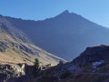
The Balcons des Barmettes trail

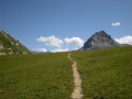
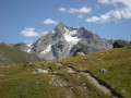
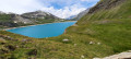
Balcony trail from La Daille to Le Fornet with several possible entry points. The Balcony Trail is a must-do walk in Val d’Isère. It requires a bit of physical effort, but you’ll soon be rewarded with breathtaking views of the village, Solaise and Bellevarde.

Details

99213746
Creation:
Last update:
Last review:
  • Walking
    Activity: Walking
  • ↔
    Distance: 3.05 mi
  • ◔
    Average duration: 2h 10 
  • ▲
    Difficulty: Easy

  • ⚐
    Back to start: No
  • ↗
    Ascent: + 899 ft
  • ↘
    Descent: - 436 ft

  • ▲
    Highest point: 6,634 ft
  • ▼
    Lowest point: 5,886 ft

Description of the walk

(S) From the Daille bus stop, take Rue de la Daille and walk past the Chapelle Saint-Germain de La Daille.

(1) Turn left at the junction and take the small grassy path leading uphill.

(2) At the junction, turn right towards Le Crêt. Follow the path to Le Crêt. Then keep right again at the next junction.

(3) At Le Crêt, take the path leading uphill to the left towards the ‘Sentier des Balcons’.

(4) Carry on straight ahead at the junction for Val d’Isère centre and continue straight on towards Le Fornet (E).

Waypoints

  1. S : mi 0 - alt. 5,889 ft - La Daille - Isère (rivière)
  2. 1 : mi 0.13 - alt. 5,896 ft - Crossroads, Rue de la Daille
  3. 2 : mi 0.16 - alt. 5,922 ft - Crossroads, La Daille
  4. 3 : mi 0.73 - alt. 5,988 ft - Le Crêt
  5. 4 : mi 1.78 - alt. 6,407 ft - Junction for Val d’Isère Centre
  6. E : mi 3.05 - alt. 6,352 ft - Fornet - Isère (rivière)

Notes

Access: the red shuttle bus stops at “Daille”, “Crêt”, “Office de Tourisme” and “Village du Fornet”. To return to the starting point from the finishing point, you’ll need to take the shuttle bus or leave a car there.

There are four main entry points: La Daille (S), Le Crêt ( 3), Val d’Isère (4) and Le Fornet (E). This trail offers views across the whole village and the Manchet valley. It is possible to walk the trail in either direction: uphill or downhill.

Trail route: you can combine Les Balcons with Le Fornet via the meadows and La Daille – Le Crêt for a walk of around 10 km with 300 m of elevation gain.

This route passes through a protected area, which may be subject to special regulations:

Worth a visit

- Various panoramic views

Other walks in the area

For more walks, use our search engine .

The GPS track and description are the property of this route's author. Please do not copy them without permission.