Country:

 City:
City:



Car park: Rue de la Gare, Pont de Bonne, Modave, opposite the RAVeL.
(S/E) From the car park, join the RAVeL L126 and follow it south-east (towards Modave) for 2 km.
(1) 300 m after the former ‘Modave Village’ station, take the tarmac track on the right, then, 100 m further on, the track on the left.
This path is circular and curves to the right; keep to the right at the three-way junction.
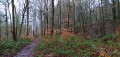
(2) At the junction of the dirt tracks, just before the main road, turn right to cross it diagonally. Cross the road and cut across the grassy triangle opposite to reach another road. Continue straight on along the track leading towards the woods. The track goes round a house and then crosses part of the woods.
(3) Take the first path leading down to the left (before you reach the tarmac!); this is partly cobbled and heavily rutted. It becomes passable by vehicle near a farm.
(4) Shortly after a war memorial, it crosses fields and meadows. At the end of the path, turn left onto the Grand Rue to reach the Route du Val further down.
(5) Turn sharply right onto the Route du Val, avoid the ford by taking the concrete footbridge on the right and carry on straight ahead along Rue Tibiémont.
(6) At the top of the hill, turn right near a large farmhouse.
The path continues as a signposted trail (GR®® 575 – “Petit Modave”). Follow it to the end. It overlooks the Hoyoux and eventually descends to a vast grassy area used for drinking water catchment.
(7) When you reach the catchment area (a long grassy area crossed by the Hoyoux), turn left and walk along the edge of this meadow.
(8) At the end of the meadow, 50 m past the second path crossing it, take the path rising diagonally to the right. At the top, this path joins a forest track which you follow straight on to cross the partly overgrown plateau. This track then leads back into the woods. Just before reaching the main road, take the path on the right which continues to descend, joining the main road diagonally.
(9) When you reach the main road, cross it and take the forest track opposite, slightly to the right. This track climbs towards the village of Vyle and Tharoul (Rue des Arcis). At the top, turn right and walk alongside the woods. Ignore the street on the left and carry on straight ahead along the path running alongside the woods, then take a path on the right, 200 metres after the junction, which leads back down into the woods.
(10) Once at the bottom, on the road, head up it to the left until you reach the first junction.
(11) A few metres past the junction, take the path on the right which descends between the thickets and the woods. This path joins Rue du Pont de Vyle at the bottom, just before a railway bridge.
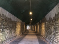
(12) Pass under the railway bridge and head up to the right to join the old railway line, which is now a RAVeL. This footpath curves widely to the left, passes over the Hoyoux and the main road, and, after a short tunnel, leads to the car park on Rue de la Gare, Pont de Bonne, Modave (S/E).

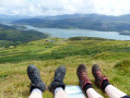
 Beautiful, varied walk
 : you pass through valleys where only the old railway line used to run. Beautiful circular over the Tibièmont valley and its footbridge. Plenty of water and a beautiful ice rink add extra interest in winter and during floods.
 Visorando Member
 Difficult
 Easy
Easy 
 Tourist office