


 Country:

 City:
City:


On arrival, you can have a drink or a bite to eat atthe Hôtel des Touristes or the Pizzeria Chez Laurent, depending on the time, and enjoy an ice cream from CAPOUE for dessert .
Mimi ACOS walk from the Pont de Bonne


A fairly challenging route for beginners but a real adventure for experienced walkers. The terrain is very varied, with roads and paths of all kinds. A walk along the Houyou, then along the Ravel L126, through woods, fields and villages, taking in magnificent scenery. At the end of the route, in the surrounding area, you’ll find the Vivaqua site and Modave Castle before heading back towards the Pont de Bonne (Modave). On arrival, there are opportunities to have a drink, grab a bite to eat depending on the time, and enjoy an ice cream from CAPOUE.
Details
Creation:
Last update:
Last review:
–
–
-
 Activity: Walking
 -
 Distance: 10.91 mi
 -
 Average duration: 6h 05
 -
 Difficulty: Difficult
 -
-
 Back to start: Yes
 -
 Ascent: + 1,194 ft
 -
 Descent: - 1,194 ft
 -
-
 Highest point: 873 ft
 -
 Lowest point: 446 ft
Waypoints
- S/E : mi 0 - alt. 607 ft - “Entre Eaux et Châteaux” Tourist Information Centre
- 1 : mi 3.17 - alt. 446 ft - Crossroads - Hoyoux (rivière) - Affluent de la Meuse - Belgique
- 2 : mi 3.51 - alt. 627 ft - Séchamp Woods
- 3 : mi 7.6 - alt. 722 ft - In Arsis
- 4 : mi 9.06 - alt. 623 ft - Hoyoux (rivière) - Affluent de la Meuse - Belgique
- 5 : mi 9.97 - alt. 738 ft - Château de Modave
- S/E : mi 10.91 - alt. 607 ft - “Entre Eaux et Châteaux” Tourist Information Centre - Hoyoux (rivière) - Affluent de la Meuse - Belgique
Notes
Worth a visit
Walk along the Houyou
At the end of the route, you’ll pass the VIVAQUA site and Modave Castle, then head back towards the Pont de Bonne (Modave).
Other walks in the area
The Hoyoux Valley between Pont de Bonne and Val Tibiémont
 Visorando Member
 7.77 mi
+607 ft
-623 ft
4h 05
7.77 mi
+607 ft
-623 ft
4h 05
 Moderate
 Departure from Modave (Province de Liège)
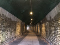
A very beautiful walk in the Hoyoux valley, alternating between wooded sections, open landscapes with beautiful views and charming sites.
Between the woods of Modave Castle and Vyle-et-Tharoul
3.40 mi
+341 ft
-325 ft
1h 50
 Easy
Departure from Modave (Province de Liège)
Easy
Departure from Modave (Province de Liège)
Departure from the car park opposite the water catchment (Chaussée de Pailhe, 4577 Modave GPS coordinates: 50.448143, 5. 284329), passing by the water catchment and Modave Castle. Pass through the Ravel (an old disused railway line converted for pedestrians and cyclists) between Modave and Vyle-et-Tharoul. Return to the starting point through the woods of Vyle-et-Tharoul.
Between the castle and the old railway line from Modave
 8.23 mi
+574 ft
-587 ft
4h 15
Moderate
Departure from Modave (Province de Liège)
8.23 mi
+574 ft
-587 ft
4h 15
Moderate
Departure from Modave (Province de Liège)
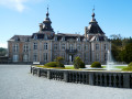
This walk, probably a classic in the region, starts at Modave Castle (visits in season) and follows the Hoyoux valley, sometimes very close to the river, sometimes much further away, to the outskirts of the village of Avins.
Modave Castle and the Hoyoux Valley
 11.61 mi
+1,191 ft
-1,191 ft
6h 25
Moderate
Departure from Modave (Province de Liège)
11.61 mi
+1,191 ft
-1,191 ft
6h 25
Moderate
Departure from Modave (Province de Liège)
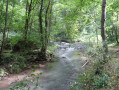
This walk will take you to discover the magnificent Modave Castle and its gardens, as well as the Vivaqua Estate, which collects and manages part of the water supply for the city of Brussels, the Hoyoux valley, the Condroz villages of Vyle-et-Tharoul, Jamagne and Grand-Marchin, and vast expanses of farmland and woodland.
Walk in Petit Modave
 Tourist office
 4.92 mi
+354 ft
-331 ft
2h 35
Moderate
Departure from Modave (Province de Liège)
4.92 mi
+354 ft
-331 ft
2h 35
Moderate
Departure from Modave (Province de Liège)
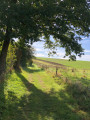
Starting from Modave Castle, this walk takes you through the southern part of the Modave nature reserve and the Hoyoux valley. You will also discover the hamlet of Tibiémont, the Val ford, the site of the former Survillers castle and its beautiful viewpoint. A beautiful forest path (the wooded lane) will take you gently back to the castle. This walk is recognised by the Wallonia Tourist Board (Belgium).
Circular starting from Modave
6.44 mi
+361 ft
-387 ft
3h 15
Moderate
Departure from Modave (Province de Liège)
From the village centre, the route first heads towards the church and its distinctive bell tower, then on to the castle via a beautiful tree-lined avenue.After a short tour of the castle grounds, head for the nature reserve overlooking the Hoyoux valley and the Vivaqua facilities upstream of the pumping station. This valley was once home to the village of Petit-Modave.The route follows the course of the Hoyoux (from quite a distance) through the woods to the beautifully restored old farmhouse of Tibiémont.A little further on, you will discover the hamlet of Val Tibiémont, located on either side of the Hoyoux. The ford, which can be quite impressive in flood conditions, is fortunately equipped with a small permanent footbridge. Please note that there is no railing, just a rather narrow slab laid on a few stone or concrete bases.At Clavier Station, the route follows the RAVeL, sometimes in open countryside, sometimes in the woods, to the old Modave-Village stop.
Between Vierset, Barse and Pont de Bonne
10.64 mi
+1,004 ft
-1,027 ft
5h 45
Moderate
Departure from Modave (Province de Liège)
While the situation is probably clear to locals, day visitors will be completely lost.Vierset-Barse is a former municipality formed by the village of Vierset, located on the heights, and the hamlet of Barse, located below on the right bank of the Hoyoux. Today, it is part of Modave.The starting point, the old Barse railway station, on the other hand, is on the left bank and located in the current hamlet of Ereffe (municipality of Marchin).
For more walks, use our search engine .
The GPS track and description are the property of this route's author. Please do not copy them without permission.

