


 Country:

 City:
City:


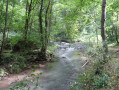
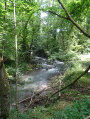

Park in the Château de Modave car park.
(S/E) Leave the car park and walk past the outbuildings and the castle’s monumental entrance, where access to the grounds is free. Turn left onto the second castle lane, passing through a wooden gate. After about a hundred metres, leave this lane to go round the castle’s surrounding walls on the right and enter the Modave RNOB nature reserve. Continue between these walls and the surrounding woodland. When you reach a wooden gate, turn a quarter of a turn to the right, followed shortly afterwards by a quarter of a turn to the left; then, as the surrounding wall curves to the right, you will come to a Y-junction.
(1) Stay on the dirt track on the left, which soon narrows and then begins to descend to join a tarmac road. Follow it down to the right and enter a protected Vivaqua water intake area. Walk along a vast grassy area crossed by a water collection channel, privately owned by Vivaqua and bordered, towards the end, by a poplar hedge. Walk alongside the channel, then cross it via a concrete footbridge.
(2) At the T-junction ahead, turn right onto Rue de Petit Modave but leave it very quickly to climb a path on the right, following the local ‘Blue Diamond’ markings. At the junction with a grassy, stony track, continue straight on through the woods. Ignore several side paths. The path soon begins to descend and approaches a main road. Shortly before reaching it, at the Y-junction, take the path on the right (still following the Blue Diamond), which soon leads out onto this main road.
(3) Cross the N636 carefully, keeping slightly to the right, go through a metal gate and head up into the woods along a stony track which, after 500 m, leads onto a road opposite a few houses.
Turn left, initially onto tarmac which quickly gives way to a stony track. After skirting some meadows, opposite a private track, turn right at the edge of the forest. Very soon, at the junction, the track curves to the left. Continue along the dirt track on the left, which passes through plantations of various tree species (birches, conifers, etc.) and is, in places, very damp.
(4) At a junction of several paths, at the foot of a remarkable beech tree, leave the Blue Diamond markings to turn right and pass to the left of this beech tree. Descend a sunken path with lush vegetation (this time following the local Blue Rectangle markings). Pass a path on your right. Caution! Before a right-hand bend, make your way along a barely visible path below the main track. After a few metres, at the junction with a path coming from the left, continue straight ahead. Cross a concrete footbridge over a stream and follow it until you reach a ford. Head up Rue du Ruisseau to the right and, at the end of the street, you’ll come out onto a small square (war memorial).
(5) Turn left to walk past the church along Rue du Parc, going round a block of flats. At the Y-junction, turn left onto Rue de la Forge, which is a dead-end street. Pass a path on the left, leave the tarmac behind and head up the remains of an old road. At the top, ignore a wide path branching off to the left and carry on straight ahead, this time downhill. You’ll reach a crossroads.
(6) Weave round a lime tree on the right, taking the restored footpath no. 8 (from Jamagne to Statte) on the left. The path is initially hard to spot and runs either to the right or left, depending on its passability, alongside a wild hedge rising up on a spur of the land. It maintains the same direction between two fields before merging with a wide dirt track, joins the tarmac road and continues to a T-junction. Turn right, cross the bridge over the Triffoy and reach the hamlet of Jamagne, the origin of Marchin (alt. 210 m).
(7) Head to the right, between a house dating from 1645 and the boundary wall of a farm. Cross a concrete-paved area to the right of a manure spillway and continue along a gravel track at the bottom of the valley which passes through woodland. Ignore a path branching off to the left and continue along the tarmac road. The site is protected by Vivaqua for water abstraction. Walk past an isolated, beautifully restored farm and, after a slight left turn, head uphill to a T-junction. Turn right then left to climb the hill along a sunken dirt track, leading to the Church of Notre-Dame de Marchin and emerging onto a road.
(8) Cross the road and head up the narrow, one-way street opposite. At the end of this, at the T-junction, follow the road to the left; after 150 m, you’ll walk alongside a large grassy square featuring a bandstand. At the end of the square, at the T-junction, follow the road to the right and reach a crossroads.
(9) Cross the junction and continue straight on until you reach a chapel at the corner of the Tige farm. Turn a quarter turn to the right, staying on the tarmac. Pass by a water tower and, a few dozen metres further on, you’ll come out onto a road.
(10) Follow this road to the left. Caution! After just under 100 m, leave the tarmac and, after the last house on the right, take the dirt track on the right. This is the restored local footpath No. 6 (from Grand-Marchin to Statte). The path, running between meadows and hedgerows, ends at the edge of a field. After a quarter-turn to the right, head down alongside the field, go through two metal swing gates and come out onto a road.
Head down the road to the left and turn onto a dirt track, again to the left. Pass by a water intake and follow the stream, then cross it via a concrete footbridge before walking alongside a large restored farm.
(11) Cross a road and head up a gravel track; almost at the top, you’ll reach a T-junction.
(12) Continue climbing up the stony track on the left, which further on makes a quarter-turn to the right in front of a field, becomes grassy and continues in a straight line between the crops. After passing private properties on both the left and right, the path returns to the cover of the woodland.
(13) At the T-junction, head left between rows of trees. Enter the woodland and head down the hill along a very rocky path. At the bottom of the descent, the path curves to the right and continues, almost level, ending up in front of the entrance to a quarry, near the RAVeL.
(14) Cross the access road to the quarry and continue opposite on a dirt track running parallel to the RAVeL.
Walk between the houses along a cobbled path. Cross the RAVeL L126 and continue along the tarmac path, which the walk leaves at the next bend to take the dirt track straight ahead, between the Hoyoux and the RAVeL. Reach a road to the left of a bridge over which the RAVeL passes.
(15) Cross the road and, via a short but steep climb, rejoin the RAVeL. Follow it to the left. Cross over the Hoyoux. Immediately after passing under the N641 Huy–Ocquier bridge, leave the RAVeL and turn left, crossing a paved area to the left of a Proximus building and emerging onto a cobbled street, Rue de la Gare. Follow it to the left. At the end, cross the main road and head down to the right to join the N636.
(16) Follow it to the left towards Dinant and Havelange. Pass under the RAVeL’s metal bridge and leave Pont-de-Bonne. At a wide right-hand bend in the road, leave the road and, after passing through a wooden gate, turn left onto a wide grassy path running alongside the Vivaqua facilities. Then follow the stony track that runs alongside a canal.
(17) Just before a gate and level with a footbridge, slip left onto a discreet path which begins to wind its way up the hillside. When you reach a wide path, continue along it, first turning left then right, and return to the starting car park (S/E).

 Visorando Member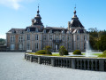

 Tourist office
 Easy
Easy 
 Difficult
