


 Country:

 City:
City:


Car park: Saint-Martin’s Church, Rue du Centre 21a, Modave.
Alternative car park: Modave Castle car park, Rue du Parc. Walk past the castle outbuildings to reach the start of the walking trail directly.
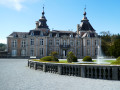
(S/E) From Modave Church, take Rue du Centre then turn right onto Rue Drève du Château. Cross the main road and continue straight on along Rue du Parc (= drève) towards the castle, which is well worth a look.
(1) Carry on straight ahead to visit the castle.
(2) From the castle entrance (portico), walk back about a hundred metres.
(1) Take the path on the right which runs alongside the castle wall. This path bends first to the right and then to the left, continues alongside the wall for 400 metres and then veers off, curving to the left.
(3) Shortly after this bend, take the small path on the right which leads to a grassy area and follow it for about a hundred metres to enjoy a magnificent view of the Petit Modave valley, the Hoyoux and the water catchment area of the Vivaqua water company (which supplies water to the city of Brussels).
(4) Leave the viewpoint and return to the path at the previous junction.
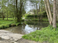
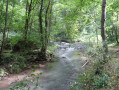
(3) Follow the path downhill until you reach the small tarmac road; turn right here and walk half a kilometre downhill to reach a ford across the Hoyoux, which also has a footbridge.
(5) Take the footbridge and continue to the end, then turn left onto the road which follows the valley floor for about 500 metres. Cross the bridge over the Hoyoux.
(6) Immediately afterwards, turn right onto the path that climbs back up towards the plateau, ignoring the forest track that runs alongside the stream to the right. At the top of the slope, the path leaves the woodland and passes through the meadows. At the end (stone house), turn right onto the stony track.
(7) At the end of the track, turn left onto the concrete path and then, 200 m further on, take the forest track which continues in line with the road, just as the road curves to the left. Follow this forest track downwards until you reach a small tarmac road; turn right onto this to descend to the ford at Val Tibiémont.
(8) Facing the ford, take the path on the left which runs alongside the Hoyoux. After 500 m, at the first houses, the path widens and becomes tarmacked with a grassy central verge.
(9) Shortly after the bridge (house), continue along the path which climbs to the left between a meadow and a wood. The path leads to the end of a street, which you follow up to the next one (Rue du Centre). Turn left onto it. At the next junction, carry on straight ahead along the farm track for about fifty metres and join the RAVeL on the left.
(10) Follow the RAVeL for 300 metres to the next junction and take the road opposite, running alongside the RAVeL on the left, towards some farm buildings. After these, the road becomes a farm track. Follow it to the end, then turn right onto the tarmac road (Route du Val).
At the next junction, carry on straight ahead and rejoin the RAVeL after 600 m (Clavier station). Turn left onto it and follow it for 650 m to reach the former gatekeeper’s house (now converted into a lodge). Cross the main road (take care!) and continue along the RAVeL for 900 m, until you reach the first junction.
(11) (Information board), take the path on the right which descends into the woods to reach a damp, grassy area. As soon as the path begins to climb up the valley, turn left onto the path running alongside the pasture.
Follow it to the end (about 1,300 m). After a detached house, it becomes a stony track and leads to a crossroads.
(12) Turn immediately right onto the path passing to the right of the farm and running alongside a field. After 150 m, take the path on the left. Cross the road and continue straight on along the path, which descends slightly between the pastures. The path, which widens, then begins to climb up the valley.
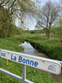
(13) As you approach the summit, keep left at the Fork in the road and continue across the fields. As the village comes into view, the path joins another: continue to the left towards the village. Once you reach the tarmac road, continue down Rue Rômont to the bridge over the Bonne.
(14) At the bridge, carry on straight ahead for fifty metres and take the path that climbs to the right, soon rejoining the road you have just left (Rue du Village). Continue along this street to No. 16 (the Village Hall and CPAS).
(15) Turn left, go under the porch and walk alongside the house to reach a small path that runs alongside a sports ground and soon joins Rue du Centre and the church (S/E).


 Visorando Member
 Tourist office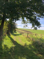
 Easy
Easy 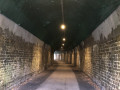
 Difficult
