


 Country:
 City:
City:


Car park: behind the Fallais Sports Hall, 13 Rue de Drèye, 4260 Braives
(S/E) Leave the car park and head left towards the village exit. After 200 m, as the road bends to the left, carry on straight ahead onto the path joining the RAVeL. Follow it in the opposite direction for about ten metres, then turn right onto the path leading into the woods. When you reach the tarmac (end of a street), continue straight ahead on the path.
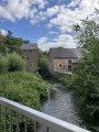
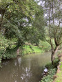
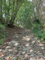
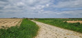
(1) At the end of this, start the climb to the left along the roughly cobbled path which crosses the woodland and then emerges into the countryside. Carry on straight ahead at the junction (two isolated houses), then take the path to the left at the next crossroads (Rue Neuve). This leads to the village of Pitet. Walk through the village until you reach the bridge over the Mehaigne.
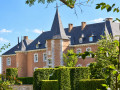
(2) Turn right immediately after the stream onto Rue des Falihottes. At the first junction (veterinary surgery), turn left onto the grassy path and head towards the farm-castle. At the end, turn right into Rue Alice de Donéa (there is a hedge running along the road on the castle side). At the end of the street, first turn right then left to join Rue Saint-Sauveur (this runs alongside the hill of the same name).
(3) When you reach the main road (N64), walk along the left-hand side of it for 300 m (caution: heavy traffic! Walk in single file on the left-hand side of the road!). Then turn left, diagonally, onto the path leading into the countryside (Rue Jules Henault, no sign).
(4) When you reach the houses, turn right into Rue du Calvaire. At the top (chapel), turn left onto the dirt track and then left again 500 m further on, heading downhill alongside the orchard (pear trees). At the bottom, cross the road and continue along Rue du Chardon.
(5) When you reach No. 12 (a large ivy-covered building, “Le Chardon”), turn right onto the path leading down into the woods. After 400 m, this path joins a road (Rue des Broux), which you should follow to the crossroads (large farmhouse). Cross the road to reach the reception building (Cours de Justice) further down.
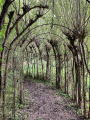
(6) Go round the building on the right to reach the Parcours du Saule: this takes visitors through tunnels of living willow trees, over wooden walkways, through mazes and other attractions. Return to the road (Rue du Cortil), walk past the square farm of the same name and take the path leading uphill to the right shortly afterwards. The path runs alongside fields and then through woodland.
(7) Just before the path emerges onto the road, turn left into the woodland: the path runs alongside the road at a distance before joining it after 300 metres; cross straight ahead to reach the RAVeL.
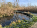
(8) Turn left onto it towards Huy (signposted). Follow it for 2 km, until you reach the hamlet of Fallais. Just before Fallais, the RAVeL runs alongside the castle and its moat (not accessible from this path).
(9) At the junction of the RAVeL with Rue de Bossia / Rue Hubert Kralins, leave the RAVeL and continue straight on into Rue de Dreye, then turn left to reach the car park (S/E).
 Visorando Member

 Easy
Easy 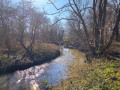
 Difficult
