


 Country:
 City:
City:


Fallais Castle and its moat (private – not open to the public – clearly visible from the entrance gate)
The village of Le Saule, a community and training centre dedicated to basket-weaving
Circular Hesbaye starting from Fallais


The walk follows the country lanes of the Liège Hesbaye region, passing through the villages of Fallais and Braives.
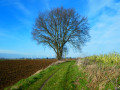
Set against a generally gently undulating landscape, the circular path offers lovely views of the crops – which are sometimes a rich golden colour depending on the time of year – as well as solitary trees, rows of poplars, bushes and other grasses swaying in the wind along the paths.
Egrets and herons are usually to be seen against a backdrop of wind turbines.
Details
Creation:
Last update:
Last review:
–
–
-
 Activity: Walking
 -
 Distance: 10.00 mi
 -
 Average duration: 5h 00
 -
 Difficulty: Moderate
 -
-
 Back to start: Yes
 -
 Ascent: + 463 ft
 -
 Descent: - 446 ft
 -
-
 Highest point: 548 ft
 -
 Lowest point: 354 ft
Photos
Waypoints
- S/E : mi 0 - alt. 354 ft - Fallais eco-car park
- 1 : mi 5.02 - alt. 400 ft
- 2 : mi 6.26 - alt. 404 ft
- 3 : mi 7.8 - alt. 436 ft
- 4 : mi 9.52 - alt. 381 ft
- S/E : mi 10 - alt. 354 ft - Fallais eco-car park
Worth a visit
Other walks in the area
The Mehaigne valley between Pitet and Hosdent
 Visorando Member
 7.70 mi
+308 ft
-279 ft
3h 50
Moderate
7.70 mi
+308 ft
-279 ft
3h 50
Moderate
 Departure from Braives (Province de Liège)
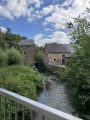
From the village of Fallais, the walk leads to the hamlet of Pitet, passing the small ‘Réserve de la Quiétude’ nature reserve and through the fields. The route continues through Les Falihottes, past its old mill and the former forge of the Pitet manor farm, and runs alongside its arbour. It then reaches the hamlet of Hosdent, known as the Village du Saule, before returning to Fallais via the RAVeL L127.
From La Mehaigne to La Burdinale via Fumal, Huccorgne and Marneffe
 7.86 mi
+643 ft
-636 ft
4h 10
Moderate
Departure from Braives (Province de Liège)
7.86 mi
+643 ft
-636 ft
4h 10
Moderate
Departure from Braives (Province de Liège)
This circular route starting from Fumal winds through the Burdinale-Mehaigne Nature Park, passing successively through the villages of Huccorgne and Marneffe, before returning to Fumal via the countryside around Fallais.
Around the feudal castle of Moha
 10.04 mi
+692 ft
-689 ft
5h 15
Moderate
Departure from Wanze (Province de Liège)
10.04 mi
+692 ft
-689 ft
5h 15
Moderate
Departure from Wanze (Province de Liège)
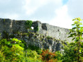
The feudal castle of Moha is one of the region's jewels. It is located at the top of a rocky spur on the heights of the Mehaigne, on the edge of the limestone quarries (both old and still in operation), and was apparently built in several phases between the 11th and 14th centuries. Archaeological excavations have revealed a much older presence.
On the heights above the Meuse between Moha, Bas-Oha and Couthuin
 11.94 mi
+741 ft
-745 ft
6h 10
Moderate
Departure from Wanze (Province de Liège)
11.94 mi
+741 ft
-745 ft
6h 10
Moderate
Departure from Wanze (Province de Liège)
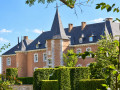
Farmland and manorial estates – that’s what’s on offer. Numerous castles and manor houses await you – sometimes clearly visible, sometimes nearby, sometimes well hidden, sometimes slightly off the route – each with its own story!In order: Lamalle, Laminne, Blanc, Envoz, Temple and Moha, whilst Potesta and Fosseroule lie just off the route.
The Chevées walk
3.24 mi
+66 ft
-66 ft
1h 35
 Easy
Departure from Hannut (Province de Liège)
Easy
Departure from Hannut (Province de Liège)
In the mysterious area of the numerous springs of the Geer, encounter the ghosts of the Lord of Herzée in the Chevées, the nuns in the former Carmelite convent, the prior of the convent in his farmhouse, and let yourself be seduced by the quiet charm of the two Lens.
The Upper Geer between Lens-Saint-Servais and Hollogne
 8.39 mi
+49 ft
-49 ft
3h 55
Moderate
Departure from Geer (Province de Liège)
8.39 mi
+49 ft
-49 ft
3h 55
Moderate
Departure from Geer (Province de Liège)
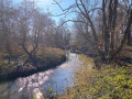
The upper reaches of the Geer, between Lens-Saint-Servais and Hollogne-sur-Geer, are largely set in woodland along much of its course. This route also offers the chance to linger in the Haut-Geer nature reserve (the settling ponds of the former sugar factory) and discover its birdlife.
Walk in the Haut-Geer
 5.93 mi
+36 ft
-36 ft
2h 45
Easy
Departure from Geer (Province de Liège)
5.93 mi
+36 ft
-36 ft
2h 45
Easy
Departure from Geer (Province de Liège)
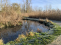
A walk that takes you along the Geer and into the Haut Geer nature reserve. Walkers will enjoy the scents of the earth, the sound of flowing water, the colourful palette of freshly blooming flowers, the ballet of pollinating insects, the melodious song of birds and the rustling of leaves swaying in the gentle breeze as they pass through the nature reserve.
Avin Hannut – Thorembais-Saint-Trond
 15.36 mi
+148 ft
-148 ft
7h 10
15.36 mi
+148 ft
-148 ft
7h 10
 Difficult
Departure from Hannut (Province de Liège)
Difficult
Departure from Hannut (Province de Liège)
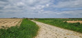
This31st stage is a gentle stroll through the countryside, with distance being the only real challenge. No significant elevation gain, no meadows to cross. Small country lanes with very little traffic, apart from a long climb over old cobblestones – just enough to rouse the walker from any lethargy. And the scenery is as beautiful as ever for those who love the countryside – though, of course, this depends on the season and the weather. Once again, I prefer the countryside to the city, and there are very few villages along the way.
For more walks, use our search engine .
The GPS track and description are the property of this route's author. Please do not copy them without permission.

