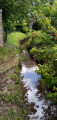
The Upper Geer between Lens-Saint-Servais and Hollogne

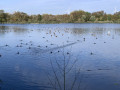
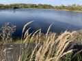
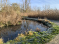
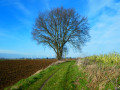
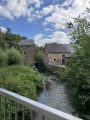
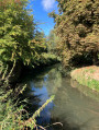
The upper reaches of the Geer, between Lens-Saint-Servais and Hollogne-sur-Geer, are largely set in woodland along much of its course. This route also offers the chance to linger in the Haut-Geer nature reserve (the settling ponds of the former sugar factory) and discover its birdlife.

Details

69553145
Creation:
Last update:
Last review:
  • Walking
    Activity: Walking
  • ↔
    Distance: 8.39 mi
  • ◔
    Average duration: 3h 55 
  • ▲
    Difficulty: Moderate

  • ⚐
    Back to start: Yes
  • ↗
    Ascent: + 49 ft
  • ↘
    Descent: - 49 ft

  • ▲
    Highest point: 446 ft
  • ▼
    Lowest point: 390 ft

Photos

Description of the walk

Car park: On the square behind the church in Lens-Saint-Servais, Rue Communale 1–3, 4250 Geer (= Rue de Lens-Saint-Rémy).

(S/E) With your back to the church, take the second cul-de-sac on the left (after the two large lime trees) and follow the narrow path wedged between the entrance to a farm and the house. Follow it to the end. It leads onto a small side road (Rue Nestor Bajot); turn right here and follow it to the main road.

(1) Cross the main road diagonally and take the path opposite. The path soon joins the Geer and follows it for about a kilometre before meeting the A-road. 

(2) Turn left onto the main road, cross the Geer, then turn right back onto the path running alongside the stream (on its left bank). Follow it to the next street. The path comes out opposite No. 1 Rue Centre Bernadette.

(3) First turn right then left to join Rue des Peupliers. Follow it to the end and turn left onto Rue du Village. At the end of this street, it curves to the right and leads to a junction.

(4) Turn left into Rue Auguste Lambert and continue to Darion Church. Go round the church on the left (Ruelle Maquet) and, at the end, first turn right then left into Rue Jules Masy to leave the village towards the nature reserve, situated about 800 m away.

(5) Take the road on the right, follow the edge of the reserve for 400 m and enter it through the gate (information boards).

(6) Once inside the reserve, head up the path opposite, between the two ponds. Then turn right after the first pond, then left to go round the next pond. At the end of the pond, turn right to leave the reserve (gate).

(7) On leaving the nature reserve, turn immediately left and walk along the outside of the reserve. The path curves to the right and soon joins the Geer; follow its right bank until you reach a road.

(8) Turn right onto the road, cross the Geer and continue for a further hundred metres.

(9) Take the path on the left which leads to the left bank of the Geer. Follow the Geer for two kilometres (path then tarmac) crossing the two tarmac roads, until you finally reach Rue du Centre Bernadette.

(10) Turn right onto this street, then turn left into Rue Émile Lejeune. At the end, carry straight on along Rue Gérard Walkens (N657) to number 26.

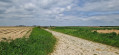
(11) Take the concrete track on the right and follow it past meadows, fields and the edge of a wood until you reach the next houses. At the junction with Rue de Lens-Saint-Servais, carry straight on along Rue de la Chavée (concrete road) until you reach a concrete farm track.

(12) Turn left and follow this farm track which runs alongside the fields (on the right) and the edge of a woodland. Continue to the end, then carry on along the path which enters the woodland and emerges a little further on.

(13) Then turn left onto the farm track between the meadows. After about a hundred metres, once you have crossed the Geer, it joins another track; turn left here again. This track passes through the woodland, then follows the edge of the woodland before returning to Rue de Lens-Saint-Rémy, which you should follow to the left to reach the car park (S/E).


Waypoints

  1. S/E : mi 0 - alt. 440 ft - St-Servais Church car park
  2. 1 : mi 0.2 - alt. 410 ft - Cross Rue Nestor Bajot diagonally - Geer (rivière) - Belgique
  3. 2 : mi 0.69 - alt. 423 ft - Turn left then right onto Rue du Geer
  4. 3 : mi 1.2 - alt. 400 ft - Turn right, then left onto Rue Bernadette
  5. 4 : mi 1.95 - alt. 423 ft - Crossroads
  6. 5 : mi 2.95 - alt. 404 ft - Junction towards the - Réserve naturelle du Haut-Geer
  7. 6 : mi 3.2 - alt. 413 ft - Entrance to the nature reserve - Réserve naturelle du Haut-Geer
  8. 7 : mi 3.81 - alt. 394 ft - Northern exit from the nature reserve
  9. 8 : mi 4.32 - alt. 397 ft - Road junction
  10. 9 : mi 4.39 - alt. 397 ft - Path to the Geer
  11. 10 : mi 5.65 - alt. 404 ft - Rue du Centre Bernadette
  12. 11 : mi 6.15 - alt. 407 ft - No. 26, Rue Gérard Walkens
  13. 12 : mi 6.98 - alt. 413 ft - Junction on a concrete farm track
  14. 13 : mi 7.55 - alt. 427 ft - Junction between the meadows
  15. S/E : mi 8.39 - alt. 440 ft - St-Servais Church car park

Notes

Please note: the section between the reserve’s exit (7) and the banks of the Geer may be flooded during very wet periods (warning signs with radar barriers), requiring a detour via the village of Hollogne. To do this, turn right as you leave the nature reserve to join Rue du Centre, which you follow to the left for just under a kilometre, then turn left into Rue du Manil and, shortly after number 10, you will reach point (9) and take the footpath leading to the Geer.

The return route to the village of Lens-Saint-Servais after the waypoint (13) can be very muddy: make sure you wear suitable footwear!

Picnic spot (with barbecue) shortly after point (1). Covered picnic table along the Geer, halfway between points (9) and (10) (see photo).

Worth a visit

Haut-Geer Nature Reserve (6

Hexapoda Insectarium in Grand-Axhe (www.hexapoda.uliege.be) 

Reviews and comments

4.8 / 5
Based on 2 reviews

Reliability of the description
5 / 5
Ease of following the route
5 / 5
Route interest
4.5 / 5
ArinaTomberg
ArinaTomberg

Overall rating : 4.7 / 5

Date of your route : Oct 19, 2025
Reliability of the description : ★★★★★ Very good
Ease of following the route : ★★★★★ Very good
Route interest : ★★★★☆ Good
Very busy route : No

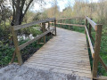
After a long stretch along motor roads – admittedly not very busy – at the start of the route, walkers are rewarded with the magnificent spectacle of the lakes in the Haut-Geer Nature Reserve. On the flooded section after point 7, as indicated by the author of the walk, wooden footbridges have been installed, so there is no need for hunting boots; a simple pair of trainers will suffice. After point 13, the path remains passable even in mid-autumn. The sections of the route along the river are particularly picturesque.

Machine-translated

User 14589306

Overall rating : 5 / 5

Date of your route : Jun 02, 2025
Reliability of the description : ★★★★★ Very good
Ease of following the route : ★★★★★ Very good
Route interest : ★★★★★ Very good
Very busy route : No

A lovely walk just a stone’s throw from Waremme. A real change of scenery; it’s an easy walk with a few slightly muddy patches, but there aren’t many and they’re marked on the app.

Machine-translated

michel14
michel14

I didn't go on that walk

Machine-translated

michel14
michel14

I didn't go on that walk

Machine-translated

Other walks in the area

For more walks, use our search engine .

The GPS track and description are the property of this route's author. Please do not copy them without permission.