Country:
 City:


The route starts from the Sens and Sénonais Tourist Office (6, rue du Général Leclerc).
(S/E) Leaving the tourist office, take the second street on the right as you exit the roundabout to join Boulevard Garibaldi, then turn right onto Boulevard Maupéou. At the next junction, turn left, then cross the car park on the right to reach the promenade. Walk past the bandstand and head down towards the River Yonne.
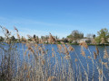
(1) At the roundabout by the river, take the second street on the right and follow the River Yonne for several hundred metres until you reach the Pont Neuf. After passing under the bridge, continue straight on along the cycle path until you come to a barrier.
(2) Go through the barrier then turn immediately right. When you come to the old abbey, turn left onto the path leading to Saint-Denis-lès-Sens. Carry on straight ahead to the town hall.
(3) At the “Stop” sign, on the corner by the town hall, turn right into Rue Albert Garnier. At the “Give Way” sign, cross the D606, then go round the church on the right to reach Rue de Granchette opposite. Take the second road on the right, the Chemin des Ladres. In the distance, on your right, you’ll see the church of Saint-Martin-du-Tertre, perched on the hill. Continue along the track, passing two paths on your right.
(4) At the end of the path, near the Rosler company, turn left. Continue to the roundabout and take the second street on the right, Rue Thomas Becket. On your right, you’ll see the hamlet of La Fontaine d’Azon. Carry on to the next roundabout, then take the road opposite until you reach the next roundabout, where you should take the second street on the right, Rue Henri Vincenot.
(5) At the ‘Stop’ sign, turn right into Rue du Popelin. Carry on, passing two streets on your right. At the next ‘Stop’ sign, turn left into Rue Calmette, then at the ‘Give Way’ sign, carry on straight ahead to cross the bridge over the D606.
(6) After the bridge, take the second right, then the first left (path through the fields). Carry on and cross the bridge over the railway line.
(7) Immediately after the bridge, turn right onto the track running alongside the railway line. Continue along this track. On your right, you’ll see the vineyards belonging to the Saint-Vincent de Saint-Clément brotherhood.
(8) At the next junction, turn right onto the track. You’ll be walking alongside the Vanne aqueduct. Carry on to the next junction, turn slightly left, then, after a few metres, turn right.
(9) At the end of the dirt track, turn left and carry on along the road. At the ‘Stop’ sign, turn left onto the D46, heading in the opposite direction to the sign for Sens.
(10) After entering Saligny, take the first street on the left, Rue de Vauluisant. At the junction, carry on straight ahead along Rue des Rougemonts. Take the first street on the right, Rue des Menardes, and turn left into Grande Rue. Carry on along the D46 to Fontaine-la-Gaillarde. After entering Fontaine-la-Gaillarde, carry on along the main road to the church and the wash house.
(11) Return along the same route. Pass Rue des Menardes on your right and head towards the junction with Rue du Gué.
(12) Turn left onto it, before the Le Basilic hotel and restaurant.
(13) Turn left onto Rue de la Quenevelle. You’ll now walk past the Lincet cheese shop.
(14) At the next junction, turn right onto Chemin de la Chatière. You’ll pass Saint-Laurent Church, which has a small Renaissance-style door. At the three-way junction, carry on straight ahead. Follow the route, which curves to the right.
(13) At the junction, turn left onto Rue des Vaux Renards. Continue along the departmental road (you’ll be leaving Saligny).
(15) Take the first left after leaving Saligny, onto Rue des Acacias, towards Les Saints-Pères. Pass through the Bois des Saints-Pères and continue along the road to the Saints-Pères farm.
(16) Turn right onto the road opposite the farm. Continue to the Vauguillettes Industrial Estate. At the ‘Give Way’ sign, carry on straight ahead along Rue de Sancey, passing through the two vehicle barriers. After a bend (to the right), carry on straight ahead until the next ‘Stop’ sign. Cross the road to join the dirt track. Carry on straight ahead, passing a path on your right.
(17) At the end of the track, after a house, turn left. Continue along the D173 departmental road, pass under the bridge on the RD606 and carry on until you reach a “Give Way” sign, then take the dirt track opposite.
(18) At the end of the track, turn left into Rue du Port. At the ‘Give Way’ sign, at the junction with Rue Vauban, carry on straight ahead. At the ‘Stop’ sign, go straight ahead, then at the second ‘Stop’ sign, go straight ahead again.
(19) After the second ‘Give Way’ sign, take the second right onto Rue de la Ballastière. At the three-way junction, turn left onto Rue du Général Leclerc, then after about a hundred metres, turn left again to reach the church of Saint-Clément. Go round the church on the left to reach Rue Marie Noël, then at the end of this street, turn left again onto Rue Jean Jaurès.
(19) Turn right onto Rue de la Ballastière until you reach the three-way junction, then turn right onto Rue Pasteur, which runs alongside Parc de la Ballastière.
(20) At the ‘Stop’ sign, turn left into Rue de la République and enter Parc de la Ballastière via the main entrance (for pedestrians). After the children’s playground, turn right to walk alongside the pond and reach the south exit of the park, which leads onto the Voie Verte (cycle path). Follow this, on the left, for about 1 km.
(21) After the second bridge, leave the Voie Verte by turning right at the next junction onto Rue Marcelin Berthelot (there is a traffic light nearby). Carry on to the traffic lights, then continue to the end of the street. Turn left onto Rue des Arènes and follow this street at the three-way junction. At the ‘Stop’ sign, turn left into Rue du Puits de la Chaîne. At the second ‘Stop’ sign, turn left into Rue d’Alsace-Lorraine, then immediately right into Rue Ambroise Paré. You’ll pass the Saint-Jean Hospital. Turn right onto Rue du Gué Saint-Jean, which runs alongside the washhouse of the same name.
(22) At the end of the street, cross over to join the promenade and turn right towards the War Memorial. Continue along the promenade until you reach Place Jean Jaurès. At the “Give Way” sign, turn right into Rue Victor Guichard, then left into Rue des Orfèvres. Continue straight on until you reach the tourist information office.

 Tourist office

 Visorando Member
 Moderate
 Easy