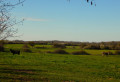
The Orvanne Valley from Dollot

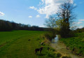
A walk starting from Dollot, a small village in the Gâtinais region, which will take you along good paths through the Orvanne Valley via the Oasis and the Gué des Archers.

Details

1629629
Creation:
Last update:
Last review:
  • Walking
    Activity: Walking
  • ↔
    Distance: 5.01 mi
  • ◔
    Average duration: 2h 25 
  • ▲
    Difficulty: Easy

  • ⚐
    Back to start: Yes
  • ↗
    Ascent: + 131 ft
  • ↘
    Descent: - 118 ft

  • ▲
    Highest point: 548 ft
  • ▼
    Lowest point: 436 ft
  • ⚐ Country: France
  • ⚐ City: Dollot (89150)
  • ⚑
    Start/End: N 48.213261° / E 3.076474°
  • ❏
    IGN map(s): Ref. 2518E
  • Hour-by-hour weather

Photos

Description of the walk

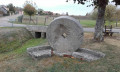
Start in Dollot, from the car park near the wash house, on the D82, Grande Rue.

(S/E) Head towards Dollot and the town hall, then take the first left onto Rue des Moulins. At the end of the tarmac road, continue along a path through the countryside. At the end of this, follow a tarmac road to the left and cross over the Orvanne.

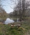
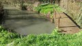
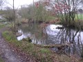
(1) At the T-junction (old railway station), turn right. Enter the woods and walk alongside a pond (you can go round it on the right if you wish). Cross a stream, cross the D65 and continue straight on.

(2) At the crossroads at the entrance to the hamlet of l’Oasis, take the second path on the left. At the T-junction which you’ll come to very soon, turn right onto the road. At the next crossroads, turn right to continue along a grassy path.

(3) At the crossroads, turn left. Further on, cross the D65 road. Continue straight ahead for about 200m.

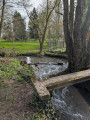
(4) Turn left and go round the back of Les Martinières. Ignore a path coming from the right and head downhill. At a place called Gué des Archers, cross a stream over a small stone bridge.

(5) At the T-junction, turn left to follow theGRP® de l’Orvanne (red and yellow markings). Pass through La Bondue and rejoin the tarmac road.

(6) At the next junction, first turn left then right (take care when crossing the road) and continue north-west.

(7) At the Maison Rouge, turn right and follow the path for a few dozen metres (leaving theGRP®). Then turn left and head into the woods. At a Fork in the road, turn left. Follow the path north-west and ignore a turn-off on the left.

(8) At the T-junction, turn left to join the Route de la Gare. Turn right onto it. Further on, you’ll come out onto the D224; follow it to the left to return to the starting point (S/E).


Waypoints

  1. S/E : mi 0 - alt. 436 ft - Old washhouse on the banks of the - Orvanne (rivière)
  2. 1 : mi 0.69 - alt. 453 ft - Former railway station
  3. 2 : mi 1.72 - alt. 499 ft - L’Oasis
  4. 3 : mi 2.17 - alt. 515 ft - Junction
  5. 4 : mi 2.57 - alt. 548 ft - Junction
  6. 5 : mi 3.26 - alt. 486 ft - Junction with the GRP
  7. 6 : mi 3.64 - alt. 502 ft - Ferme de la Grande Roue
  8. 7 : mi 3.98 - alt. 518 ft - A place known as La Maison Rouge
  9. 8 : mi 4.49 - alt. 449 ft - T-junction
  10. S/E : mi 5.01 - alt. 436 ft - Old Washhouse

Worth a visit

Short detour at Gué des Archers: you can turn right to visit the wash house and the Source de l’Orvanne
Round-trip distance: 2 km.

Reviews and comments

4.6 / 5
Based on 3 reviews

Reliability of the description
4.7 / 5
Ease of following the route
4.7 / 5
Route interest
4.3 / 5
Cyril Drion
Cyril Drion

Overall rating : 5 / 5

Date of your route : Jun 02, 2026
Reliability of the description : ★★★★★ Very good
Ease of following the route : ★★★★★ Very good
Route interest : ★★★★★ Very good
Very busy route : No

A lovely little walk! Thanks.

Machine-translated

Francis M
Francis M

Overall rating : 4.7 / 5

Date of your route : Aug 26, 2022
Reliability of the description : ★★★★★ Very good
Ease of following the route : ★★★★★ Very good
Route interest : ★★★★☆ Good
Very busy route : No

A short, easy and very pleasant walk

Machine-translated

Joigny
Joigny

Overall rating : 4 / 5

Date of your route : May 25, 2020
Reliability of the description : ★★★★☆ Good
Ease of following the route : ★★★★☆ Good
Route interest : ★★★★☆ Good
Very busy route : No

A lovely walk along the stream, with some beautiful houses here and there

Machine-translated

Other walks in the area

For more walks, use our search engine .

The GPS track and description are the property of this route's author. Please do not copy them without permission.