


Refine your search for walks in Orvanne (rivière)
Orvanne (rivière) walks


 The Pierre Cornoise Menhir between Thoury and Flagy
 Visorando Member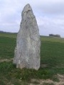
 5.24 mi
 +98 ft
 -66 ft
 2h 30
2h 30
 Easy
Easy
 Departure from Thoury-Férottes (Seine-et-Marne)
Hike along the banks of the Orvanne from Thoury to Flagy. Discover Flagy and the Pierre Cornoise menhir.
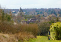
The wash houses of Voulx and Diant
 3.84 mi
+187 ft
-174 ft
1h 55
Easy
Departure from Voulx (Seine-et-Marne)
3.84 mi
+187 ft
-174 ft
1h 55
Easy
Departure from Voulx (Seine-et-Marne)
This is an easy, short hike, offering the opportunity to discover some beautiful wash houses and the banks of the Orvanne. Children who are used to walking and older people can keep up.
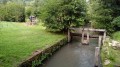
The Orvanne between Écuelles and Montarlot
 9.09 mi
+328 ft
-358 ft
4h 30
9.09 mi
+328 ft
-358 ft
4h 30
 Moderate
Departure from Écuelles (Seine-et-Marne) (Seine-et-Marne)
Moderate
Departure from Écuelles (Seine-et-Marne) (Seine-et-Marne)
Running parallel to the Orvanne river, this hike takes place mainly through fields, with sections along the edge of woods and through pretty villages.
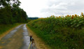
From Blennes to Vallery Castle
 6.09 mi
+272 ft
-269 ft
3h 00
Easy
Departure from Blennes (Seine-et-Marne)
6.09 mi
+272 ft
-269 ft
3h 00
Easy
Departure from Blennes (Seine-et-Marne)
A circular route leading from Blennes to Vallery along the Orvanne river. Upon arrival in Vallery, you will discover the magnificent Saint-Thomas de Cantorbéry Church and the Château de Vallery (private). The return journey takes you through Les Bergeries and across the Orval river.
Three Romanesque churches and five crosses around the Orvanne
 10.88 mi
+400 ft
-400 ft
5h 20
Moderate
Departure from Flagy (Seine-et-Marne) (Seine-et-Marne)
10.88 mi
+400 ft
-400 ft
5h 20
Moderate
Departure from Flagy (Seine-et-Marne) (Seine-et-Marne)
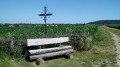
A hike through fields for the most part, which conceals a very rich heritage: three Romanesque churches, an old mill, an old watchtower, a castle and a menhir. Five metal crosses mark the route around the pretty, flower-filled village of Flagy.
Around the Bois Boucher Grignon
 4.75 mi
+164 ft
-161 ft
2h 20
Easy
Departure from Voulx (Seine-et-Marne)
4.75 mi
+164 ft
-161 ft
2h 20
Easy
Departure from Voulx (Seine-et-Marne)
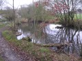
A circular loop in the hills above Voulx, a mix of open countryside and woodland...
The Orvanne Valley from Dollot
 5.01 mi
+131 ft
-118 ft
2h 25
Easy
Departure from Dollot (Yonne)
5.01 mi
+131 ft
-118 ft
2h 25
Easy
Departure from Dollot (Yonne)
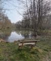
A walk starting from Dollot, a small village in the Gâtinais region, which will take you along good paths through the Orvanne Valley via the Oasis and the Gué des Archers.
Diant circular route via Blennes
 5.73 mi
+135 ft
-135 ft
2h 45
Easy
Departure from Diant (Seine-et-Marne)
5.73 mi
+135 ft
-135 ft
2h 45
Easy
Departure from Diant (Seine-et-Marne)
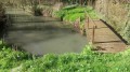
A circular walk following theGRP® “Tour de l’Orvanne”, crossing from the right bank to the left bank from Blennes. This 9.4 km walk can be extended by adding the “Blennes – Vallery” walk (approx. 10 km). We pass the start of the other walk.
From Fontainebleau-Avon station to Montereau station via Moret-sur-Loing
 17.59 mi
+531 ft
-594 ft
8 hrs
17.59 mi
+531 ft
-594 ft
8 hrs
 Very difficult
Departure from Avon (Seine-et-Marne)
Very difficult
Departure from Avon (Seine-et-Marne)
The first stage of a long journey towards the Jura. It is also a day walk, with the option of travelling there or back by train.
An excellent variety of landscapes in the south of Seine-et-Marne and the Gâtinais
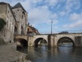
The route crosses the south-eastern part of the Forest of Fontainebleau, then passes through the town of Moret-sur-Loing. It continues along the Loing Canal and the Orvanne Valley. It then crosses the vast plateau of cereal crops overlooking the Yonne Valley before reaching Montereau.
From Montereau-Fault-Yonne to Moret-sur-Loing, from one confluence to another.
 15.76 mi
+492 ft
-456 ft
7h 40
15.76 mi
+492 ft
-456 ft
7h 40
 Difficult
Departure from Montereau-Fault-Yonne (Seine-et-Marne)
Difficult
Departure from Montereau-Fault-Yonne (Seine-et-Marne)
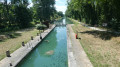
This is the twenty-fifth stage of the Grand Tour of Île-de-France via the GR®11, starting from Montereau station, not far from the confluence of the Seine and the Yonne, and ending at Moret-Veneux-les-Sablons station, not far from the confluence of the Seine and the Loing. The stage, entirely on the GR®11, follows a route on the left bank of the Seine, joining the Orvanne valley a little further south, and returns to Moret-sur-Loing and its beautiful historic centre, following the Canal du Loing on its towpath.
Grand tour of Île-de-France in 34 stages on the GR®11
 528.35 mi
+22,037 ft
-22,156 ft
34 days
Difficult
Departure from Paris
528.35 mi
+22,037 ft
-22,156 ft
34 days
Difficult
Departure from Paris
This marked GR® route around the Île-de-France region (with a few forays into neighbouring departments and regions) complements its "little brother", the GR®1, by forming a circular route around Paris, generally with a slightly larger radius.
It follows the same overall pattern: first, a radial section starting from Paris (more precisely from the Pont d'Austerlitz, near the former confluence of the Bièvre and the Seine), going up the entire Bièvre valley, then continuing to Villiers-Saint-Frédéric, in the Yvelines. From there, it is a circular route that loops around the Île-de-France region, close to its borders with neighbouring regions.
The route passes through beautiful regions, often untouched by intensive urbanisation, regional nature parks and other protected natural areas, and takes in some architectural wonders.