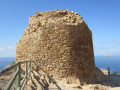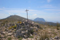
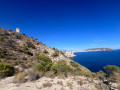

The Aguiló Tower as seen from Villajoyosa

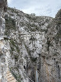
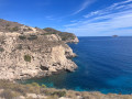
This walk is known as the ‘Sender de la Costa’ and is maintained by the Generalidad Valenciana, the provincial government. It is therefore a wide path lined with benches and tables, making it suitable for the whole family. Along the way, you can enjoy superb views of various coves and, out to sea, you can make out a large fish farm.

Details

n°20561916
Creation:
Last update:
Last review:
  • Walking
    Activity: Walking
  • ↔
    Distance: 3.58 mi
  • ◔
    Average duration: 2h 10 
  • ▲
    Difficulty: Easy

  • ⚐
    Back to start: Yes
  • ↗
    Ascent: + 581 ft
  • ↘
    Descent: - 577 ft

  • ▲
    Highest point: 472 ft
  • ▼
    Lowest point: 23 ft

Photos

Description of the walk

The starting point for this walk is on Avenida Tellerola in the town of VillaJoyosa. Here’s how to get there by car from Alicante city.
Take the A31 motorway (from Calle Mexico) towards Madrid and, shortly afterwards, take exit 236A towards Benidorm and Valencia.
Continue on the motorway, which becomes the AP7 towards Benidorm and Valencia, and take exit 66 towards the N332 and CV770, La VillaJoyosa.
At the roundabout, take the2nd exit towards the CV 770, La VillaJoyosa.
At the next roundabout, take thesecond exit towards La VillaJoyosa, and carry on straight ahead until the next roundabout, where you should turn left (towards Polygono Ind. or Camping Torres).
At the end of the road, turn right and follow this road, which is Avenida de Finestrat.
At the roundabout, go straight on, towards Benidorm. You’ll come to a small roundabout; continue straight on, towards Benidorm.
At the next roundabout, carry on straight ahead again, towards Benidorm, and do the same at the following roundabout.
Finally, at the next roundabout, take thesecond exit onto Avenue Tellerola. Drive to the end of this road, which leads to the beach, and park on this road as close to the beach as possible.
As a guide, the journey was approximately 48 km and took about 40 minutes.

(S/E) At the end of the car parks, near the beach known as Torres Beach, take a short walk there and back to see the Tower of Hercules (also known as the Tower of Sant Josep), situated about fifty metres from the car park where you are (to the right if you’re facing the beach).
On your return, look for a flight of steps and wooden railings (the starting point of the walk).
Take the path on the right and then continue along a wider path. Walk past Platja del Raco del Conill at a distance. You’ll reach a crossroads at the end of this beach.

(1) Leave the wide path that continues straight ahead and take the narrower path leading uphill to the left. Here, once again, enjoy superb views of the cove at Raco del Conil Beach. Then turn right to stay close to the sea. You’ll reach a tarmac road.

(2) Cross it and continue along the dirt track opposite to reach another junction.

(3) Turn right and go round the various gates. Carry on to reach the furthest point of the walk: the Torre del Aguiló.

(4) Follow the same route back to the car park at Playa Torres (S/E).

Waypoints

  1. S/E : mi 0 - alt. 26 ft - Playa Torres car park
  2. 1 : mi 0.66 - alt. 95 ft - End of the beach
  3. 2 : mi 1.22 - alt. 276 ft - Tarmac road
  4. 3 : mi 1.51 - alt. 312 ft - Junction
  5. 4 : mi 1.78 - alt. 463 ft - Torre del Aguiló
  6. S/E : mi 3.58 - alt. 26 ft - Playa Torres car park

Notes

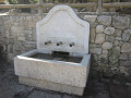
There are no water sources. Take care in summer as there is no shade.
To reach the starting point by car, it is best to follow the route described rather than the car’s sat-nav, as the avenue is new and does not seem to be very well known.

Worth a visit

(S/E) Tower of Hercules: This is a2nd-century Roman tower containing the remains of Lucio Terencio Mancino, who lived in the ancient Roman town of Allon (now Villa Joyosa). It is one of only three large Roman funerary towers preserved in Spain (the other two are in Tarragona and Cartagena). It is a pity that modern apartment blocks are encroaching dangerously close to this site, which had remained intact for decades.

(4) The Torre del Aguiló is part of a series of watchtowers built along the coast inthe 16th century. These towers were intended to warn the population inland of the arrival of pirates coming from the sea to plunder or take hostages.
Inland, a large number of defence towers were also built to provide the population with refuge and enable them to defend themselves against the enemy.
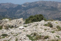
From this tower, you can enjoy views of the town of Benidorm with its skyscrapers on one side, as well as the superb Ponient Beach. Further afield, you can spot the Serra Gelada. There are information boards to help you identify the various peaks.

Reviews and comments

4.7 / 5
Based on 2 reviews

Reliability of the description
4.5 / 5
Ease of following the route
4.5 / 5
Route interest
5 / 5
aicragellebasi
aicragellebasi

Overall rating : 4.3 / 5

Date of your route : Oct 10, 2026
Reliability of the description : ★★★★☆ Good
Ease of following the route : ★★★★☆ Good
Route interest : ★★★★★ Very good
Very busy route : No

A lovely walk. Personally, I preferred to follow the GR route, which runs along the coast up to the tower. It’s a bit steeper. Then I made my way to Cala Finestrat by continuing past the tower. I returned to the starting point by doing a short circular route inland and then rejoining this route once back on the hill. In short, it’s a lovely walk that offers a range of options depending on the weather and what each person fancies.

Machine-translated

gigiber
gigiber

Overall rating : 5 / 5

Date of your route : Aug 05, 2024
Reliability of the description : ★★★★★ Very good
Ease of following the route : ★★★★★ Very good
Route interest : ★★★★★ Very good
Very busy route : No

A brilliant hike, with stunning views. After working up a good sweat, the view as you reach Benidorm Bay is magnificent

Machine-translated

Other walks in the area

For more walks, use our search engine .

The GPS track and description are the property of this route's author. Please do not copy them without permission.