Country:

 City:
City:


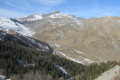
Park in the hamlet of Cougne near marker 41.
(S/E) Cross the bridge and continue carefully uphill along the D30 to reach the junction marked with signpost 50 quickly.
(1) Take the path on the left and continue uphill to reach a crossroads at marker 103.
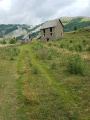
(2) Turn left at the junction, follow the path alongside the forest and then cross a clearing to reach the Cabane d’Ars.
(3) Continue climbing through open countryside until you reach a multi-way junction marked by marker 104.
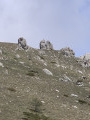
(4) Leave the paths here and take an off-trail route to reach the summit of Countent.
(5) Continue off-trail along the ridge to the summit of Sallette.
(6) Continue along the ridge, alternating between descents and ascents, to reach the summit of the Tête de Chamia.
(7) Begin the descent at almost 180° to the left, rejoin a well-marked path and follow it to the left to reach the junction marked with signpost 104.
(4) Turn left onto the well-marked path and you’ll soon reach the woods. Start a short climb followed by a rapid descent to reach the junction marked 102a.
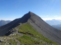
(8) Turn right to reach the summit of Mont Brussière, which is visible ahead.
(9) Turn right off the path onto the south-west ridge, veering slightly to the right at a small stream. Enter the woods and continue on to reach the Vallon de Conchas stream.
(10) Cross the stream and follow a well-marked path on the opposite side. Head towards the chalets at Ars, then those at Cruset. On leaving this hamlet, turn right onto a track for a few metres. You will then reach a junction where several paths meet.
(11) Take thesecond path on the right, continue slightly downhill, and reach the Vallon d’Ars. Cross the stream and climb slightly to reach the junction marked with signpost 103, which you passed on the way out.
(2) Turn left to follow the route taken on the way out and return to the car park in the hamlet of Cougne (S/E).

 Visorando Member
 Moderate
 Easy
Easy