La Tête de Pommier from Le Cians

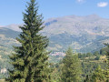
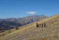
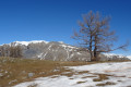
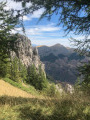
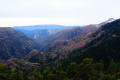
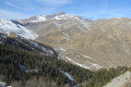
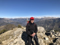
A very lovely walk, sometimes through woodland, sometimes across alpine pastures, offering a stunning 360° panorama from the summit of the Tête de Pommier.

Details

57570817
Creation:
Last update:
Last review:
  • Walking
    Activity: Walking
  • ↔
    Distance: 4.76 mi
  • ◔
    Average duration: 4h 00 
  • ▲
    Difficulty: Moderate

  • ⚐
    Back to start: Yes
  • ↗
    Ascent: + 2,060 ft
  • ↘
    Descent: - 2,054 ft

  • ▲
    Highest point: 6,270 ft
  • ▼
    Lowest point: 4,196 ft

Photos

Description of the walk

Park in the large car park by the roadside, at marker 67.

(S/E) Walk down a few metres towards the ford and cross it. Follow the flat, wooded path, marked in yellow. After about two hundred metres, the path turns into a track suitable for vehicles. Pass marker 72, then, a few metres further on, you’ll come to a wooden gate and a crossroads of paths.

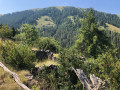
(1) Turn left onto the unmarked track suitable for vehicles. Walk gently uphill, following the Ruisseau du Chaudan. After crossing the stream and then the clearing, you will reach a four-way junction.

(2) Turn right – almost a 180° turn – into a beautiful pine forest. Follow the yellow markings and begin a steeper climb here to reach marker 61b in the hamlet of Pommier.

(3) Turn left; you’ll soon reach marker 61a. Keep left and continue through the forest until you reach the edge of the woodland.

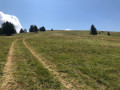
(4) Carry on across the pasture, following the unnumbered markers. Follow the track on the ground – a sort of cart track – to reach the junction at marker 62.

(5) Continue along the path opposite and reach the summit of the Tête de Pommier.

(6) Head down, retracing your steps along the same route back to the Pommier junction at marker 61b.

(3) Continue straight on towards the Pré de Chaudi along a path that descends steeply via tight hairpin bends. At marker 61c, turn right and you will soon reach the junction with the wooden barrier, which you also passed on the way there.

(1) Follow the route you took on the way there, but in the opposite direction, to return to the car park at marker 67 (S/E).

Waypoints

  1. S/E : mi 0 - alt. 4,209 ft - Car park marker 67
  2. 1 : mi 0.44 - alt. 4,386 ft - Wooden barrier crossroads
  3. 2 : mi 0.87 - alt. 4,626 ft - Four-way crossroads
  4. 3 : mi 1.23 - alt. 5,023 ft - Marker 61b Pommier
  5. 4 : mi 1.69 - alt. 5,636 ft - Pasture
  6. 5 : mi 2.39 - alt. 6,115 ft - Marker 62
  7. 6 : mi 2.62 - alt. 6,270 ft - Tête de Pommier
  8. S/E : mi 4.76 - alt. 4,216 ft - Car park marker 67

Notes

Hiking boots and walking poles are recommended.
The walk is suitable all year round, weather permitting.
There is no water along the route.

Worth a visit

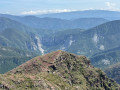
(6) Tête de Pommier: a grassy summit at 1,913 metres. There is a table and benches here, perfect for a welcome break. The ski lift for the “Espace Snow Kite du Pommier” also terminates here.
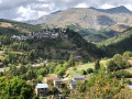
Well worth a visit is the village of Beuil, which boasts remarkable architecture.
A beautiful signposted route starting from the Beuil Tourist Office takes you on a journey through the highlights of local history, in a village shaped by both people and the environment.

Reviews and comments

4.4 / 5
Based on 3 reviews

Reliability of the description
4.7 / 5
Ease of following the route
4.3 / 5
Route interest
4.3 / 5
bernard bb
bernard bb

Thank you, bebeghislaine, for your feedback and suggestions
Best wishes from Rando, b.

Machine-translated

bebeghislaine
bebeghislaine

Overall rating : 5 / 5

Date of your route : May 01, 2025
Reliability of the description : ★★★★★ Very good
Ease of following the route : ★★★★★ Very good
Route interest : ★★★★★ Very good
Very busy route : No

A lovely walk – we extended it a little by returning via the Clari descent: after marker 121, turn right at marker 76 towards Les Giarons (marker 74), then turn right to reach marker 69 and finally the car.
At the end, the walk was 11.34 km with an approximate elevation gain of 800 m.

Machine-translated

bernard bb
bernard bb

Thanks, Casteljaloux, for this review… in the Périgord style :-)
Hiking friends, b.

Machine-translated

Casteljaloux
Casteljaloux

Overall rating : 3.7 / 5

Date of your route : Aug 19, 2024
Reliability of the description : ★★★★☆ Good
Ease of following the route : ★★★☆☆ Average
Route interest : ★★★★☆ Good
Very busy route : No

A poorly signposted walk with very few people; quite pleasant; lovely weather, but a thunderstorm in the middle of the afternoon – do bring a raincoat

Machine-translated

Olivier06
Olivier06

Overall rating : 4.7 / 5

Date of your route : Aug 04, 2024
Reliability of the description : ★★★★★ Very good
Ease of following the route : ★★★★★ Very good
Route interest : ★★★★☆ Good
Very busy route : No

Hello Visio,

A round trip – with a slight variation on the return leg – that alternates between walking through woodland and across pastures. There are no particular difficulties apart from between stages 2 and 3, where a steep climb awaits you. But as it’s on a forest track, it shouldn’t be a problem.

From stage 4 to the end, you’ll be crossing pastures lined with trees, which are ideal for taking a break in the shade.

A rather pleasant little walk, with no difficulties for children or older people, offering a change from the rocky landscapes of the high mountains. I really enjoyed it.

Machine-translated

Other walks in the area

For more walks, use our search engine .

The GPS track and description are the property of this route's author. Please do not copy them without permission.