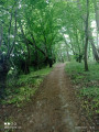
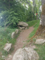
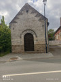
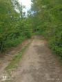
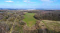
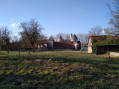
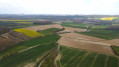
The Table des Fées as seen from Fresnicourt-le-Dolmen

A walk running alongside the golf course, through the Olhain Forest and past the Table des Fées dolmen.

Details

69656366
Creation:
Last update:
Last review:
  • Walking
    Activity: Walking
  • ↔
    Distance: 7.25 mi
  • ◔
    Average duration: 3h 45 
  • ▲
    Difficulty: Moderate

  • ⚐
    Back to start: Yes
  • ↗
    Ascent: + 443 ft
  • ↘
    Descent: - 433 ft

  • ▲
    Highest point: 617 ft
  • ▼
    Lowest point: 279 ft

Photos

Description of the walk

Park in the Olhain Castle car park, Rue Léo Lagrange.

(S/E) Leave the car park and take the road on the left, then turn right onto Chemin de Béthune and continue straight on until you reach a T-junction.

(1) Keep left onto the uphill track, then at the next Y-junction turn right and continue to a five-way junction.

(2) Carry on straight ahead, keeping to the left at the junctions you come to, until you reach the end of the track.

(3) Turn right, and carry on straight ahead until you reach a wide forest track on the right.

(4) Follow this until you reach the road.

(5) Cross over and carry on straight ahead until you reach the third path on the left.

(6) Take this path until you reach a tarmac area near a house. Take the path on the right which runs diagonally, keeping in the same direction, and carry on straight ahead until you reach the road (Rue Roger Salengro). 

(7) Turn right, then, as you come out of the bend, take the first turn left then right to join Rue des Grenadiers. Continue to the first path on the right. 

(8) Follow it, rejoin Rue Roger Salengro and follow it to the left until you reach the roundabout.

(9) Turn left onto Rue Jean Moulin (D57). Pass the town hall and, at the Y-junction, keep right. Continue to the first junction. 

(10) Take the path on the right and follow it to the end. 

(11) Turn right and carry on straight ahead at the junction with a small tarmac road. Stop off at the Table des Fées dolmen.

(12) Carry on to the junction with the D57 (cross) and follow the road to the right. Walk alongside the Bois Bayon. 

(13) Take the path on the left into the woods, then continue downhill, following the edge of the woods until you reach the road.

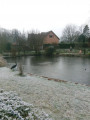
(14) Head down the road, keeping to the left, then take the path on the right at the car park. After the pond, take the path on the left and return to the junction you passed on the way out. 

(1) Turn left and retrace your steps along the path you took on the way there to reach the car park (S/E). 

Waypoints

  1. S/E : mi 0 - alt. 285 ft - Car park at the - Château d'Olhain
  2. 1 : mi 0.22 - alt. 295 ft - Crossroads at the end of the circular loop
  3. 2 : mi 0.71 - alt. 512 ft - Crossroads with five paths
  4. 3 : mi 0.94 - alt. 584 ft - End of the path
  5. 4 : mi 1.39 - alt. 486 ft - Forest track
  6. 5 : mi 2.26 - alt. 568 ft - Road
  7. 6 : mi 2.56 - alt. 581 ft - Path on the left
  8. 7 : mi 2.92 - alt. 614 ft - Rue Roger Salengro
  9. 8 : mi 3.32 - alt. 587 ft - Path on the right
  10. 9 : mi 3.62 - alt. 574 ft - Rue Jean Moulin
  11. 10 : mi 4.14 - alt. 551 ft - Fork
  12. 11 : mi 4.68 - alt. 509 ft - End of the trail
  13. 12 : mi 5.29 - alt. 554 ft - La Table aux Fées (Fresnicourt)
  14. 13 : mi 5.72 - alt. 577 ft - Bois Bayon, on the left
  15. 14 : mi 6.6 - alt. 344 ft - Road
  16. S/E : mi 7.25 - alt. 285 ft - Car park at the - Château d'Olhain

Notes

No water source.

Worth a visit

Reviews and comments

4.4 / 5
Based on 3 reviews

Reliability of the description
4.3 / 5
Ease of following the route
4.3 / 5
Route interest
4.7 / 5
souchez rando
souchez rando

Thanks for your feedback. I try to vary the routes, but it’s not always easy.

Machine-translated

BaudouinB
BaudouinB

Overall rating : 5 / 5

Date of your route : May 01, 2026
Reliability of the description : ★★★★★ Very good
Ease of following the route : ★★★★★ Very good
Route interest : ★★★★★ Very good
Very busy route : No

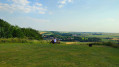
The walk took place in good weather and was thoroughly enjoyable overall. The route is varied, alternating between forest paths, open countryside and some lovely views of the surrounding valleys.

Discovering the Table aux Fées is clearly the highlight of the walk. The site is impressive and adds a real heritage dimension to the route.

Some sections can be a bit trickier depending on the weather, particularly in the forest, but that’s also part of the route’s charm.

An interesting route, well signposted on the whole, which I recommend for those who enjoy walks combining nature and heritage.

Full report and photos here:
https://nomdunrandonneur.com/2026/05/01-...

Machine-translated

thorwordor
thorwordor
• Edited:

Overall rating : 5 / 5

Date of your route : Mar 28, 2026
Reliability of the description : ★★★★★ Very good
Ease of following the route : ★★★★★ Very good
Route interest : ★★★★★ Very good
Very busy route : No

A lovely walk, mainly through woodland and along paths.
A short section on the road.
Despite the week’s rain, the paths remain easily passable, but walking boots are essential.
We found the table but not the fairies
This walk is also fully signposted.

Machine-translated

souchez rando
souchez rando

Thank you for your feedback and sorry if you got lost, but the route is well detailed and easy to follow. Feel free to zoom in on the map for better visibility.

Machine-translated

User 28049862

Overall rating : 3.3 / 5

Date of your route : Nov 10, 2025
Reliability of the description : ★★★☆☆ Average
Ease of following the route : ★★★☆☆ Average
Route interest : ★★★★☆ Good
Very busy route : No

We encountered difficulties following the route described, had to retrace our steps a few times, and missed the final stretch to the Table des Fées.
Nevertheless, it is an interesting route with some good views.

Machine-translated

Other walks in the area

For more walks, use our search engine .

The GPS track and description are the property of this route's author. Please do not copy them without permission.