Country:
 City:


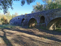


To get there from Bagnols-sur-Cèze, either go via Donnat if your vehicle is wider than 2.00 m (van, motorhome), or cross the Charles Martel Bridge from the D980. Park in the pay-and-display car park next to the Charles Martel Bridge.
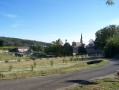
(S/E) From the car park entrance, walk up through the village and pass the Church of Saint-Laurent.
(1) Continue along Rue de l’Arceau and head up to the Promenade du Château.
(2) Carry on up the concrete track, which eventually leads downhill, until you reach a right-hand bend in the track.
(3) Follow the track downhill to a gamekeepers’ post.
(4) The path, made up of large white stone slabs, climbs slightly and reaches a T-junction.
(5) Turn left and follow the track until it ends (where it widens) and becomes a footpath.
(6) At the boundary marker, head down to the right, down the steep slope, along a path not shown on the IGN map. At the junction (metal hunting post), continue down, more gently, until you reach a track.
(7) Turn left and follow the main track eastwards until you reach a Fork in the road.
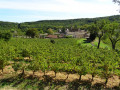
(8) Turn right, walk alongside a vineyard, then past a holiday home, and arrive at the D166.
(9) Cross it carefully to take the track that leads downhill (to the left of the Slaw Village campsite). It is a little rutted, turns left and joins a tarmac road, which you should follow until you are 10 metres from the D166.
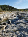
(10) Turn right onto a track running alongside a plot of vines. Pass a small hut and turn left. 50 m further on, you can head down (a steep path) to the pebble beach at La Cèze. Follow the Cèze, walk back up alongside the fence of the Camping des Cascades, and follow the banks of the Cèze, without getting too close to the edges (danger).
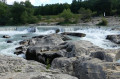
(11) Admire the waterfall, then continue along the road leading to the Charles Martel Bridge, pass under the first arch, and head for the car park (S/E).
 Visorando Member


 Moderate