A visit to Cornillon

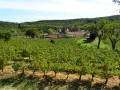
Set off to explore the old village of Cornillon.

Details

71314851
Creation:
Last update:
Last review:
  • Walking
    Activity: Walking
  • ↔
    Distance: 2.82 mi
  • ◔
    Average duration: 1h 35 
  • ▲
    Difficulty: Easy

  • ⚐
    Back to start: Yes
  • ↗
    Ascent: + 348 ft
  • ↘
    Descent: - 331 ft

  • ▲
    Highest point: 568 ft
  • ▼
    Lowest point: 259 ft
  • ⚐ Country: France
  • ⚐ City: Cornillon (30630)
  • ⚑
    Start/End: N 44.218469° / E 4.48559°
  • ❏
    IGN map(s): Ref. 2940OT
  • Hour-by-hour weather

Description of the walk

Start from the Town Hall car park, on the edge of the D220.

(S/E) On leaving the car park, turn left, then immediately right onto Route de Barjac. Continue to No. 3418 and, at the corner, take the Calade de la Vérune on the right. Follow this street until you reach a three-way junction.

(1) Keep to the left, then head uphill through the woodland.

(2) At the edge of the woodland, take the path on the right which runs alongside the vineyards, then enters the woods. Continue straight on until you reach another stretch of vineyards, then turn right between the two fields.

(3) At the stream, take the wooden footbridge and follow the path to a small road. Follow it to the right, keep left at the next junction, and you’ll reach the end of Chemin de Saint-André. Head right and you’ll come to a junction with a cross and a car park on your right.

(4) Head straight on along Rue du Château, then turn right at Place de la Fontaine. Follow Rue Basse, which curves to the left.

(5) Cross Place du Barry, then keep to the right onto Rue de la Gargouille, and join Rue du Château. Follow it to the right, and you’ll come back to the junction with a cross.

(4) Turn right onto Impasse des Rempart and continue along a footpath. At the road, turn left, then carry on straight ahead until you reach an esplanade opposite the cemetery. Turn right and head towards the washhouse.

(6) Carry on to the right, enter the woodland and reach a fork in the path after crossing the stream.

(7) Carry on to the right. At the bottom of the descent, walk alongside the vineyards on your left until you reach the road at the entrance to Cornillon. Turn left onto this road, then you’ll soon reach the town hall car park (S/E).

Waypoints

  1. S/E : mi 0 - alt. 276 ft - Town hall car park
  2. 1 : mi 0.56 - alt. 299 ft - Three-way junction
  3. 2 : mi 0.76 - alt. 384 ft - Edge of the woods
  4. 3 : mi 1.14 - alt. 377 ft - Wooden footbridge
  5. 4 : mi 1.39 - alt. 548 ft - Cornillon
  6. 5 : mi 1.56 - alt. 554 ft - Place du Barry
  7. 6 : mi 1.89 - alt. 522 ft - Washing house
  8. 7 : mi 2.41 - alt. 502 ft - T-junction
  9. S/E : mi 2.83 - alt. 276 ft - Town Hall car park

Notes

Water source at the village fountain.

There are few shops in the old village.

Worth a visit

Geography
Cornillon is situated in the north-east of the Gard department in the Occitanie region. The old village of Cornillon stands on a rocky outcrop, at an altitude of 156 metres.
Enjoying a Mediterranean climate, the village is drained by the River Cèze and had a population of 908 in 2022, following a sharp rise in population since 1968. Its inhabitants are known as Cornillonois or Cornillonoises.
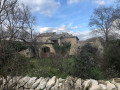
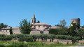
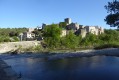
Perched on a rocky outcrop, the medieval village, with its castle, narrow streets and vaulted passageways, is listed in the register of protected sites.
Many artists (painters, sculptors, potters, etc.), who have formed an association, are based in the village and offer tours of their studios and organise events during the summer.
Established in 2013, the annual theatre festival ‘Cornillon se la joue au château’ is held during the first week of August in the castle courtyard, which is transformed into an open-air theatre.

Cornillon, a town of historical significance
Cornillon takes its name from a Gallo-Roman family: the Cornelli. The earliest known reference to Cornillon dates back to 1121, mentioning the existence of an early castle. Guillaume de BEAUFORT, a former owner of the castle, was the brother of Pope Gregory XI and settled in Cornillon in 1376.
The castle then underwent its first extension, coming to comprise around forty rooms, two chapels and a large six-storey keep.
Guillaume de Beaufort, who owned vast tracts of land, had also purchased the castles of Verfeuil, Montclus and Vénéjan.
Later, in 1632, Henry de Montmorency, another owner of the castle and then governor of Languedoc, rebelled against royal authority. Defeated, he was beheaded that same year in Toulouse, and Louis XIII ordered the dismantling of his estates, notably the castles of Bagnols and Cornillon.
We should also mention 19th-century Cornillon, with its cafés, blacksmiths, silkworm rearing and the development of the hamlets, as well as the tragic period of theFirst WorldWar , during which the village of Cornillon paid a heavy price.

The church of Cornillon
Before the Revolution of 1793, the village of Cornillon was part of the Diocese of Uzès. The church was situated in the lower part of the old village, near the cemetery (a section of wall, surmounted by a cross, bears witness to this).
In the mid-16th century, Cornillon was not spared the Wars of Religion, but the destruction of the church was not solely due to the consequences of those conflicts. A record exists of a decision taken by the local council on 11 May 1550 to compel the priest to repair this building, which was falling into ruin. The ruined church was replaced by the castle chapel, whose outer wall is formed by the ramparts.

The Saint-Vincent ochre quarry in Cornillon
In the 19th century, kaolin (white ochre) was mined in the Cornillon area, in the districts of Montejean and Chante Perdrix. Extraction took place via shafts that could reach depths of over 20 metres; the ochre was hauled to the surface using a winch fitted with a thick rope.
All these products were packed into metal drums protected by a small wooden barrel to shield them from knocks. Transported to Bagnols station by the company’s lorry, they were taken to the port of Sète and shipped all over the world, notably to Buenos Aires (Argentina) and Rio de Janeiro (Brazil).
Between the mine staff, the factory workers and the administrative staff, the company employed an average of around twenty people from the region. For about ten years, the factory operated at full capacity. The factory ceased production in 1940 and the company’s assets were placed under administration.
In 1948, the shed was dismantled and reclaimed by the craftsman who had built it, whilst the clay pit was reclaimed by the landowner. This date marks the end of ochre mining in the Cornillon area. Apart from a few sections of wall from the huts and the beginnings of shafts, now filled in by erosion, nothing remains of the oldest mining sites. One must have lived through part of that era to detect the barely visible traces in these places, for nature has reclaimed its rights almost everywhere.

Reviews and comments

4 / 5
Based on 3 reviews

Reliability of the description
3.7 / 5
Ease of following the route
3.7 / 5
Route interest
4.7 / 5
roro30
roro30

Overall rating : 4.3 / 5

Date of your route : Mar 09, 2026
Reliability of the description : ★★★★☆ Good
Ease of following the route : ★★★★☆ Good
Route interest : ★★★★★ Very good
Very busy route : No

A visit to Cornillon, a charming village with views over the Cèze valley, makes it one of the most beautiful villages in France. A very pleasant walk.

Machine-translated

JLE12
JLE12

Overall rating : 4.3 / 5

Date of your route : Jul 08, 2025
Reliability of the description : ★★★★☆ Good
Ease of following the route : ★★★★☆ Good
Route interest : ★★★★★ Very good
Very busy route : No

We followed the route using GPS and had no problems, except that we did it backwards, which wasn't a bad thing because the start of the route was very steep on that side and, in the end, we found it better to do this part uphill rather than downhill.
However, in this direction, the start of the trail from the vineyards after the wooden footbridge was difficult to find. In the other direction, it would have been easier as the footbridge is impossible to miss.

Although not listed like others in the area, the old village of Cornillon is definitely worth a visit. At the beginning of July, when the heatwave was over, we didn't meet anyone except in the village.

Machine-translated

JPRaffin
JPRaffin

Overall rating : 3.3 / 5

Date of your route : Apr 21, 2025
Reliability of the description : ★★★☆☆ Average
Ease of following the route : ★★★☆☆ Average
Route interest : ★★★★☆ Good
Very busy route : No

Quite a few very stony paths – you need to keep your eyes on the ground and watch your step.
The appeal of walking through the forest, which means you’re often in the shade, is particularly pleasant on sunny days
A lovely village with a view over the whole Cèze valley
No signposting. If in doubt at a crossroads, I’d advise checking Google Maps or another app.

Machine-translated

Other walks in the area

For more walks, use our search engine .

The GPS track and description are the property of this route's author. Please do not copy them without permission.