Country:

 City:


Once in the village of Guillaumes, cross the Pont Maurice Durandy, turn left towards the Parc des Sports, and park by the tennis courts.
(S/E) Follow the right bank of the Var along the riverside path and head for marker 13 just before the Pont des Roberts.
(1) Take the path on the right, following the sign for Sauze Vieux: wooden signpost. Follow the yellow markings on this path, which climbs gently through the forest.
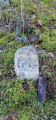
(2) At marker 12, turn right towards Sauze Vieux and Roche Trouée, keeping to the yellow markings. Just after stone marker no. 66, you’ll come out onto a wider track leading to a property; follow this to the right for a few dozen metres, then rejoin the yellow-marked path, which winds upwards opposite and leads to another wide track: marker 95 and a sign for “Sauze Vieux”.
(3) First turn left then right, and rejoin the path. Navigate another series of hairpin bends before reaching the junction at marker 90.
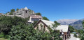
(4) Carry on straight ahead: you’ll cross a small pile of rubble from a wall on the path. You’ll reach the hamlet of Sauze Vieux: drinking water tap.
(5) After thefirst house on the left, take the path on the right which runs between a building and a caravan above it. The path is no longer very clearly marked, but you should keep slightly to the left after the caravan, then follow a small wire fence and a field on your right.
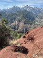
(6) Pass between two large piles of stones, cross the large field downhill (superb view of the surrounding mountains), and rejoin the forest and the more clearly marked yellow-signposted path coming from marker 90.
(7) Head left towards La Roche Trouée and you’ll come to a three-way junction: marker 91.
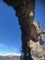
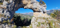
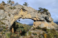
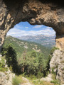
(8) Keep to the left. At marker 92 (damaged), turn left again to reach La Roche Trouée after climbing a short, steep slope: magnificent views and an ideal spot for a picnic.
(9) Return to marker 91.
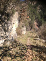
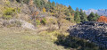
(8) Take a sharp left-hand bend to begin the descent. The path passes by a large ruin: go round it and continue down the very steep, winding but sheltered path to marker 14. You will then reach the car park very quickly (S/E).
 Visorando Member
 Very difficult

 Difficult