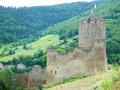
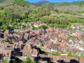
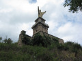
La Roche du Tétras as seen from Kaysersberg

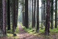
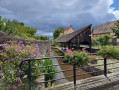
Kaysersberg is a village well known for its architecture and historic centre. It is also possible to combine a visit to this village with a route that takes in Aspach, the Ermitage Saint-Joseph, the Roche du Tétras, the Chêne de la Chapelle and the Rocher des Corbeaux. Most of the route runs through woodland. The main viewpoints are largely concentrated towards the end of the walk, but the route offers several points of interest to liven up the day.

Details

67385969
Creation:
Last update:
Last review:
  • Walking
    Activity: Walking
  • ↔
    Distance: 12.88 mi
  • ◔
    Average duration: 8h 00 
  • ▲
    Difficulty: Difficult

  • ⚐
    Back to start: Yes
  • ↗
    Ascent: + 2,421 ft
  • ↘
    Descent: - 2,438 ft

  • ▲
    Highest point: 3,074 ft
  • ▼
    Lowest point: 810 ft

Photos

Description of the walk

Park in the car park on Rue du Geisbourg opposite the sports ground in Kaysersberg.

Unmarked

(S/E) With your back to the sports ground, turn left onto Rue du Geisbourg. At the Fork in the road, continue left towards the swimming pool, and you’ll reach the junction with Rue du Schossrain.

Signpost: Red Rectangle with a white cross

(1) Keep left on Rue du Geisbourg, carry on straight ahead, pass the factory and continue to the next junction, after the entrance to the sewage treatment plant.

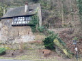
(2) Turn right and carry on straight ahead until you reach a body of water. Follow the path on the left to reach the Ermitage Saint-Joseph.

(3) Head up the path on the right towards Ursprung. Continue along the track which soon branches off to the left, cross a track, go round a bend and cross another track.

(4) First turn right then left onto this track before reaching a plateau.

(5) Carry on straight ahead towards Ursprung. At the next two junctions, keep straight ahead on the uphill track and reach Ursprung.

(6) Turn left at the first houses and carry on straight ahead until you reach the tarmac forest track.

(7) Turn right onto the track leading to Aubure. Head up this track to the left until you reach the bend in the track.

(8) Leave the track and follow the path to the right to the Col du Kalblin.

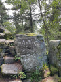
(9) Follow the ridge path to the right. After a short climb, the slope levels out; stay on the ridge all the way to the Roche du Tétras. Take a moment to admire this geological feature.

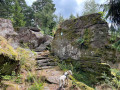
(10) Cross the rocky area and head straight on to the rock outcrop. At the junction, go straight ahead then turn right to reach another rocky area with inscriptions.

(11) Follow the path as it turns right, go round a hairpin bend, then head down a track, keeping to the right all the way to the Croix du Sapin des Français and its crossroads.

(12) Keep to the right.

Blue Cross markings

Then turn right again at the next Fork in the road and stay on the wide, descending track until you reach a hairpin bend.

(13) Just before this, turn right and then continue straight on towards the road. Then take thefirst path on the left and, at the Fork in the road, continue to the right to reach the Finsterhurst junction.

(14) Keep to the right and continue straight ahead until you reach the climb. At the crossroads at the top of the climb, keep to the left to reach the Hohe Schwaerz junction.

(15) Head straight ahead, keeping the same course, then descend towards the Chapel Oak.

Red Saltire signposting

(16) Carry on straight ahead to reach the Rocher des Corbeaux viewpoint and enjoy the view.

(17) Head down the path and, when you reach the track, turn right to rejoin the Blue Cross markings.

Blue Cross signpost

Head down to the left until you reach the next junction.

(18) Head straight on towards the mast. Go round it, leave the descending path and take the next one. Continue straight on until you reach Kayserberg Castle. Don’t hesitate to climb to the top of the tower for the panoramic view.

(19) Head down the wide path to the right of the ruins.

No signposts

At the road (Rue des Forgerons), follow it down to the end.

(20) Turn right, cross the fortified bridge over the Weiss, then head back up the road opposite (Rue du Général de Gaulle). Walk past the museum and continue along Avenue Georges Ferren-Bach.

Blue Triangle signposting

Continue to the roundabout.

No signposting

(21) Take the first exit onto the D415, towards Orbey, then take the second street on the right towards the swimming pool to reach the car park by the stadium (S/E).


Waypoints

  1. S/E : mi 0 - alt. 896 ft - Car park on Rue du Geisbourg in Kaysersberg
  2. 1 : mi 0.11 - alt. 906 ft - Rue du Shossrain
  3. 2 : mi 0.87 - alt. 1,020 ft - Junction after the factory
  4. 3 : mi 1.22 - alt. 1,138 ft - Saint Joseph’s Hermitage
  5. 4 : mi 1.96 - alt. 1,706 ft - Trail
  6. 5 : mi 2.48 - alt. 2,034 ft - Plateau
  7. 6 : mi 3.02 - alt. 2,241 ft - Ursprung
  8. 7 : mi 3.54 - alt. 2,277 ft - Forest track
  9. 8 : mi 4.09 - alt. 2,477 ft - Turn in the trail
  10. 9 : mi 4.88 - alt. 2,818 ft - Kalblin Pass
  11. 10 : mi 5.69 - alt. 2,943 ft - Roche du Tétras (Ursprung)
  12. 11 : mi 6.18 - alt. 3,071 ft - Rocks
  13. 12 : mi 7.02 - alt. 2,562 ft - Crossroads at the Croix du Sapin des Français
  14. 13 : mi 7.79 - alt. 2,297 ft - Junction before the hairpin bend
  15. 14 : mi 8.66 - alt. 2,195 ft - Finsterhurst junction
  16. 15 : mi 9.6 - alt. 2,073 ft - Hohe Schwaerz
  17. 16 : mi 10.25 - alt. 1,978 ft - Chapel Oak
  18. 17 : mi 10.48 - alt. 1,936 ft - Viewpoint at the - Rocher+du+corbeau
  19. 18 : mi 11.04 - alt. 1,562 ft - Junction
  20. 19 : mi 11.62 - alt. 971 ft - Château de Kaysersberg
  21. 20 : mi 11.85 - alt. 820 ft - Bridge over the - Weiss (rivière)
  22. 21 : mi 12.4 - alt. 876 ft - Roundabout
  23. S/E : mi 12.88 - alt. 896 ft - Car park on Rue du Geisbourg in Kaysersberg - Weiss (rivière)

Notes

Refreshments and toilets in Kaysersberg.

Picnic tables available at the Roche du Tétras (10) and the Chêne de la Chapelle (16).

Worth a visit

- (20) Visit the historic centre of Kaysersberg before or after the walk.
- (10) Roche du Tétras.
- (11) Rocks.
- (16) Chêne de la Chapelle.
- (17) Rocher des Corbeaux.
- (19) Kaysersberg Castle.

Reviews and comments

5 / 5
Based on 2 reviews

Reliability of the description
5 / 5
Ease of following the route
5 / 5
Route interest
5 / 5
User 11856963

Overall rating : 5 / 5

Date of your route : Aug 18, 2025
Reliability of the description : ★★★★★ Very good
Ease of following the route : ★★★★★ Very good
Route interest : ★★★★★ Very good
Very busy route : No

Beautiful hike mainly in the forest, but beware of a few difficult sections

Machine-translated

virgule
virgule

is it possible to eat "out of a bag" under shelter?
thank you for your reply

A little off the beaten track, in the centre of Aubure, there is a sheltered picnic table and two outdoor tables. It is opposite the town hall. There is also a drinking fountain and a café-grocery store called "Chez Marinette" where GR5 hikers can stock up on supplies.

Machine-translated

virgule
virgule

Very beautiful route. In this very touristy area, a 20 km route is likely to be little used.

Machine-translated

Nature57
Nature57

Overall rating : 5 / 5

Date of your route : Dec 29, 2024
Reliability of the description : ★★★★★ Very good
Ease of following the route : ★★★★★ Very good
Route interest : ★★★★★ Very good
Very busy route : No

A long and very scenic walk, mainly through woodland, offering the chance to discover geological features such as the ‘Roche du Tétras’, which you reach after a long climb with an elevation gain of almost 800 metres from the starting point. There are also some stunning views from the ‘Rocher du Corbeaux’ over Kaysesberg and its valley. The descent, a visit to the castle and a stroll through the streets of this lovely town round off a superb day’s walk, though it does require a good level of fitness.

Machine-translated

tontonviki
tontonviki

Thank you, and Happy Hiking New Year 2025

Machine-translated

Orando974
Orando974 ★

Hello,

There are tables but no shelters along the route.

Enjoy your walks,

Orandi974

Machine-translated

tontonviki
tontonviki

Is it possible to have a packed lunch in the shelter?
Thanks for your reply

Machine-translated

virgule
virgule

Hello,

A lovely route, but one to avoid at all costs on Christmas market days.

Machine-translated

Other walks in the area

For more walks, use our search engine .

The GPS track and description are the property of this route's author. Please do not copy them without permission.