Country:

 City:
City:


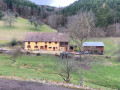
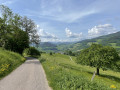
Park at the side of the road between Hachimette and Kaysersberg, near the Chemin du Limbach. There is a widening at this point where you can park safely.
(S/E) The route starts on Chemin du Limbach, a tarmac road (signposted towards a lodge). Continue along this tarmac road.
(1) At the junction, go straight on, following the Yellow Triangle markings. The path on the left will be the one you take on the return journey. The road then becomes a forest track running alongside the Limbach. Pass several houses below on the other side of the valley and continue uphill until you reach a tributary of the stream at a small ford.
(2) Cross the stream and continue along a narrower path (Yellow Triangle) which climbs through the forest. After a series of fairly wide hairpin bends, you’ll emerge onto a wide forest track, the Chemin du Breuil.
(3) Turn left and follow this track until you reach a junction with another wide forest track.
(4) Turn left (Blue Ring markings) and continue along the track through a beautiful mixed forest to the Col du Herrenwasen.
(5) Take the wide Chemin de Ceinture du Vorhofkopf (Yellow Ring) which branches off to your left until you reach a Fork in the road.
(6) Please note: this is where you leave the signposted path and turn left onto the Chemin des Vachettes (signposted), which you will follow until you reach the junction with the forest track known as the Haut Limbach.
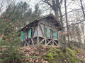
(7) At this junction, take the hairpin bend to the right and continue to the Chalet de l’Étoile, which is actually a small hut where you can take shelter in case of bad weather.
(8) Go round the hut on the left to begin a fairly steep descent. After about twenty metres, turn left onto the path that descends into the valley to join a wide forest track, which you follow straight on downhill. Pass the inter-municipal woodchip production plant before rejoining a Club Vosgien trail (Red Rectangle with a white cross).
(9) Follow it to the left until you reach the vicinity of the Kaysersberg–Hachimette departmental road (D415).
(10) Leave the road on your right and head left up the tarmac track (Yellow Triangle), which turns into a forest track after about twenty metres. Follow it to a wooden footbridge, cross it and continue along the path (Yellow Triangle), which climbs quite steeply through the forest before levelling out slightly. Cross a forest track and continue straight on until you reach a Fork in the road.
(11) Take the right-hand fork and you’ll rejoin the tarmac road you took on the way there.
(1) Turn right and head downhill to your starting point (S/E).



 Visorando Member

 Tourism professional
 Easy
Easy 
 Difficult