Country:

 City:


In Pontaumur (40 km west of Clermont-Ferrand), follow the D941 towards Aubusson. At Saint-Avit, turn left onto the D13 towards Giat. Car park at Place de l’Hôtel de Ville.
(S/E) From the starting sign, head down Rue de l’Hôtel de Ville, skirting the square on the left until you reach the Y-junction.
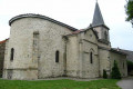
(1) Turn left towards Aubusson. At Place Barthélémy, head up to the left of the fountain then turn right towards the church, facing the cross. Turn left until you reach the far end of the square and the start of the climb up to the Motte Castrale, also known as the Motte Féodale.
(2) Walk up opposite towards the motte castrale, then take the steps to reach the summit: an 11th-century motte castrale, with views of the Puy de Dôme and the village of Giat. Return to Place de l’Église.
(2) Turn right, cross the D204 towards Rue de la Clinique, leaving the signposted route to Aubusson on your right. Take Rue de la Clinique, keep right at Place du Crau and continue straight on along Chemin de Ganobert until you reach the road (Croix de Roure). Turn right onto this track. At the next bend, pass a track on your right (Croix des Adieux) and continue for a few metres until you come to a track on your left as you emerge from the bend.
(3) Take this path and turn onto the first tarmac track on the right. Cross the Masconet and continue for a few hundred metres until you reach a shed.
(4) Carry on along the track opposite, heading south, to reach the D13.
(5) Turn right and walk carefully alongside the D13. After less than 1 km, you’ll reach a junction.
(6) Take the first road on the right (towards Étang de la Ramade) for 200 m. Turn left towards the
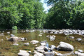
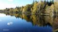
car park and walk down to the edge of the lake. Follow the shore to the left as far as the dyke (in the event
flooding, return to point 2 and take the D30 to the right as far as the dyke). Cross the dyke and
turn left immediately to reach Coulignat via the road. In the hamlet, take the first track
on the left. Pass through the locality known as Les Planches (the section just before the bridge may be flooded). When the
track becomes tarmac, continue uphill to a crossroads (Villevergne).
(7) Turn left, continue uphill to the left, then take thefirst path on the right to join the D95 (cross).
(8) Cross the road and continue straight ahead. At the Fork in the road, keep to the right. Cross the stream (the path is often flooded), ignore a path on the left, head uphill and continue until you reach the junction with a wide path on the left.
(9) Take this path and head down to La Ramade, passing paths on either side. Cross the stream, turn left immediately and carry on to the next junction.
(10) Take the first path on the right: views of the Puy de Dôme and the Sancy. At the buildings, carry on straight ahead along the road and head for Ligny.
(11) At the first junction, head up to the right until you reach a small pond on the left. Turn left and carry on straight ahead between the houses. Take thefirst path on the left, heading north-east. Cross a stream and head up to a path.
(12) Turn right, cross the bridge over the railway line and immediately turn left onto a track until you reach a road.
(13) Do not cross, but take the path on the left. Turn off onto the first path on the right after the bridge under the railway line. Continue due north until you reach a road at the entrance to Giat; leave the cul-de-sac on your right and head for the next Y-junction.
(14) Turn left onto Avenue de la Gare and head straight up to Place Arlette Brette. Walk down the opposite side to return to the starting point (S/E).

 Visorando Member

 Easy
 Tourist office

 Local authority