Country:
 City:
City:


(S) Once you have crossed the bridge, take the grassy path running alongside the road between the meadow fences and the hedgerow on the left for 1.3 km.
(1) Facing the wayside cross, continue along the path on the left, pass Saint-Thibert Chapel, descend the plateau and cross a stream before heading up a sunken path to a junction.
(2) Turn left onto a natural track that runs alongside a hedge and crosses, in turn, a tarmac road and a footbridge over the Èvre, goes round the hamlet of Pied Tribert and comes out onto a road.
(3) Continue along the road to the right, heading for Le Cerisier, then La Brosse by turning right, before joining the D15 on the right to reach La Jubaudière.
(4) After the town hall, take the path on the right, continue left along Rue des Tourterelles, cross Avenue de la Carrée, take the grassy path opposite, skirting private properties and pastures, and head towards a wooded area. Follow a path through the woods there, cross a road and walk through the woods of the Parc de la Gautrêche and the château. Follow the River Èvre, passing under a bridge on the D15, and continue as far as La Gourgoulière.
(5) Then continue along the road on the right and, further on, along its stabilised-surface footpath. During flood periods: before reaching the bridge, you can cross the D15 at the park’s exit and rejoin the signposted route by following the path alongside the road.
(6) Leave La Jubaudière by turning right before the sports grounds and head towards Les Blauderies. From here, the route winds its way through wide open countryside and hedgerow-lined landscapes. At the junction, continue to the left.
(7) Cross a road to reach the Bois Ham and its pond on the left. Go round it on the left.
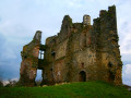
(8) As you leave the car park, continue to the left towards the Bois Viau. A long path winds its way round the Bois de la Marmottière. Keep to the right and walk past the ruins of the Château des Hayes Gasselin (private property). On leaving the hamlet of La Cabane, the stony path leading to the wayside cross takes you to Andrezé via a track on the left, running alongside the D91 road. Shortly afterwards, cross the road and continue along the lane running alongside a housing estate until you reach the main road.
(9) Leave Andrezé by taking the path furthest to the right, passing through nurseries until you reach a road.
(10) Follow this road to the right for just over 200 metres before turning right onto the Chemin de Jallais until you reach another road leading left towards La Hérissière. Take this road.
(11) Take the path on the right which descends to the Èvre. Before the footbridge, turn left and follow the river as it meanders through the hollows of the hillsides and valleys, then cross it via the Moulin Neuf footbridge.
(12) Walk up the hillside on the right and take a grassy path on the left before joining a road. Cross the road and head left, then straight ahead towards Le Pré and La Combe. Pass under a bridge on the D752 and enter the Beaupréau business park. At the roundabout, take Rue Sainte-Anne straight ahead and head towards the Sainte-Anne Chapel and Rue Saint-Martin.
(13) Turn left onto this road, then further down, on the left, follow Rue du Moulin Foulon. Continue to the right along Rue de l’Aumonerie. Enter the park, turn right, then left, and walk through the wooded park of Beaupréau for about 1 km. At the end, turn right. Head towards the château. On leaving the park, turn left down Rue de Durfort Civrac before reaching Rue des Mauges (E).
 Visorando Member
 Moderate
  Tourist office

 Easy
Easy