Country:

 City:
City:


The walk starts at Le Planay, 3 km from Arêches, at the foot of the Piapolay chairlift. Plenty of parking spaces are available, including for motorhomes.
(S/E) Take the path that runs behind the ski lift ticket offices (Chemin de Melon), following the arrows for Trail No. 7. Then, before passing under the chairlift, immediately take a small track that climbs to the right.
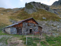
(1) After the Piapoley chalet (1,600 m), continue the climb, which runs alongside the chairlift for a while before veering off to the right.
(2) Continue along the path towards the Col de la Bathie. The slope levels out and the view opens up.
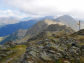
(3) At the Col de la Bathie, carry on following the ridge along the path furthest to the right. In an increasingly rocky landscape, the track climbs steeply amongst boulders and blueberry patches. After a steep climb over scree, the path levels out and curves round a small rocky outcrop to the left.
(4) At the end of this level stretch, leave the faint path that continues straight on and take the one on the left – which is also barely visible – and continue the ascent.
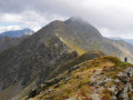
(5) Follow the cairns to quickly reach a gully, which you must cross before emerging on the left. You are now on a large scree slope at the foot of the Pointe de la Grande Journée, whose cross stands out against the summit. Reach the peak by following the ridge to arrive at the highest point of the hike at 2,460 m.
(6) From the Pointe de la Grande Journée, follow the ridge northwards. The path descends initially, then climbs again to the Pic de la Vache Rouge.
Caution! Some steep sections may be daunting for those prone to vertigo and should be negotiated with care.
(7) Continue along the path that follows the ridge. It becomes less steep and crosses small meadows. You’ll reach a fork about a hundred metres below the Pas de L’Âne.
(8) Turn left for a return trip to the Pas de l’Âne.
(9) Take in the magnificent scenery, then return to the previous fork.
(8) Take the descent towards Plan Villard. The path winds down the mountainside. After about 1.5 km, do stop off at the Chalet du Lac, where a small bar welcomes you for a well-deserved break.
(10) Then continue along the path towards Plan Villard. When you reach the edge of the woodland, leave the track and take the path on the left instead. This runs alongside the woodland, then turns right and descends into the forest. At the entrance to Plan Villard, walk about a hundred metres along the forest road until you find a path starting on the right.
(11) Follow this path (both lead to Le Planay, but this one is shorter).
(12) At the road near the hamlet of Les Granges, continue the descent by taking the paths that cut across the hairpin bends. Once you reach the hamlet of La Dray, simply follow the road to reach the foot of the Piapolay chairlift (S/E).


 Visorando Member
 Difficult
 Moderate