Country:

 City:
City:


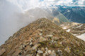
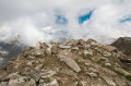
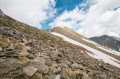
The route starts from the small hamlet of Douans. Once you have passed the village of Isola and then the hamlet of Le Bourguet, a small road on the right signs for Douans, which you’ll reach quickly. Park in the small car park at the end of the road before the track, at marker 98.
(S/E) The Tête de l’Autaret is signposted from the car park. Cross the hamlet along the track to marker 94.
(1) The arrow pointing towards the pass has disappeared; you must turn right between the two houses and head uphill. The path is well signposted here. Walk gently up the valley to reach Douans Supérieur (a few barns here and there mark the route). Follow the path to the next marker.
(2) Marker 125 is accompanied by a wayside shrine dedicated to Saint Anne. Here, continue heading towards the Tête de l’Autaret due east. The path is clearly visible and easy to follow; the only difficulty is the constant climb.
(3) Marker 127 points north towards Les Rabuons. ↕Continue towards the Tête de l’Autaret to the south-east. You will see the small Lac du Lagarot a little further on to your right. The path skirts round it and passes over it along a ridge. It then climbs a little less steeply and runs alongside the Tinée valley on a very pleasant path dotted with large cairns, with the majestic Mont Mounier to your right.
(4) The path becomes more technical here, running along the mountainside; caution is advised.
(5) There are still a few snowfields here (I was there in late May); crampons are recommended.
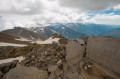
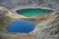
(6) You’ll reach the Pas de Colle Longue. The path levels out and you’ll notice a few buildings here and there (as well as barbed wire – take care). The Colle Longue lakes are visible below to the north. Stay on theGR® until marker 59.
(7) From here, the path alternates between France and Italy. Proceed with caution over the scree; the path remains clearly visible and markedwith GR® signs. There are still snowfields in May – be careful!
(8) There is a large, somewhat dangerous snowfield here, but it is easy to bypass it by climbing up the ridge on the French side. A boundary marker shows the correct route, and you rejoin the path about ten metres further on. Continue along the mountainside – take care.
(9) The Tête de l’Autaret has two summits; you’ll arrive here at the foot of the first, which is slightly lower, where a few ruins of military structures still remain. The higher of the two summits, and the next one, is quickly reached a little further to the east.
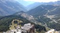
You have reached the summit; enjoy the view over the Tinée Valley and Italy. The Isola 2000 ski resort is visible to the east if you look closely.
(10) Return via the same route to Douans (S/E).

 Visorando Member
 Difficult
 Moderate