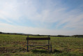
The rolling countryside of Neurey-en-Vaux

Discover the birthplace of Claude-François, the creator of the walking trails in the Forest of Fontainebleau that now bear his name. The village is situated on a hillside, sheltered from the wind by the Chassagne hillocks. Originally a rural area, vineyards were present here until the end of the 19th century; the village has many houses with beautiful vaulted cellars.

Details

504870
Creation:
Last update:
Last review:
  • Walking
    Activity: Walking
  • ↔
    Distance: 7.89 mi
  • ◔
    Average duration: 4h 15 
  • ▲
    Difficulty: Moderate

  • ⚐
    Back to start: Yes
  • ↗
    Ascent: + 673 ft
  • ↘
    Descent: - 686 ft

  • ▲
    Highest point: 1,329 ft
  • ▼
    Lowest point: 846 ft

Description of the walk

Parking is available in the church square.

(S/E) Start the walk by heading up Rue de Saint-Valbert. At the three-way junction, turn right onto Rue des Marcussons and carry on to the last houses.

(1) Turn left onto a grassy path that runs alongside piles of wood and leads into the forest. Follow this path straight ahead until you reach a turning area.

(2) Turn right and follow the Chemin du Loup to the hamlet of Le Fays.

(3) Cross the road leading to Vilory and take the Chemin du Champ du Fays opposite until you reach the forest.

(4) At the junction, ignore the path on the right and carry on straight ahead until you reach the D10.

(5) Cross the departmental road and head down to the right towards Neurey for about 30 metres. Then take the path to the left of the road which leads down to the Ruisseau de Neurey, which you cross.
Follow this path, which leads to the clearing in the Bois de la Varanne. Turn left and follow this forest track until you reach the Route du Moulin de Varogne.

(6) Turn right onto the D52, then, when you reach the Moulin du Val farm, turn left onto the track and then immediately right onto the Chemin des Seigles at the edge of the woods.

(7) At the junction, turn right, then turn left at the next T-junction. Once on the road, continue to the right to reach the village of Val-Saint-Eloi and the Grande Rue (when we did this route, there were a lot of felled trees at the start of the woodland edge; we went a little way into the woods to get round them and rejoined the path along the edge a little further up).

(8) Turn left onto this street and stay on it until you leave the village. After crossing the Pont Barret, turn left onto a tarmac road that winds through meadows and continues as a path on the right.

(9) When, at a junction, you can see a hamlet in the distance (Auberge du Chaumont), turn right at a 90° angle. Follow this small road down to the junction with the D52. Cross this county road and immediately turn right onto a path through the woods which joins a small road.

(10) Turn left onto this road, which leads to the starting village, Neurey-en-Vaux. Once you reach the D10, cross carefully and continue to the right, heading back up through the village to the Place de l’Église (S/E).

Waypoints

  1. S/E : mi 0 - alt. 1,181 ft - Church Square
  2. 1 : mi 0.31 - alt. 1,178 ft - Grass path on the left
  3. 2 : mi 0.83 - alt. 1,329 ft - Turning point
  4. 3 : mi 1.48 - alt. 1,230 ft - The hamlet of Le Fays
  5. 4 : mi 1.93 - alt. 1,165 ft - Entrance to the forest
  6. 5 : mi 2.4 - alt. 1,024 ft - Departmental Road 10
  7. 6 : mi 3.66 - alt. 846 ft - Route to the Moulin du Val
  8. 7 : mi 4.11 - alt. 1,033 ft - Junction, turn right
  9. 8 : mi 4.91 - alt. 932 ft - Val-Saint-Éloi
  10. 9 : mi 6.16 - alt. 1,066 ft - Right-hand bend
  11. 10 : mi 6.97 - alt. 935 ft - The road leading back to Neurey. After the - Bâtard (cours d'eau)
  12. S/E : mi 7.89 - alt. 1,178 ft - Church Square

Notes

If you’re unsure at any point along the route, make sure you follow the yellow circle markings, which are either painted on the trees or drawn on small white sheets of paper.

Worth a visit

In Val-Saint-Éloi, a fountain featuring a mural painted by the village children.

Chaumont Farm Inn in Val-Saint-Éloi.

At Moulin du Val, on the right, about 50 metres away, there is a beautiful spring with bluish water.

Reviews and comments

4.1 / 5
Based on 3 reviews

Reliability of the description
5 / 5
Ease of following the route
4.3 / 5
Route interest
3 / 5
gibbs
gibbs

Overall rating : 4.7 / 5

Date of your route : Sep 16, 2019
Reliability of the description : ★★★★★ Very good
Ease of following the route : ★★★★★ Very good
Route interest : ★★★★☆ Good

Lots of walking in the woods, so it’s very pleasant when it’s hot; no major difficulties; not much to see

Machine-translated

kaola123
kaola123

Overall rating : 4 / 5

Date of your route : Jan 10, 2018
Reliability of the description : ★★★★★ Very good
Ease of following the route : ★★★★☆ Good
Route interest : ★★★☆☆ Average

A nice little walk along various paths
Signposting is a bit patchy in places, faded or missing

Machine-translated

kaola123
kaola123

Overall rating : 3.7 / 5

Date of your route : Dec 27, 2017
Reliability of the description : ★★★★★ Very good
Ease of following the route : ★★★★☆ Good
Route interest : ★★☆☆☆ Disappointing

a route of no particular interest, with markings worn away in places

Machine-translated

Other walks in the area

For more walks, use our search engine .

The GPS track and description are the property of this route's author. Please do not copy them without permission.