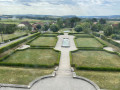
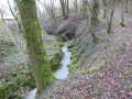
The Fontaine aux Ânes in Mailleroncourt-Charette

Just a stone’s throw from Vesoul, a beautiful village to explore amidst the surrounding countryside.

Details

659999
Creation:
Last update:
Last review:
  • Walking
    Activity: Walking
  • ↔
    Distance: 3.41 mi
  • ◔
    Average duration: 1h 50 
  • ▲
    Difficulty: Easy

  • ⚐
    Back to start: Yes
  • ↗
    Ascent: + 279 ft
  • ↘
    Descent: - 282 ft

  • ▲
    Highest point: 1,106 ft
  • ▼
    Lowest point: 820 ft

Photos

Description of the walk

Start in front of Mailleroncourt-Charette Town Hall.

(S/E) Head towards the bridge over the Durgeon and turn left immediately after it. Continue along Rue de la Forge. At the next three-way junction, turn left onto Rue du Point du Jour, which takes you gently out of the village as you walk alongside pastures.

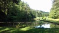
(1) You’ll also pass by the Arboretum de la Cude – which can be visited by appointment – and walk past some private ponds on your right.
Carry on along this path, which ends with a climb up to the hamlet of Les Landres.

(2) At the junction, take the road on the right which winds through the hamlet and ignore the turnings to the right.

(3) On leaving the village, when you reach a farm (with sheds), follow the stony track on the right which passes through a few copses.

(4) Immediately upon entering the Bois des Landres, turn left straight away onto a path through the woods (a small sign points to Chapelle Saint-Léger). Follow this path straight on until you reach a road, and be sure to admire the Chapelle Saint-Léger.

(5) Turn left and continue walking carefully along the road (D140).

(6) At the junction, turn left again and walk gently back down to the village, to Place la Mairie (S/E).


Waypoints

  1. S/E : mi 0 - alt. 827 ft - Town Hall Square. Towards the bridge at - Durgeon (rivière)
  2. 1 : mi 0.62 - alt. 863 ft - Arboretum
  3. 2 : mi 1.47 - alt. 1,040 ft - Les Landres
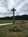
  4. 3 : mi 1.77 - alt. 1,070 ft - Chapelle Cross
  5. 4 : mi 2.12 - alt. 1,106 ft - Entrance to the Bois des Landres
  6. 5 : mi 2.46 - alt. 909 ft - Saint-Léger Chapel
  7. 6 : mi 2.73 - alt. 915 ft - Turn left at the fork in the road
  8. S/E : mi 3.41 - alt. 823 ft - Town Hall Square

Worth a visit

The Saint-Léger Chapel and its little spring (whose water is said to work wonders for eye conditions).

Two private ponds (in the Bois de la Cude).

La Cude Arboretum (visits by appointment only).

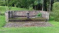
Its fountains.

Behind the town hall, there is an area set aside for games, tennis, basketball and five-a-side football.

Reviews and comments

4.3 / 5
Based on 3 reviews

Reliability of the description
4.3 / 5
Ease of following the route
4.7 / 5
Route interest
4 / 5
Claudiousse
Claudiousse

Overall rating : 4 / 5

Date of your route : Aug 10, 2026
Reliability of the description : ★★★★☆ Good
Ease of following the route : ★★★★☆ Good
Route interest : ★★★★☆ Good
Very busy route : No

There were no problems following the GPX track. We hope to be able to go back and visit the English garden, which looks very interesting. We had a brief chat with the owner, who created the garden.
Thank you for this walk.

Machine-translated

Patrick R.
Patrick R.

Overall rating : 4.7 / 5

Date of your route : Apr 15, 2018
Reliability of the description : ★★★★★ Very good
Ease of following the route : ★★★★★ Very good
Route interest : ★★★★☆ Good

A lovely little walk, best done in dry weather as the descent to the chapel is very muddy. Otherwise, as already mentioned in a comment, at the three-way junction, you must stay on Rue de la Forge. As for the final section along the road, you can walk safely on the left-hand side, on the other side of the wooden fence.

Machine-translated

gazok54
gazok54 ★

Thank you, valotvalerie
I do feel, though, that the description is accurate. Could you tell us more?

Machine-translated

valotvalerie
valotvalerie

Overall rating : 4.3 / 5

Date of your route : Feb 19, 2018
Reliability of the description : ★★★★☆ Good
Ease of following the route : ★★★★★ Very good
Route interest : ★★★★☆ Good

There’s a small error in the description at the start of the walk: at the three-way junction, stay on Rue de la Forge; do not take Rue du Point du Jour (leave it on your right).
When you reach La Chapelle Saint Léger, take care when crossing the wooden bridge… which, by some great mystery, is still standing!
The walk ends on the road (a good kilometre).
Otherwise, a pleasant walk, one to do again in summer as it’s likely to be quite chilly along La Cude...

Machine-translated

Other walks in the area

For more walks, use our search engine .

The GPS track and description are the property of this route's author. Please do not copy them without permission.