Country:

 City:
City:


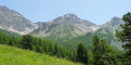
Park at the Grande Cabane bridge.
(S/E) Head due south towards the Olettes torrent. Turn right after the torrent towards the Combe de Perouyère. The path simply cuts across the first hairpin bend; follow the track to the Cabane de Perouyère mountain pasture.
(1) Continue to the right at the entrance to the mountain pasture: follow a stream towards the large rocks opposite.
You’ll soon find the path, which climbs ever more steeply to emerge at the top right of this lovely slope. Carry on to the wooded ridge line that follows; you’ll come out onto it near a signpost. Ignore this signpost and continue to the left up the ridge. You’ll soon come to a boulder in the middle of the path; go round it and follow the flat path for a few steps. When you reach the edge of the meadow, head left to join the ring path just above.
(2) Now follow this path to the left (east) until you pass the area where the slopes become increasingly steep. You’ll reach the junction on the slope leading to the Pas de la Claie.
(3) Head up to the right along the grassy slopes at the entrance to the valley leading to the Col Haut and the Pas de la Claie. Follow the GPS track all the way up this valley to reach the Pas de la Claie.
(4) Cross the small rocky outcrop to reach the start of the ridge line.
Climb up the path that branches off to the left on the north-facing slope. When the path ends, continue zigzagging to reach the ridge line.
Keep to the right to climb the scree slope that follows. Continue along the ridge line and turn left to go round a rocky outcrop and rejoin the ridge. Keep right along the flat, grassy ledge to go round the rocky outcrop.
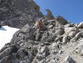
Then, immediately afterwards, climb straight up the couloir on the left, reach a small shoulder and continue along an ascending slope to the right (small cairns) – the rock is quite broken but offers stable handholds – to emerge onto the ridge line.
When you reach the next rock outcrop, take the gentle, cairned ascending ledge to the right. Pass the first shoulder, climb to the left and then cut back to the right (large cairn).
Descend and follow the path that climbs up opposite.
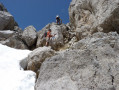
You’ll reach the crux of the ascent. Climb straight up the slope where the route naturally veers left. Ahead, two small dihedrals follow one after the other; both are climbed in exactly the same way. Cross for about 10 metres and veer right to reach a more manageable slope (cairns) which leads to a small shoulder. Climb the gully, which is partly grassy and partly rocky, and exit to the right via a gently rising ledge that ascends towards a pointed rock and the shoulder beyond it.
Climb back up towards the rocky outcrop and go round it to the left, past a giant natural cairn.
Climb up in front of it to complete the steep slope that follows on from above. The slope levels out, allowing you to reach the ridge line as far as some very steep slabs, which you climb as best you can. Follow the ridge line more or less as it leads quickly to the summit.
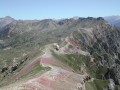
(5) No detailed instructions are needed for the ridge traverse; simply proceed by sight through the rocky scree, and you will soon come across old, large Blue Circle markings. Most of the traverse is on the north-facing slope and fairly close to the ridge line.
At the very last moment, the route turns southwards, emerging above the saddle separating the Montagnette from the summit of Lausa Plana.
(6) Once in the saddle, head up the Lausa Plana side to avoid the area of large scree on the left. The descent now follows a diagonal route below Lausa Plana to reach a lower secondary ridge; follow the clear blue markings. Descend as far as possible until you reach a ‘Danger’ sign painted in blue. Just before this, descend carefully to the right (a slope with loose scree) for a few metres. You’ll find yourself above a 3-metre vertical section. Climb down it from left to right using good handholds and footholds.
(7) From the foot of the cliff, head towards the main route of the western Pouzenc valley and descend it to the ring path. Continue the descent along the stream (path) to where it opens out into the meadow. Cross the stream and head for the cow paddock well below, to the right of the drinking troughs. Head into the small hollow to the right of the paddock and descend it until you reach the exit of the narrow section. From there, keep to the right, heading for the small path visible further on.
(8) Follow this path. Cross the meadow that follows it (the path disappears in the middle of it) but stay on course. Further on, ignore the fork that branches off to the left and heads downhill; continue to follow the path, which turns into a small track. After a slight levelling-off, turn left (cairn).
(9) The route continues through slightly thicker grass but remains clearly visible.
Turn left immediately at the junction and follow this track to the stream; cross it and rejoin the hairpin bend on the track you took on the way up. Turn right to return to the car park at the Grande Cabane bridge (S/E).



 Visorando Member
 Moderate
 Difficult