Cirque de Morgon via the ridges

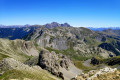
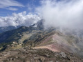
The full circular route around the Cirque de Morgon via the ridges. This circular route is long and physically demanding, and some short sections require you to use your hands.

Details

n°13276681
Creation:
Last update:
Last review:
  • Walking
    Activity: Walking
  • ↔
    Distance: 12.89 mi
  • ◔
    Average duration: 10h 10 
  • ▲
    Difficulty: Difficult

  • ⚐
    Back to start: Yes
  • ↗
    Ascent: + 4,846 ft
  • ↘
    Descent: - 4,865 ft

  • ▲
    Highest point: 7,779 ft
  • ▼
    Lowest point: 5,144 ft

Photos

Description of the walk

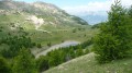
(S/E) From the Fontaine de l’Ours car park, head down 200 metres to find the start of the path that climbs up to the Cirque de Morgon. Continue for about 1 km to reach a beautiful viewpoint overlooking the Cirque de Bragousse.

(1) Continue climbing the winding path. You’ll reach the eastern ridge of the cirque.

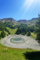
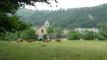
(2) Descend the western side of the ridge, then head towards Lac Saint-Pierre to reach the chapel. Keep an eye out in this vast meadow, as it’s a great place to spot marmots.

(3) Set off again along the path heading due north for 1 km. At the junction, turn left onto the Sentier des Marmottes.

(4) Follow the Sentier des Marmottes to the left until you reach the summit of the Pic de Morgon.
Just before reaching the summit, you can take a short detour beneath the cliffs on the north-western side.

(5) This slightly challenging section is optional.

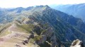
(6) Descend south-eastwards, staying on the ridges of the cirque, and continue for 2 km until you reach a path branching off to the right of the ridges, after the 2277-metre mark.

(7) Take this path to go round the cliff that blocks the way along the ridge.
There are then two options:
- Return to the ridge as soon as possible.
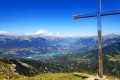
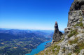
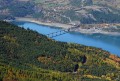
- As shown on the map, head downwards towards the south-west to enjoy a lovely view of Lake Serre-Ponçon.

(9) In either case, continue along the ridges until you reach the Tête de la Vieille.

(10) Continue east-southeast along the ridges for 600 m.

(11) Cross a section where you’ll need to use your hands. Continue south-east until you reach a lovely viewpoint over the Vallon du Clot Mélèze.

(12) Climb north-eastwards until you reach a short, easy descent.

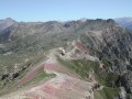
(13) Continue along the ridge to the Pic de Charance.

(14) Continue north-west along the ridge until you reach the junction from the outward journey.

(2) Turn right and head back down the same route you took on the way up to the car park (S/E).

Waypoints

  1. S/E : mi 0 - alt. 5,164 ft - Fontaine de l’Ours car park
  2. 1 : mi 0.7 - alt. 5,702 ft - Belvédère de Bragousse
  3. 2 : mi 2.65 - alt. 6,670 ft - Crossroads on the circular loop
  4. 3 : mi 3.18 - alt. 6,335 ft - Chapelle Saint-Pierre (Cirque de Morgon)
  5. 4 : mi 3.86 - alt. 6,138 ft - Crossroads – Marmot Trail
  6. 5 : mi 5.59 - alt. 7,297 ft - Viewpoint over the - Lac de Serre-Ponçon
  7. 6 : mi 5.71 - alt. 7,608 ft - Pic de Morgon
  8. 7 : mi 7.37 - alt. 7,375 ft - Path skirting the cliff to the west
  9. 8 : mi 7.72 - alt. 7,205 ft - Viewpoint
  10. 9 : mi 7.92 - alt. 7,690 ft - Ridge
  11. 10 : mi 8.11 - alt. 7,762 ft - Tête de la Vieille
  12. 11 : mi 8.46 - alt. 7,631 ft - A short, easy climbing section
  13. 12 : mi 8.7 - alt. 7,753 ft - Optional viewpoint
  14. 13 : mi 8.9 - alt. 7,700 ft - A short, easy descent
  15. 14 : mi 9.7 - alt. 7,566 ft - Pic de Charance (Massif du Parpaillon)
  16. S/E : mi 12.89 - alt. 5,161 ft - La Fontaine de l’Ours car park

Notes

The short climbing sections are straightforward and accessible to anyone who is physically fit and takes a minimum of care.

Some sections involve steep slopes (25–30 per cent). It is therefore advisable to undertake this walk in dry weather, wearing good walking shoes and using walking poles to maintain your balance.

During the walk, I didn’t see any water sources to refill your supplies, and the lake may be dry in summer.

Remember to protect yourself from the heat, as there is little shade along the route.

Worth a visit

After the walk, it might be worth visiting Boscodon Abbey and the Arboretum, which is near the abbey.

Reviews and comments

3.6 / 5
Based on 3 reviews

Reliability of the description
3 / 5
Ease of following the route
3 / 5
Route interest
4.7 / 5
lucbultel
lucbultel

Overall rating : 4 / 5

Date of your route : Sep 15, 2025
Reliability of the description : ★★★★☆ Good
Ease of following the route : Not used / Not applicable
Route interest : ★★★★☆ Good
Very busy route : No

It's almost impossible to follow the GPX route. The route along the ridges is very difficult and at times there are no paths that match the route.
It's a shame, as the scenery is magnificent

Machine-translated

Mimizen38
Mimizen38

Hello,
Yes, you can set off from the Grand Clos car park: https://www.visorando.com/randonnee-pic-...
... however, I don’t think you’ll save much time on the walk (the altitude at the starting point is similar). Furthermore, according to the comments, it seems that the final stretch of the path leading to the car park isn’t in very good condition, so several people have set off from further down.

Machine-translated

Farine's
Farine's

Hello.
We’ve already done the ‘short’ Morgon route (cutting across the middle of the cirque to head back down) a few years ago and would now like to tackle the ‘long’ version.
This route would suit us, but the duration is putting us off a bit. We’ve found an alternative starting from the Grand Clos car park (https://www.altituderando.com/Pic-de-Mor...).
Do you think this might be a good compromise?
Thank you.

Machine-translated

Mimizen38
Mimizen38

Thanks, Sophie, for your feedback.
Why did you rate the accuracy of the description as just ‘Good’ and the ease of following the route as ‘Average’?
... I’m asking so we can improve the route description. Any suggestions?

Kind regards,

Machine-translated

Sophie Jack
Sophie Jack

Overall rating : 4 / 5

Date of your route : Aug 02, 2022
Reliability of the description : ★★★★☆ Good
Ease of following the route : ★★★☆☆ Average
Route interest : ★★★★★ Very good
Very busy route : No

A few dizzying sections, but a superb hike

Machine-translated

Mimizen38
Mimizen38
• Edited:

Hello Malpassé,

Thank you for taking the time to write this review.

The estimated time shown is automatically calculated by Visorando based on the distance and elevation gain: unfortunately, I can’t change it, but your feedback will help others gauge how much time to allow. However, I had to set a maximum of 10 hours even though I wasn’t at all familiar with the area (though I’d prepared my route in advance and I maintain a good walking pace).

As for the difficulty, it’s clearly not ‘extremely difficult’… at a push, you could perhaps classify it as ‘very difficult’ given the length of the route, but really no more than that. The few short climbing sections require no climbing experience and aren’t particularly exposed; they’re around grade 3. For your information, the route to the summit of the Grand Morgon without following all the ridges is rated ‘difficult’ and not ‘very difficult’ as you suggest.
Did you actually follow the same route as the GPS track? Perhaps some information is missing from my guide and you didn’t take the correct routes? (I’m thinking in particular of point 7, where you need to go round the ridge)... If you have any suggestions, I can update the route description so that future walkers can make the most of this walk.

Kind regards,

Machine-translated

Malpassé
Malpassé

Overall rating : 3 / 5

Date of your route : Oct 23, 2021
Reliability of the description : ★☆☆☆☆ Very disappointing
Ease of following the route : ★★★☆☆ Average
Route interest : ★★★★★ Very good
Very busy route : No

This hike is classified as ‘difficult’ with an estimated time of 10 hours 15 minutes, but it is absolutely impossible to complete unless you’re from the area and an experienced climber. It took us 13 hours without any significant breaks. I regularly undertake ‘very difficult’ hikes, but I would describe this one as ‘extremely difficult’.
The first section up to the summit of Pic de Morgon is very beautiful and well signposted (very difficult), but tackling the ridge section after that – with so few signposts, a very long route and requiring intense concentration – is extremely difficult and not suitable for everyone.
Not suitable for children…
You mustn’t be afraid of heights, and you should only attempt this hike when the days are long; we ended up using a head torch.

Machine-translated

Other walks in the area

For more walks, use our search engine .

The GPS track and description are the property of this route's author. Please do not copy them without permission.