The ‘Enfants de la Lune’ walk starting from Sassetot-le-Mauconduit

A walking route that was the setting for a 24-hour walk in aid of the Enfants de la Lune charity. The top walkers covered over 100 km.

Details

n°479524
Creation:
Last update:
Last review:
  • Walking
    Activity: Walking
  • ↔
    Distance: 7.55 mi
  • ◔
    Average duration: 3h 55 
  • ▲
    Difficulty: Moderate

  • ⚐
    Back to start: Yes
  • ↗
    Ascent: + 476 ft
  • ↘
    Descent: - 486 ft

  • ▲
    Highest point: 308 ft
  • ▼
    Lowest point: 23 ft

Photos

Description of the walk

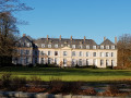
Park at the fairground opposite Sissi Castle.

(S/E) Head south-west along theGR®21, which follows Rue des Écoles. Continue to the Côte des Roulettes junction.

(1) Follow theGR®21to the right. Walk through the Bois du Fonds du Hêtre. On emerging from the woods, you’ll reach the junction with a narrow tarmac road.

(2) Turn left onto this road and, after a gentle climb, reach the entrance to the village of Ancretteville-sur-Mer.

(3) Turn right onto Rue de la Mairie. On leaving the village, you’ll come to a wayside cross at a crossroads where several paths meet.

(4) Turn right, go through the wooden gate onto a downhill path – not shown on the IGN map but visible on the OSM map – which leads back onto theGR®21.

(5) Turn left onto theGR® and follow it into Saint-Pierre-en-Port. You’ll reach the crossroads by the church.

(6) Stay on theGR® to cross a wooded park situated behind the former sanatorium. On leaving the park, head straight towards the sea. Reach the picnic area.

(7) Continue to the right along the tarmac path until you reach another crossroads.

(8) Leave theGR® here and carry on straight ahead into the woods. After a few bends, you’ll reach the Grandes Dalles car park.

(9) Head due south along Rue des Péqueux and cross Les Grandes Dalles. You’ll emerge further on at a crossroads with four perpendicular roads.

(10) Turn left onto Chemin Vieille Côte. Please note: at the end of this path, near a wayside cross, rejoin the D79, which can be busy during the summer months. A few hundred metres further on, you’ll reach Rue des 24 Marches.

(11) Turn left onto this street to go round the grounds of Sissi Castle. You’ll soon reach theGR®21.

(12) Follow it straight ahead, passing through a small beech wood as you walk alongside the former castle grounds. As you come out of a bend, you’ll reach the fairground car park on your left (S/E).


Waypoints

  1. S/E : mi 0 - alt. 289 ft - Fairground car park
  2. 1 : mi 0.44 - alt. 240 ft - Côte des Roulettes crossroads
  3. 2 : mi 1.1 - alt. 167 ft - Crossroads on a narrow road
  4. 3 : mi 1.66 - alt. 295 ft - Ancretteville-sur-Mer
  5. 4 : mi 2 - alt. 279 ft - Crossroads leading in several directions
  6. 5 : mi 2.6 - alt. 161 ft - GR21
  7. 6 : mi 3.81 - alt. 289 ft - Crossroads by the church at Saint-Pierre-en-Port
  8. 7 : mi 4.32 - alt. 262 ft - Picnic area
  9. 8 : mi 5 - alt. 262 ft - Crossroads
  10. 9 : mi 5.82 - alt. 23 ft - Grandes Dalles car park
  11. 10 : mi 6.26 - alt. 82 ft - Crossroads with four perpendicular directions
  12. 11 : mi 6.89 - alt. 282 ft - Rue des 24 Marches
  13. 12 : mi 7.13 - alt. 276 ft - GR21
  14. S/E : mi 7.55 - alt. 289 ft - Fairground car park

Notes

This route presents two minor challenges. Make the most of the superb panoramic views offered by Mother Nature. Walking shoes and walking sticks are essential.
(7) There are benches there, as well as a table for walkers.

Worth a visit

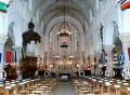
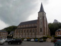
(S/E) Once you reach the village of Sassetot-le-Mauconduit, don’t miss the bust of Sissi (a bronze sculpture by local artist D. Henry) in the square, alongside the PK120 marker commemorating the Tour de France’s passage through the village on several occasions. The Church of Notre-Dame de la Nativité has plenty of surprises in store; it alone is well worth a visit.

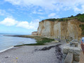
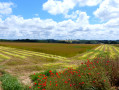
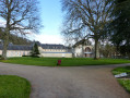
The English Channel and its shores, the pebbles, the cliffs. The church and the castle of Sassetot-le-Mauconduit.

Always be cautious and plan ahead when you're outdoors. Visorando and the author of this route cannot be held responsible for any accidents occurring on this route.

The GR® and PR® markings are the intellectual property of the Fédération Française de Randonnée Pédestre.

Reviews and comments

3.8 / 5
Based on 2 reviews

Reliability of the description
3.5 / 5
Ease of following the route
4 / 5
Route interest
4 / 5
User 20211147

Overall rating : 4.7 / 5

Date of your route : May 25, 2026
Reliability of the description : ★★★★☆ Good
Ease of following the route : ★★★★★ Very good
Route interest : ★★★★★ Very good
Very busy route : Yes

A superb hike that takes us along the Channel coast, with a spot for a swim halfway through

Machine-translated

gilou76
gilou76

I don’t hold it against you at all; I was just asking for information. As for the signs, I thought you had contacts with the GR department
The routes I’d done around Gigondas were very good.
Kind regards

Machine-translated

grospapy1947
grospapy1947

I’m really sorry about that, but I’m providing a route to follow using the TOPO map. The GR signposts are not within my remit. Please let me know what improvements need to be made, and we’ll see about correcting them.

Machine-translated

gilou76
gilou76

Overall rating : 3 / 5

Date of your route : Feb 21, 2020
Reliability of the description : ★★★☆☆ Average
Ease of following the route : ★★★☆☆ Average
Route interest : ★★★☆☆ Average

Not enough details about the various changes in direction. It’s better to download the route using the QR code (if possible). Three GR 21 signposts were lying on the ground – and it wasn’t because of the wind – (as you walk along the cliff after the picnic area and the ponds with gabions). Luckily, we were locals, so we managed to find our way.

Machine-translated

Other walks in the area

For more walks, use our search engine .

The GPS track and description are the property of this route's author. Please do not copy them without permission.