Country:

 City:
City:


Park in a fairly large car park located past the hamlet of La Planche, at the end of the road leading up from Novel (end of authorised access; signpost for “La Planche à Brousoz, altitude 1,205 m”). Access from Saint-Gingolph (French-Swiss border).
Signposts + marker posts with yellow arrows + red and white markings (GR®® Balcon du Léman)
(S/E) From the signpost, head towards the Col de Neuvaz, i.e. continue along the road you arrived on, which quickly turns into a forest track. At the first fork, take the right-hand path. Cross a stream and take a sharp right-hand bend. Follow the track, known locally as the Route de la Planche, and ignore a turn-off to the right followed by one to the left (ignore the yellow signposting).
(1) Take a hairpin bend to the left (rock on the outer edge). The track, now called Route de Neuvaz, then heads broadly westwards. At the first junction (sign saying ‘Altitude 1350 m’), continue straight ahead along the track towards the Col de Neuvaz. You will soon reach a second junction (sign saying ‘Altitude 1360 m’).
No signposting
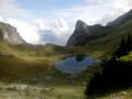
(2) Then turn left towards Lac de la Joux and the Châlets de Trépertuis and follow a grassy path that slopes gently downwards. Ford a stream, pass through a gap in a fence and head back up into the forest. In a small clearing, you’ll come out onto an alpine track; follow it to the left. Descend slightly to reach Lac de la Joux (more of a pond in summer).
(3) Leave the lake on your right and begin a steep climb along the alpine track. Stay within the woodland and, from time to time, take in the views of the impressive north face of the Château d’Oche (on the left) and the jagged peaks of the Roc de Rianda (on the right). You will reach the Chalets de Trépertuis and go round them on the right.
(4) At the corner by a drinking trough, turn right and pass through an electric fence (close it behind you if the gate was closed). Where there is no marked path, head south-west (the purple line on the 1:25,000 map is out of date in this section). At the foot of a three-trunk spruce, turn right and follow a faint path alongside an electric fence on your left. Pass through the fence (close it behind you if the gate was closed) and continue along the faint path. Cross a second fence and keep to its right-hand side. When the fence turns right, carry on straight ahead along the path, which becomes more clearly marked. Keep heading north-east, aiming for two small rocky hummocks on the right. You’ll reach a flat area after the second hummock.
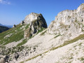
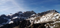
(5) Then turn left where there is no path and head uphill. You’ll come to a well-marked path; follow it to the left (west). Enjoy a pleasant traverse at the foot of the rocky outcrops that dot the Roc de Rianda ridge. Further on, cross a stony area and climb more steeply. After that, the path disappears. Keep heading west-south-west and do not climb too far to the right towards the Roc de Rianda ridge. Descend slightly into a small valley at the foot of the Dent d’Oche, cross a small scree slope and rejoin a marked path. Then climb a few steep switchbacks to reach the Col de Trépertuis.
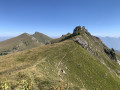
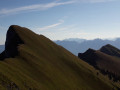
(6) Follow the ridge to the right (north-east) until you reach the foot of a peak that is half grassy, half rocky (those prone to vertigo may wish to stop here). Climb the steep slope of the peak carefully, using your hands if necessary. Descend on the other side, take a very exposed step (be extremely careful) and climb the second outcrop to reach the summit.
(7) Retrace your steps very carefully back to the foot of the first rocky outcrop. Then descend the ridge to the Col de Trépertuis.
(6) Descend to the right (north-west) through the grass (the path shown on the IGN map has disappeared). Before reaching the first spruce trees, veer to the right (avoid a bushy area on the left). Then veer left to stay amongst the grass and avoid the bushes (do not stray too far from the GPS track). Look out for a clearly marked path below and join it as best you can.
Directional signs + marker posts with yellow arrows + red and white markings (GR®® Balcon du Léman)
(8) Follow the path to the right and downhill. Go through a gap in a fence, then head back uphill. Further on, two wooden footbridges allow you to avoid damp sections and reach the Col de Neuvaz.
(9) Turn right towards Neuvaz-dessous and Novel and go through a gap in the fence. Head downhill and cross a few wet sections to reach the Neuvaz du Milieu chalet. Then head down an alpine track. Ignore a path branching off to the left and take a hairpin bend to the right, then left. After a hairpin bend to the right, the track descends very steeply to the Neuvaz Dessous chalet.
(10) Continue down the alpine track. At a junction (signposted ‘Altitude 1412 m’), carry on straight ahead and downhill. This will take you back to a junction you passed on the way up.
(2) Carry on straight ahead towards Novel. Shortly afterwards (sign ‘Altitude 1350 m’), continue straight ahead again until you reach a hairpin bend.
(1) Turn right onto the track and, shortly afterwards, do not turn left as indicated by a yellow arrow, but continue along the track you took on the way there to reach the car park at La Planche à Brousoz (S/E).

 Visorando Member
 Very difficult
 Moderate
  Association / Club / Walk leader