The Pessalle Wood

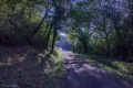
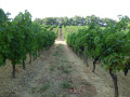
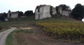
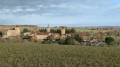
Another lovely walk through the Gers countryside, where the silence is broken only by the shrill whistles of buzzards or kites and the cawing of crows in the harvested fields. Sunflower fields in the foreground, the Pyrenees in the distance, and a multitude of valleys and hills that you must cross to be rewarded with these views. The Pessalle woods are just one part of this walk, but what a part…

Details

n°3916140
Creation:
Last update:
Last review:
  • Walking
    Activity: Walking
  • ↔
    Distance: 5.77 mi
  • ◔
    Average duration: 3h 00 
  • ▲
    Difficulty: Easy

  • ⚐
    Back to start: Yes
  • ↗
    Ascent: + 443 ft
  • ↘
    Descent: - 433 ft

  • ▲
    Highest point: 577 ft
  • ▼
    Lowest point: 371 ft

Photos

Description of the walk

(S/E) Start from the car park next to the rugby stadium. Head towards the stadium, then turn right onto the road that climbs opposite the tennis courts.

(1) Leave the road and take the path on the right after the Calvary cross.

(2) Turn left at the junction towards the hamlet of L’Hétéré.

(3) Carry on to the right at the hamlet near a scrapyard and cross the bridge over the Ruisseau Gimat.

(4) Take the path on the left after the pond. Continue along the same path. Pass through the hamlet of Manotte.

(5) Turn right towards the hamlet of La Joyeuse de Haut.

(6) Turn onto the track on the right after this hamlet and arrive at a crossroads.

(7) Keep slightly to the right to cross the woodland and reach the hamlet of Pessale.

(8) Carry on straight ahead, leaving this hamlet on your left, and cross the Gimat Stream again. Turn right before the building materials yard.

(2) Turn left onto the path you took on the way there.
Head back along the road leading to the car park in the opposite direction (S/E).

Waypoints

  1. S/E : mi 0 - alt. 371 ft - Car park next to the rugby stadium
  2. 1 : mi 0.35 - alt. 456 ft - Junction on the path to the right
  3. 2 : mi 0.54 - alt. 397 ft - Crossroads at the end of the circular loop
  4. 3 : mi 0.9 - alt. 453 ft - Hamlet of L’Hérété (car scrapyard)
  5. 4 : mi 1.32 - alt. 423 ft - Take the path on the left after the pond.
  6. 5 : mi 2.57 - alt. 518 ft - Turn right after Manotte
  7. 6 : mi 2.93 - alt. 568 ft - Path on the right
  8. 7 : mi 3.44 - alt. 538 ft - Walk through the woods
  9. 8 : mi 4.19 - alt. 472 ft - The hamlet of Pessalle on the left
  10. S/E : mi 5.77 - alt. 371 ft - Car park next to the rugby stadium

Worth a visit

(8) Pessalle: A charming hamlet home to several craftspeople.
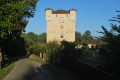
Halfway between points (8) and (2), you can see Gimat Castle on the left.

Reviews and comments

4.7 / 5
Based on 1 review

Reliability of the description
5 / 5
Ease of following the route
5 / 5
Route interest
4 / 5
Dill
Dill

Overall rating : 4.7 / 5

Date of your route : Feb 27, 2021
Reliability of the description : ★★★★★ Very good
Ease of following the route : ★★★★★ Very good
Route interest : ★★★★☆ Good
Very busy route : No

A pleasant route through the Gers countryside. The route is very well signposted.

Machine-translated

Other walks in the area

For more walks, use our search engine .

The GPS track and description are the property of this route's author. Please do not copy them without permission.