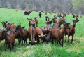
Through the Armagnac Forest to Riguepeu

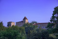
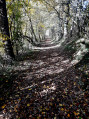
A lovely circular walk with some very pleasant sections through the woodland. A picnic break in the Armagnac Forest and, on arrival in the village, the chance to visit the renovated and fully operational watermill.

Details

n°5613682
Creation:
Last update:
Last review:
  • Walking
    Activity: Walking
  • ↔
    Distance: 5.45 mi
  • ◔
    Average duration: 2h 50 
  • ▲
    Difficulty: Easy

  • ⚐
    Back to start: Yes
  • ↗
    Ascent: + 338 ft
  • ↘
    Descent: - 338 ft

  • ▲
    Highest point: 784 ft
  • ▼
    Lowest point: 446 ft
  • ⚐ Country: France
  • ⚐ City: Riguepeu (32320)
  • ⚑
    Start/End: N 43.649123° / E 0.34406°
  • ❏
    IGN map(s): Ref. 1743SB
  • Hour-by-hour weather

Photos

Description of the walk

Start at the corner by the Riguepeu school. Park in the town hall car park.

(S/E) Take the street that runs between the town hall (on the left) and the school (on the right). You’ll come out onto the D34; follow it to the right. Take thefirst road on the left (take care when crossing the D34). Immediately ignore a turn-off on the right and you’ll soon reach a three-way junction at a place called Petit-Jean.

(1) Keep left and head uphill to Pédantin. Continue along a dirt track. Stay on this west-facing track and ignore any side paths. The track turns south and soon reaches a junction.

(2) Continue southwards along a track suitable for vehicles. At the junction in the hamlet of Carsicot, turn right onto the tarmac road. Ignore a road on the right and pass the hamlets of Maillau and Molère.

(3) At the junction, leave the hamlet of Hontrède on your right and carry straight on along a track. Enter the forest and head uphill. Continue until you reach a clearing just before the Chêne du Juge.

(4) Turn left (south-east). You’ll soon reach a track and should follow it to the left. Head east. You’ll come out onto a road; follow it to the left until you reach a T-junction.

(5) Then turn left (due north) and pass the hamlet of Raguet. Immediately take thefirst right and continue to the hamlet of Panepan.

(6) Take the path that branches off to the left and runs alongside a farm shed on your right. Continue along this path (north-east) until you reach a tarmac road at the hamlet of Monmirail.

(7) Then turn right and follow this road downhill towards the village. Join the D34, follow it to the left , taking care, and ignore a road immediately on the left. Take thefirst right and you’ll find the school (S/E).

Waypoints

  1. S/E : mi 0 - alt. 446 ft - Riguepeu School
  2. 1 : mi 0.16 - alt. 453 ft - Petit Jean crossroads
  3. 2 : mi 1.5 - alt. 712 ft - Junction
  4. 3 : mi 2.25 - alt. 748 ft - Junction
  5. 4 : mi 2.73 - alt. 771 ft - Junction
  6. 5 : mi 3.51 - alt. 712 ft - T-junction
  7. 6 : mi 4.08 - alt. 696 ft - Panepan crossroads
  8. 7 : mi 4.72 - alt. 607 ft - Monmirail crossroads
  9. S/E : mi 5.45 - alt. 446 ft - Riguepeu School

Worth a visit

- Picnic area on a grassy patch in the Armagnac Forest near the Chêne du Juge

- Visit to the Riguepeu watermill

Reviews and comments

5 / 5
Based on 1 review

Reliability of the description
5 / 5
Ease of following the route
5 / 5
Route interest
5 / 5
User 2841015

Overall rating : 5 / 5

Date of your route : Sep 30, 2025
Reliability of the description : ★★★★★ Very good
Ease of following the route : ★★★★★ Very good
Route interest : ★★★★★ Very good
Very busy route : Yes

a very beautiful walk with varied landscapes. There is a significant elevation gain at the start, but the walk is easy after that.
a superb hike whatever the season.

Machine-translated

Other walks in the area

For more walks, use our search engine .

The GPS track and description are the property of this route's author. Please do not copy them without permission.