


 Country:

 City:
City:


Start from Méry-sur-Oise station (line H from Gare du Nord).
(S/E) Cross the car park heading west, then turn right onto Avenue Marcel Perrin and follow it to the Chapelle Saint-Jean-de-Bosco.
(1) Retrace your steps and cross the railway line.
(2) Turn left. Continue until you cross the railway line again, then turn right onto Chemin de l’Église, between the blocks of flats and the woodland. Turn left onto Sente du Moulin, which runs between the stadiums and ends in a flight of steps.
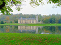
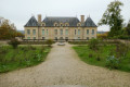
(3) Turn right, cross two junctions, then enter the grounds of Château de Méry through the gate.
(4) Walk alongside the large rectangular pond; at the far end, turn right, then left onto the path that runs alongside the pond. Follow the main path past the first fence. Turn left, then pass a second fence before reaching the banks of the Oise. Turn left and walk along the river.
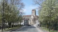
(5) Turn right onto the bridge, then head towards the church in Auvers, made famous by Van Gogh, which is clearly visible in line with the road.
(6) Behind the chancel, take the street leading uphill towards the cemetery (signposted ‘cimetière’).
The graves of the Van Gogh brothers are against the north wall of the cemetery.
(7) Leave the cemetery, turn right, then at the corner of the wall, take the path on the left. You’ll reach the crossroads marked by the sign for ‘Wheat Field with Crows’.
(8) Carry on straight ahead across the fields. When you reach a beautiful stone cross, continue straight on along the path which enters the woodland and descends quite steeply to the houses.
(9) At the crossroads, turn left towards Daubigny’s studio.
(10) Turn round.
(9) Walk straight up the street for about 500 m. Turn left onto the correct path (yellowPR® markings). After about 150 m, on the uphill section, follow the markings which take you onto a path on the left. You’ll reach the upper entrance gate of Léry Castle, where you can enter the grounds.
(11) In the gardens below the château’s esplanade, leave the grounds heading west and take Rue Victor Hugo opposite, which continues as Rue du Docteur Gachet.
(12) At the end of the street, first turn right then left to join Rue François Coppée. At a Fork in the road, turn right onto the narrow Rue de la Chérielle, which bends to the right, climbs and becomes Chemin des Monts, which then bends to the left.
(13) Just after a path coming from the left, turn right at a right angle onto Chemin des Glaises. It turns left after about 70 metres. Then continue along the main path, which becomes Chemin des Gobelins, passing through a mix of wooded and open areas, before turning into a footpath that descends into the valley.
(14) When you reach another footpath (Sente des Jardins), turn right, then left onto the road, then take the first right onto Rue d’Ennery. This continues as Chemin de Martinets, which in turn becomes a footpath. After a descent, you’ll come to the Sentier du Chou.
(15) Turn right. Carry on straight ahead (south-west) until you reach the tarmac road. Continue straight across.
150 m further on, at the junction, turn left and you’ll reach the riverbank.
(16) Turn right. Follow the banks of the Oise. When you reach the large crossroads opposite the Tourist Office (on the left) and at the foot of the fortifications (on the right), turn right onto the wide Rue Séré Depoin. 300 m further on, turn left to reach Pontoise station (E).

 Visorando Member
 Difficult
  Association / Club / Walk leader
 Easy
Easy 
 Very difficult
