Visorando
Search
Visorando
Toggle navigation
Tools
Walking route planner
Import a GPX file
Walks
Help ↗
Viso
rando
Premium
Sign up
Log in
Visorando
Walks
Pays de la Loire
Mayenne
Torcé-Viviers-en-Charnie
Château de Bouillé
Refine your search for walks in Château de Bouillé
Clear field
Around me
Filters
NEW
Search
Filters
Close
Distance
NEW
Duration
Duration
Distance
Difficulty
Ascent
NEW
Activities
All
Walking
Mountain biking
Road cycling
Touring/Gravel
Snowshoeing
Horse riding
Skiing
Boating/Canoeing/Kayaking
Route type
All
Circular
Linear
Search in all languages
Château de Bouillé walks
Tour de Viviers
Tourist office
5.69 mi
+594 ft
-597 ft
3h 10
Easy
Departure from Torcé-Viviers-en-Charnie (Mayenne)
This route will take you to the edge of the Grande Charnie and allow you to explore the sunken paths of Torcé-Viviers-en-Charnie. This route is signposted “No. 27” on the yellow directional arrows.
Bouillé route
Tourist office
5.12 mi
+436 ft
-427 ft
2h 45
Easy
Departure from Torcé-Viviers-en-Charnie (Mayenne)
This route will take you to explore Bouillé Castle and the paths running along the edge of the Bois de la Grande-Charnie. This route is signposted “No. 26” on the yellow directional arrows.
Walks near Château de Bouillé
From Lake Sillé-le-Guillaume to Saint-Christophe-du-Jambet
Visorando Member
11.16 mi
+459 ft
-712 ft
5h 30
Average
Departure from Sillé-le-Guillaume (Sarthe)
A walk to discover (or rediscover) the countryside of northern Sarthe and the Sillé-le-Guillaume national forest.
Loading…



 Tour de Viviers
  Tourist office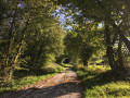


 Easy
Easy 
 Visorando Member
 Average