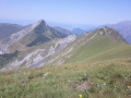
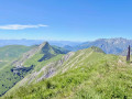
The Dent de Corps from the Route Napoléon

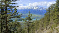
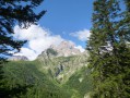
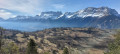
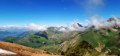
La Dent is a secondary summit of the Petit Journal, above the village of Corps. This circular walk takes hikers from the Route Napoléon to this viewpoint. From up there, you can enjoy views of the Dévoluy, the Trièves and the Écrins, and, above all, a bird’s-eye view down into Lac du Sautet.

Details

n°18971844
Creation:
Last update:
Last review:
  • Walking
    Activity: Walking
  • ↔
    Distance: 3.10 mi
  • ◔
    Average duration: 2h 45 
  • ▲
    Difficulty: Moderate

  • ⚐
    Back to start: Yes
  • ↗
    Ascent: + 1,483 ft
  • ↘
    Descent: - 1,483 ft

  • ▲
    Highest point: 4,560 ft
  • ▼
    Lowest point: 3,077 ft

Description of the walk

Park in the Corps market car park.

(S/E) From the car park, cross the road to take Rue Passe Vite opposite. At the bend, leave the road and follow the path between the houses, which leads onto Route de la Salette at the care home. Cross the road carefully and take the small Route du Bourg opposite. Immediately follow the hairpin bend by turning left onto the Chemin de la Montagne. At the junction, continue straight on along the path.

(1) About thirty metres further on, turn left onto the path which climbs steeply and quickly winds round a few bends. You’ll reach the hamlet of Boustigue.

(2) Turn right, following the road which then becomes a track that winds further on to reach a house. Continue straight on along a grassy track that crosses the mountain pasture before passing briefly through a woodland.

(3) Once at the edge of the woodland, a path on the right appears; this is the one you’ll take for the descent. Continue along the track, which makes a first hairpin bend and then a second before reaching the La Dent plateau.

(4) Take in the view before heading back down via the same route.

(3) Turn left and, at the first junction, turn right, following the sign for “Le Clichet”. The path then simply descends through the forest and is clearly signposted.

(1) Turn left, cross the Route de la Salette again with the same caution, and rejoin the path which leads out onto Rue Passe Vite. Continue to the left to return to the car park (S/E).

Waypoints

  1. S/E : mi 0 - alt. 3,077 ft - Market car park
  2. 1 : mi 0.2 - alt. 3,281 ft - Junction on the circular loop
  3. 2 : mi 0.62 - alt. 4,078 ft - The hamlet of Boustigue
  4. 3 : mi 0.96 - alt. 4,216 ft - Junction on the circular loop
  5. 4 : mi 1.54 - alt. 4,560 ft - Dent
  6. S/E : mi 3.1 - alt. 3,077 ft - Market car park

Notes

This suggested route takes you first through woodland and then across mountain pastures. Much of the route is marked in yellow.

This route is brought to you by Altimood, a mountain guide based in the north of Champsaur-Valgaudemar, on the border with the Pays de Corps/Matheysine region. See also snowshoe excursions in the Southern Alps and weekend mountain hiking trips in the same part of the Alps.

Worth a visit

On your way back, do stop off at the Corps distillery to experience the mountains in a different way (small street opposite the car park, signposted).

Reviews and comments

4.7 / 5
Based on 1 review

Reliability of the description
5 / 5
Ease of following the route
5 / 5
Route interest
4 / 5
User 3874989

Overall rating : 4.7 / 5

Date of your route : Jul 14, 2026
Reliability of the description : ★★★★★ Very good
Ease of following the route : ★★★★★ Very good
Route interest : ★★★★☆ Good
Very busy route : No

A gentle route, though a little challenging at the start. The view from the top is stunning

Machine-translated

Other walks in the area

For more walks, use our search engine .

The GPS track and description are the property of this route's author. Please do not copy them without permission.