La Dame Blanche des Clochers, along the River Oye

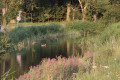
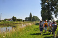
Just a few kilometres from the coast, this walking trail, which runs partly alongside the River Oye, is ideal for families. It invites you to explore a countryside still dominated by mills and traditional farmhouses, bearing witness
to the intensity of agricultural life in these lands criss-crossed by numerous watercourses known as ‘wartergangs’.

Details

1638948
Creation:
Last update:
Last review:
  • Walking
    Activity: Walking
  • ↔
    Distance: 2.73 mi
  • ◔
    Average duration: 1h 15 
  • ▲
    Difficulty: Easy

  • ⚐
    Back to start: Yes
  • ↗
    Ascent: + 7 ft
  • ↘
    Descent: - 10 ft

  • ▲
    Highest point: 13 ft
  • ▼
    Lowest point: 3 ft
  • ⚐ Country: France
  • ⚐ City: Offekerque (62370)
  • ⚑
    Start/End: N 50.953796° / E 2.014479°
  • ❏
    IGN map(s): Ref. 2203E
  • Hour-by-hour weather

Photos

Description of the walk

Getting to the start: from the town hall, turn left onto Rue de la Gare and continue straight on for approximately 1.5 km. The start is on this road after the level crossing and just before the River Oye. Before setting off on your walk, take a moment to step through the doorway of Offekerque Church and admire the frescoes by Lucien Jonas.

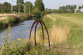
(S/E) Cross the D230 and follow the River Oye along the grassy path. At the Pont de Planche, you’ll come across a small lock called Vantelle. Carry on to the next bridge.

(1) Cross the Pont d’Arras, then turn right and walk along the River Oye on the other side. Then turn left onto Rue du Sauve-en-Temps.

(2) Turn right onto Rue des Bancs and follow it to the end.

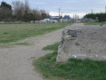
(3) Continue straight on along the path (Rue des Banes) behind the Off pony club. In the plain, you’ll come across small blockhouses known as casemates, remnants of the Atlantic Wall.
Turn right and follow the D230 to return to the starting point (S/E).

Waypoints

  1. S/E : mi 0 - alt. 7 ft - Car park at the junction with Rue de la Gare
  2. 1 : mi 1.14 - alt. 3 ft - Pont d’Arras
  3. 2 : mi 1.63 - alt. 7 ft - Rue des Bancs
  4. 3 : mi 2.22 - alt. 10 ft - Rue des Banes
  5. S/E : mi 2.73 - alt. 3 ft - Car park at the junction with Rue de la Gare

Notes

Worth a visit

Church of Saint Thérèse of the Child Jesus
The origins of this church date back tothe 18th century. Having been struck by two fires, it was rebuilt in the early20th century using ‘blonde de sable’ brick, typical of the Aa Delta region. Built in the Modernist style, the church’s interior features Marquise marble. But the most remarkable feature remains the decoration adorning the chancel and the Stations of the Cross. It is a magnificent fresco created by the military painter Lucien Jonas, known for having illustrated banknotes.

The River Oye
The River Oye is 12 km long. Although called a river, it is in fact a watergang that originates in Marck and joins the River Aa at Gravelines. This waterway drains a region of watergangs. It was once a transport route used by flat-bottomed boats.

Vantelle
Vantelles are small sluices used to retain or release water. During periods of high water, the vantelle is opened. This allows the water to flow towards the river, preventing the flooding of cultivated land. During dry periods, the vantelle retains the water, enabling the irrigation of crops.

Remains of the Atlantic Wall: The casemates
During the Second World War, the Germans built casemates or blockhouses along the coastline to repel a possible Allied landing.

The White Mill or Lianne d’Offekerque
A former wheat mill for bread, it was built in 1833. The circular brick tower was restored between 1976 and 1978.

The Guemps Bridge Mill
Situated in Guemps (a neighbouring commune) and overlooking the coastal plain, discover the Guemps mill, which is still in working order. Carefully restored, it is recognisable by its pivoting roof, which overlooks the coastal plain. It bears witness to the intense agricultural activity and processing of produce in the ‘pays des wateringues’ duringthe 19th century.

Reviews and comments

4 / 5
Based on 3 reviews

Reliability of the description
4.3 / 5
Ease of following the route
4.7 / 5
Route interest
3 / 5
Nadjanne
Nadjanne

Overall rating : 4 / 5

Date of your route : May 18, 2020
Reliability of the description : ★★★★☆ Good
Ease of following the route : ★★★★★ Very good
Route interest : ★★★☆☆ Average
Very busy route : No

Please note: the route starts, as indicated, 1.5 km from the car park. It involves walking along a country road with no pavement, which is therefore dangerous for children... See if you can park opposite the level crossing to set off safely.
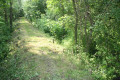
The section behind the farm is through very tall grass: this is also tricky for little ones.

Machine-translated

Destop
Destop

Overall rating : 4.7 / 5

Date of your route : Mar 25, 2019
Reliability of the description : ★★★★★ Very good
Ease of following the route : ★★★★★ Very good
Route interest : ★★★★☆ Good

A lovely walk for my dog.
The section behind the riding centre can be a bit tricky as the paths you need to take are fenced off, but the precise GPS route clears up any doubts.
Thank you!

Machine-translated

henri57
henri57 ★

Hello,

Thank you for taking the time to share your opinion.

Accuracy of the description: Good
Accuracy of the route on the map: Good

and there are some missing signs, which meant we got lost

Visorando does not recommend relying on signposting as this can be altered or removed… Whereas landmarks on the ground provide consistent information.

Visorando provides a detailed description and an IGN route map at a scale of 1:25,000. And, if you have any difficulty finding your way, there’s a virtual waymarking system: a GPS app

The aim isn’t to be glued to your smartphone, but to have a tool that allows you to check waypoints and thus clear up any doubts about your direction.

See you soon

Machine-translated

philippebertin3
philippebertin3

Overall rating : 3.3 / 5

Date of your route : Jan 10, 2019
Reliability of the description : ★★★★☆ Good
Ease of following the route : ★★★★☆ Good
Route interest : ★★☆☆☆ Disappointing

2 reasons:

the points of interest, such as the mills, aren’t actually on the route and there are some missing signs, which meant we got lost

Machine-translated

Other walks in the area

For more walks, use our search engine .

The GPS track and description are the property of this route's author. Please do not copy them without permission.