


CPETI

 Tourist office
PRO  Premium user
Premium user - 66 place Général de Gaulle
62370 Audruicq - Tel:03.21.00.83.83
- Website: http://www.tourismeaudruicq-oyeplage.fr
Sign up:
Published route(s)
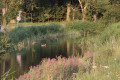
 La Dame Blanche des Clochers, along the River Oye
 2.73 mi
 +7 ft
+7 ft
 -10 ft
 1h 15
1h 15
 Easy
Easy
 Departure from Offekerque (Pas-de-Calais)
Just a few kilometres from the coast, this walking trail, which runs partly alongside the River Oye, is ideal for families. It invites you to explore a countryside still dominated by mills and traditional farmhouses, bearing witness
to the intensity of agricultural life in these lands criss-crossed by numerous watercourses known as ‘wartergangs’.
The Lady of the Wolves Trail
 8.56 mi
+98 ft
-102 ft
4h 00
8.56 mi
+98 ft
-102 ft
4h 00
 Moderate
Departure from Zutkerque (Pas-de-Calais)
Moderate
Departure from Zutkerque (Pas-de-Calais)
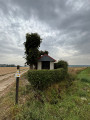
South of Audruicq, discover the Brédenarde, a landscape of hedgerows, fruit trees and wooded countryside.Starting from Zutkerque or Polincove, take the ‘Dame aux Loups’ trail, named in honour of the Baronessde Draëck; you can admire her château, the first hills of Artois and follow the winding course of the Hem: the river of mills.
 Chicory mills and drying houses around the River Oye
 26.03 mi
+20 ft
-20 ft
3 hrs
Moderate
Departure from Oye-Plage (Pas-de-Calais)
26.03 mi
+20 ft
-20 ft
3 hrs
Moderate
Departure from Oye-Plage (Pas-de-Calais)
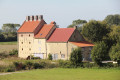
A very long time ago, the sea covered this area at high tide, but the ingenuity of the Benedictine monks inthe 10th century led to the construction of a network of drainage channels: the watergangs. This area, with its light, sandy soil, is ideal for growing chicory.
Large buildings made of yellow or red brick were once used to dry chicory roots. The people made the most of this gift from Mother Nature by building mills.
Around Hennuin
 3.82 mi
+7 ft
-7 ft
1h 45
Easy
Departure from Audruicq (Pas-de-Calais)
3.82 mi
+7 ft
-7 ft
1h 45
Easy
Departure from Audruicq (Pas-de-Calais)
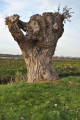
This path, where land and water merge, is a walking trail that takes you alongside the watergangs (drainage structures designed to drain low-lying marshes and wetlands) and allows you to observe, with your family, the animal and plant species native to wetland habitats.
The Ansérienne Trail
 10.29 mi
+10 ft
-10 ft
4h 45
Moderate
Departure from Oye-Plage (Pas-de-Calais)
10.29 mi
+10 ft
-10 ft
4h 45
Moderate
Departure from Oye-Plage (Pas-de-Calais)
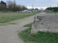
This trail takes you across the coastal plain, which stretches as far as the eye can see, and allows you to explore, within the dune system, a preserved natural area: the Platier d’Oye National Nature Reserve.
Marais Trail in Nortkerque
 5.74 mi
+26 ft
-26 ft
2h 40
Easy
Departure from Nortkerque (Pas-de-Calais)
5.74 mi
+26 ft
-26 ft
2h 40
Easy
Departure from Nortkerque (Pas-de-Calais)
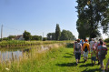
This path takes you to one of the four villages of the Pays du Brédenarde, Nortkerque, which can be translated as ‘church of the North’. Geologically, the former Pays du Brédenarde consists of a layer of clay resting on chalk that overlooks the coastal plain. It is a landscape of hedgerows, fruit trees and livestock farming. In the past, the Brédenarde also included the municipalities of Audruicq, Zutkerque and Polincove.
(4) Please note: the footbridge no longer exists; access is impossible until further notice (see practical information).
The Ghost of the Aa Trail in Ruminghen
 10.40 mi
+33 ft
-33 ft
4h 50
Moderate
Departure from Ruminghem (Pas-de-Calais)
10.40 mi
+33 ft
-33 ft
4h 50
Moderate
Departure from Ruminghem (Pas-de-Calais)
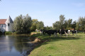
Stroll along the hedgerows surrounding the orchards, discover the Chinese cemetery and the typical farms built of yellow or red brick or stone, a reminder that we are indeed at the confluence of Flanders and Artois. Then, let yourself be haunted by the ghost of the Aa, which lurks along the waterways…
Pays de Langle Trail
 5.01 mi
+7 ft
-10 ft
2h 20
Easy
Departure from Audruicq (Pas-de-Calais)
5.01 mi
+7 ft
-10 ft
2h 20
Easy
Departure from Audruicq (Pas-de-Calais)
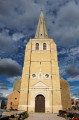
From the Hennuin drawbridge, where the River Hem meets the Calais–Saint-Omer Canal – a key crossing point for boatmen – this trail will take you through the Pays de Langle, which owes its name to the shape formed by the Aa estuary in the Middle Ages. Here, perhaps more than anywhere else, the network of waterways shapes the landscape and serves as a reminder that you are in the coastal plain, in the land of canals and waterways.
Circular route through the land of the wateringues
 1.78 mi
+3 ft
-3 ft
0h 50
Easy
Departure from Audruicq (Pas-de-Calais)
1.78 mi
+3 ft
-3 ft
0h 50
Easy
Departure from Audruicq (Pas-de-Calais)
Here in Hennuin, you are at the heart of the Aa Delta – in the land of the wateringues, to be precise.
A five-stage interpretive trail is on offer to help you understand the importance of water management in this land reclaimed from the sea.