The Crête des Charbonnières, starting from Lieuche

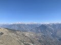
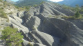
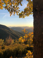
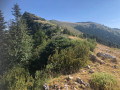
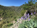
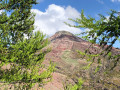
A very beautiful route, offering a diverse natural environment of strata, forests and marl, following a very pleasant, unmarked path that will take you to the Charbonnières ridge. Once you’ve explored this path, the ridge line offers a wonderful vantage point from which to admire the various surrounding mountain ranges.

Details

n°73426052
Creation:
Last update:
Last review:
  • Walking
    Activity: Walking
  • ↔
    Distance: 5.35 mi
  • ◔
    Average duration: 3h 45 
  • ▲
    Difficulty: Moderate

  • ⚐
    Back to start: Yes
  • ↗
    Ascent: + 1,483 ft
  • ↘
    Descent: - 1,467 ft

  • ▲
    Highest point: 3,789 ft
  • ▼
    Lowest point: 2,579 ft

Photos

Description of the walk

Park in one of the car parks in the village of Lieuche. 

(S/E) Head for marker 103, situated in front of the wash house near the church. Follow the signs for Thiéry – Baisse du Grand Palier and the red and white markings of the GR®510. Pass between the church and the inn, taking Rue Bréa which runs through the village. Follow a tarmac road with no traffic to reach the end of the village.

(1) Leave the road and turn right onto a path worn down by the weather, leading to a stone bridge.

(2) Cross the River Chadanne via this bridge, then climb the winding path through the terraces; continue along this path to reach the Baisse du Grand Palier, at marker 92.

(3) Here, leave the GR® by taking one of two options:
- take the middle path, marked in yellow, to go round the ridge on its southern side and reach the path junction shortly after marker 93,
- take the path on the left; it is marked on a solitary tree with a yellow mark and there is also a cairn – this is the route shown on the map. Continue along this forest path; please note that it is not shown on the map but is clearly visible. Follow the contour line, then climb gradually to reach the Crête des Charbonniers.

(4) Continue along the ridge path to the pass.

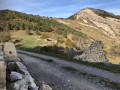
(5) Leave the ridge and turn right down a slope heading east. Use the Visorando app if necessary. Walk past the ruins of a building and join the path. 

(6) Take the path to the left, marked with yellow signposts. Continue, climbing very gently, until, after passing through an area of greyish marl, you reach signpost 107 at a place called Arsilane. 

(7) Walk past marker 107, continue straight ahead, and pass marker 105. You will reach the junction with the Piste de l’Arsilane, at a place called Saint-Féréol, near a farm shed.

(8) Take this track straight ahead, and stay on it at the junction marked by marker 104. Continue down the slope until you reach the hamlet of La Rejaisse.

(9) Keep straight ahead on the track, cut across a bend in the track, and reach, above Lieuche, the junction at the hamlet known as Le Pouyet.

(10) Leave the track leading there on your left, continue straight ahead along the track, then along Rue de l’Égalité to reach the Lieuche car park (S/E).

Waypoints

  1. S/E : mi 0 - alt. 2,920 ft - Car park in the village of Lieuche
  2. 1 : mi 0.21 - alt. 2,861 ft - End of the village
  3. 2 : mi 0.72 - alt. 2,582 ft - Stone bridge
  4. 3 : mi 1.56 - alt. 3,310 ft - Descent from the Grand Palier
  5. 4 : mi 2.1 - alt. 3,625 ft - Crête des Charbonnières
  6. 5 : mi 2.27 - alt. 3,589 ft - Pass
  7. 6 : mi 2.37 - alt. 3,448 ft - Path
  8. 7 : mi 3.45 - alt. 3,757 ft - Marker 107
  9. 8 : mi 3.7 - alt. 3,655 ft - Shed
  10. 9 : mi 4.43 - alt. 3,376 ft - The hamlet of La Rejaisse
  11. 10 : mi 5.01 - alt. 3,100 ft - Junction
  12. S/E : mi 5.35 - alt. 2,920 ft - Car park in the village of Lieuche

Notes

Walking poles and hiking boots recommended
(S/E) Toilets and water near the wash house next to the church.
Please note: after the bridge (2), the 06 department warns of a “path with tricky sections”. For about a hundred metres, the path is sometimes narrow; do not hesitate to place your hand on the rock to steady yourself if necessary.
Please close any gates you come across along the route. 

Worth a visit

Before (S/E), 200 metres before the village entrance, you’ll find the Saint-Macaire Chapel, which features small murals.
(S/E) Lieuche: a surprising find in one of the region’s smallest villages is the magnificentaltarpiece of the Annunciation by Louis Brea (1499) in the Church of Notre-Dame de l’Annonciation in Lieuche.Thisaltarpiece, installed in the church on 15 January 1499, can only be viewed on Thursdays. Please call to arrange a visit: 0493050150
(4) Crête des Charbonniers. Take a moment to stop and enjoy the view:
- to the north-west: the village of Lieuche with the peaks of the Tête de Rigaud, the Lare, the Montagne de Mairola and the Dôme de Barrot in the background. 
- to the south: the village of Thiéry with the Pointe de Chavanette, Mont Fracha and the Blaches.

Always be cautious and plan ahead when you're outdoors. Visorando and the author of this route cannot be held responsible for any accidents occurring on this route.

The GR® and PR® markings are the intellectual property of the Fédération Française de Randonnée Pédestre.

Reviews and comments

4.7 / 5
Based on 1 review

Reliability of the description
5 / 5
Ease of following the route
4 / 5
Route interest
5 / 5
bernard bb
bernard bb

Thank you Camusac for this review
best regards, B.

Machine-translated

camusax
camusax

Overall rating : 4.7 / 5

Date of your route : Aug 15, 2025
Reliability of the description : ★★★★★ Very good
Ease of following the route : ★★★★☆ Good
Route interest : ★★★★★ Very good
Very busy route : No

Very nice walk! A bit of a rough ride between 5 and 6 (or 6 and 7). Beautiful forest and spectacular geology
Thanks for the description and the route. We didn't see anyone else.

Machine-translated

Other walks in the area

For more walks, use our search engine .

The GPS track and description are the property of this route's author. Please do not copy them without permission.