


 Country:

 City:
City:


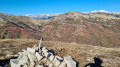
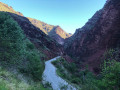
Park in the car park along the D28, 100 m before the Cianbanon tunnel. Admire the reddish gorges of the Cians flowing below the road.
(S/E) Carefully make your way towards signpost 211, 150 m away, indicating the direction of Rubi.
(1) At this signpost, go through the barrier and set off along the grassy path leading uphill. There are a few traces of yellow markings at the start of the walk.
(2) The path runs alongside a small farmstead consisting of a house and a barn. The water source below the path will be very welcome on the way back.
(3) At this cairn, turn right onto the ascending path which winds its way through the wild rose bushes towards the hamlet of Yerboa, which can be seen above.
(4) Walk past the two buildings in the hamlet of Yerboa on your right. At the house, the path heads north-west. Clearly visible at the start, it becomes somewhat less distinct further on and leads towards a rocky valley. This section is rather unpleasant as there are also a few thorny wild rose bushes all the way to the top.
(5) At this point there is a grey metal garage with a rounded roof, which serves as a shelter for the shepherds’ equipment. Continue along the path behind the garage. The cairns are very helpful, as are the Visorando app or a GPS. Continue across this reddish terrain towards the pass at an altitude of 1521.
(6) At the pass, the unmarked marker 212 lies on the ground. Turn left, pass the solitary fir tree and follow the path that runs along the contour line.
(7): Once you reach the pass below Mont Cerisier, turn right heading due north. Take the steep slope opposite to cross over to the eastern flank of Mont de la Madeleine. The path is moderately visible.
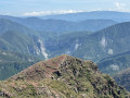
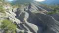
(8) At this final pass, there are no landmarks on the ground. Head towards the Tête de Rigaud, which looms overhead. After about a hundred metres, the reddish cairns reappear. The landscape is at times lunar. The ascent is steep until you reach a stone sheepfold visible in the distance to the left.
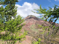
(9) At this point there is a very beautiful stone sheepfold situated at the end of a track suitable for vehicles. To the right of the building, signpost number 213 directs you towards the Tête de Rigaud, situated above the sheepfold. The path soon disappears. The climb up to the ridge is gruelling as it follows the slope directly. The Tête de Rigaud resembles a large crown. As you approach the summit, go round it on the left to avoid the steep, rocky outcrop. The northern slope provides easy access to the summit
(10) Summit of the Tête de Rigaud: altitude 1,907 m. The summit is a flat plateau. Take the time to admire the exceptional 360° view. To make the return journey easier, begin the descent due north for about a hundred metres, then turn 180° to the left to avoid the ground covered in pelites – which is slippery in places – and rejoin the track below.
(11) Turn left to reach the sheepfold and signpost 213.
(9) Continue straight on. You’ll rejoin the path and cairns you left shortly before. Follow the ascent route back to the metal garage.
(5) Carry on straight ahead along the reddish-coloured stony path heading south-east. Ignore any side paths.
(12) Just after a cairn, you’ll see the hamlet of Yerboa on your left. Turn left onto a track leading back to this hamlet, which is your destination. Walk past the ruins of a barn on your right; the return path is on the right, slightly below. The multitude of paths requires a degree of care. No need to worry, though – you can see your return route very clearly. You’ll come back to a fork in the path that you passed on the way out.
(3) Carry on straight ahead, following the route back in the opposite direction to the way out.
(2) A welcome break to refresh yourself at the spring flowing below the path. Continue along the path in the opposite direction to the outward journey.
(1) Turn left and walk carefully alongside the D28 to reach the car park where you started (S/E).


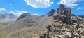

 . Visorando was a great help to us; without it, we would have had a lot of trouble reaching the summit. Thanks to Bernard bb for the details of the hike, which were also a great help. What a joy it was to reach the summit of this impressive dome!
 Visorando Member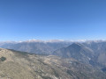

 Moderate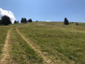
 Easy
Easy 
