Country:

 City:
City:


Leave the D621 towards Verneuge, taking the small road on the right as you descend from Le Cheix. Park your car at the junction after the last houses before crossing the river. This is the starting point of the circular route.
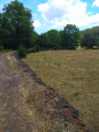
(S/E) A signpost indicating the trails suggests, amongst other things, the route to the Pont de la Chèvre via thePR®24, marked in yellow. Take this flat path which runs alongside the meadows bordering the Couze Pavin. A few dozen metres from the start, there is a very simple explanation of the ‘cherilles’. The path is shaded all the way to the
Pont de la Chèvre. Well done to anyone lucky enough to spot a brown trout blending into the black bed of the stream!
(1) Cross the bridge and, immediately afterwards, follow the path that climbs to the right (yellow markings). It is quite wide and winds its way up in hairpin bends beneath a beautiful oak forest dotted with pine trees. The beauty of this forest can make you forget the rather steep gradient. The end of the forest also marks the end of the hairpin bends. Over a few dozen metres that are still a little steep, the landscape gradually opens out. The slope levels out and the path, still quite wide, crosses through meadows. In the distance to the right (west), you can see the cliff face of the Jonas Caves, partially obscured by the Pic Saint-Pierre. A little further to the right still is the active Cheix quarry.
Just before the hamlet of Bessolle, where you can see the first houses, a signposted path is indicated to the left. Do not take this route (towards Courgoul) but carry on straight ahead until you reach the tarmac road. At the junction, take this tarmac road, which descends slightly to the right for about a hundred metres.
(2) Leave this path when it begins to descend more steeply to the right and continue along the lovely dirt track opposite. This track roughly follows the contour lines between 700 and 720 metres. It is unobstructed, offering views of the various peaks and puys that have risen in the valley as a result of volcanic activity and erosion. The descent becomes a little steeper through the deciduous forest until you reach the Ruisseau de Verneuge, where the path joins another tarmac road after a hairpin bend.
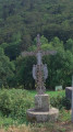
(3) Turn right and walk downhill through the hamlet of Verneuge. Note a vine growing around the entrance to a house. On leaving the hamlet, look out for a decorated iron cross; thePR® then branches off to the left from our route, heading towards Jonas.
Head straight down the road, which serves only the hamlet. A little further down, there is a landing area for hang-gliders taking off from the Pic Saint-Pierre above.
Cross the Verneuge bridge, taking a moment to admire the irrigation channels running alongside the stream, and head to the car park (S/E).


 Visorando Member
 Easy
Easy 

 Difficult