Pic and Chapel of Saint-Pierre

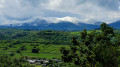
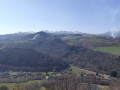
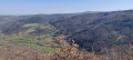
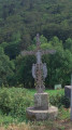
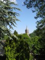
A short 5 km round-trip hike to Pic de Saint-Pierre and its chapel. A little-known summit, yet it is easily accessible and offers a 360° panorama of the Sancy, the Cotteuges Valley and, in fine weather, the Chaîne des Puys and the Livradois-Forez.

Details

n°20412969
Creation:
Last update:
Last review:
  • Walking
    Activity: Walking
  • ↔
    Distance: 2.82 mi
  • ◔
    Average duration: 2h 00 
  • ▲
    Difficulty: Easy

  • ⚐
    Back to start: Yes
  • ↗
    Ascent: + 764 ft
  • ↘
    Descent: - 764 ft

  • ▲
    Highest point: 3,268 ft
  • ▼
    Lowest point: 2,533 ft

Photos

Description of the walk

Park at the Lomprat community hall.

(S/E) From the car park, take the wide path running alongside the community hall (Chemin de Bodassat).

(1) Just before the cemetery, turn right onto the path climbing through the woods. A signpost for the Col de la Feuille helps you find the path. Follow it to the pass.

(2) When you reach the road and the pass (information sign), turn left onto the path with a wooden gate leading to the summit.

(3) At the first plateau, turn right onto the clearly visible path to reach the top of the peak and its chapel.

(4) Walk around the summit to enjoy the various views and explore the small chapel. Then return via the same route to the car park (S/E).

Waypoints

  1. S/E : mi 0 - alt. 2,569 ft - Lomprat multi-purpose hall. Near the - Couze Pavin (rivière) à finaliser
  2. 1 : mi 0.42 - alt. 2,533 ft - Cemetery
  3. 2 : mi 0.83 - alt. 2,874 ft - Col de la Feuille (880m)
  4. 3 : mi 1.19 - alt. 3,146 ft - Puy de Saint-Pierre
  5. 4 : mi 1.31 - alt. 3,264 ft - Pic de Saint Pierre (996m)
  6. S/E : mi 2.82 - alt. 2,569 ft - Lomprat multi-purpose hall

Notes

Several car parks are available in the village. Simply follow the path leading to the cemetery, which is easily accessible from the various parking areas. Very easy to find your way; you simply cannot miss any of the paths.

The Pic Saint Pierre site is a launch point for paragliding, so the wind at the top can be strong.

The climb presents no difficulty; allow for a climb of around 2 km.

For those who are less keen walkers, it is possible to start at the Col de la Feuille. Space for 2–3 cars. Expect a short kilometre’s climb and the same again on the descent.

Worth a visit

Nearby:

  • the Jonas Caves: troglodyte dwellings open to visitors in high season.
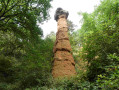
  • the ‘Cheminée des Fées’ in Cotteuges. A very short one-kilometre walk takes you to this geological curiosity steeped in legend.
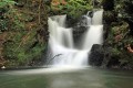
  • The Chiloza Waterfalls: just before reaching Besse, also accessible from the starting point (unmarked).

Reviews and comments

5 / 5
Based on 7 reviews

Reliability of the description
5 / 5
Ease of following the route
5 / 5
Route interest
4.9 / 5
jjmangier
jjmangier

Overall rating : 5 / 5

Date of your route : Aug 28, 2026
Reliability of the description : ★★★★★ Very good
Ease of following the route : ★★★★★ Very good
Route interest : ★★★★★ Very good
Very busy route : No

A lovely walk offering a magnificent view from the summit of Pic St Pierre. The car park at the start is very convenient; there’s no incline up to point 1, but after that it climbs continuously and steadily, and at times it feels as though there’s no end in sight. But the view from the summit is a wonderful reward. The option to park at the Col de la Feuille offers a fallback alternative for walkers who are finding it difficult.
Thanks to the author.

Machine-translated

Marianne01
Marianne01

Overall rating : 5 / 5

Date of your route : Aug 28, 2026
Reliability of the description : ★★★★★ Very good
Ease of following the route : ★★★★★ Very good
Route interest : ★★★★★ Very good
Very busy route : No

A very pleasant walk, but with an almost constant climb to the summit.
It starts off through woodland and offers a magnificent 360° view at the very top. The route is a return trip along the same path.
You can start at the Col de la Feuille to cut out the climb (and the descent^^).

Machine-translated

Berni69
Berni69

Overall rating : 5 / 5

Date of your route : Jul 31, 2026
Reliability of the description : ★★★★★ Very good
Ease of following the route : ★★★★★ Very good
Route interest : ★★★★★ Very good
Very busy route : No

Please note: you’ll need a good pair of walking shoes for this route, as there are slippery sections with gradients of up to 20 per cent in places.
Make sure you take plenty of water as it’s a long climb.
The route is very well signposted.
Avoid going if it’s raining.
Walk at a very leisurely pace

Machine-translated

User 4648730

Overall rating : 4.7 / 5

Date of your route : May 16, 2026
Reliability of the description : ★★★★★ Very good
Ease of following the route : ★★★★★ Very good
Route interest : ★★★★☆ Good
Very busy route : No

A fairly easy walk. Stunning views of the Sancy from Pic St Pierre. You can make it a circular walk by taking a different path down.
As you descend from Pic St Pierre, turn immediately right, following the sign pointing towards the woodland. This takes you to the finish via a different path and allows you to discover the terraced farming that was practised here several centuries ago.

Machine-translated

Denis26
Denis26 ★

Overall rating : 5 / 5

Date of your route : Aug 26, 2024
Reliability of the description : ★★★★★ Very good
Ease of following the route : ★★★★★ Very good
Route interest : ★★★★★ Very good
Very busy route : No

A pretty chapel and a lovely viewpoint

Machine-translated

deforge
deforge

Overall rating : 5 / 5

Date of your route : Jul 07, 2023
Reliability of the description : ★★★★★ Very good
Ease of following the route : ★★★★★ Very good
Route interest : ★★★★★ Very good
Very busy route : No

A short, gentle walk that’s perfect for getting back into the swing of things for those living in the lowlands, but the view from the top is absolutely stunning (it feels like you’re the only person in the world)

Machine-translated

claudekiko
claudekiko

Overall rating : 5 / 5

Date of your route : Jun 07, 2022
Reliability of the description : ★★★★★ Very good
Ease of following the route : ★★★★★ Very good
Route interest : ★★★★★ Very good
Very busy route : No

A short walk along forest paths leading to the Col de la Feuille and then on to the Pic de Saint Pierre, offering magnificent views. Lush greenery, a small chapel and a paragliding launch site, weather permitting.

Machine-translated

Other walks in the area

For more walks, use our search engine .

The GPS track and description are the property of this route's author. Please do not copy them without permission.