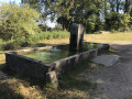
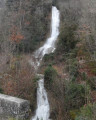
La Combe Romanet in Prénovel

A route that is mainly through woodland, alternating between single tracks, fast-riding dirt tracks and a few sections of forest roads.
The end of the route offers some beautiful views over the Nanchez valley, with its geology typical of the Haut-Jura Regional Nature Park.

Details

n°63087210
Creation:
Last update:
Last review:
  • Mountain biking
    Activity: Mountain biking
  • ↔
    Distance: 6.42 mi
  • ◔
    Duration according to the author: 1 hr 
  • ▲
    Difficulty: Moderate

  • ⚐
    Back to start: Yes
  • ↗
    Ascent: + 558 ft
  • ↘
    Descent: - 528 ft

  • ▲
    Highest point: 3,186 ft
  • ▼
    Lowest point: 3,002 ft
  • ⚐ Country: France
  • ⚐
  • ⚐ City: Prénovel (39150)
  • ⚑
    Start/End: N 46.511846° / E 5.838801°
  • ❏
    IGN map(s): Ref. 3327OT

  • ◶
    Type of surface:
  •  
     
     
    ■ 35% Road ■ 45% Byway ■ 20% Path
  • ⇧
    Bike carrying: Not specified
  • ▲
    Difficulty: Moderate
  • Hour-by-hour weather

Description of the route

You can park at the Le Duchet mountain bike centre, in Prénovel, Nanchez or at the Prénovel town hall annexe.

Mountain bike signposting: 82 Blue

(S/E) In Prénovel, at the roundabout, head towards the chalet marking the start of the hiking trails, and follow the path to the signpost marked ‘Les Rochats’.

(1) Turn right and, further on, at the ‘La Vie des Geais’ signpost, head down a grassy path to the left (Swin Golf). You’ll reach the road (D308E) for the first time.

(2) Continue to the right along the path, which at times runs parallel to the road; keep to the right until you reach the “Route du Poteau” signpost.

(3) Follow the D308 straight ahead towards Les Piards, then head down the path on the left. You’ll rejoin the road (D308).

(4) Turn left and follow the road to the signpost marked “Le Margotet”, then “Les Lâttes”.

(5) Turn right onto the Route Forestière de la Combe du Tour and, further on, turn right again until you reach the signpost for Les Preillons.

(6) Head uphill to the left, and further on, make sure to turn left, then cross a forest track to reach Les Équerres.

(7) Head down to the left to La Combe Romanet. Then head up to the right, cross a ridge and turn left onto a wider path leading to the hamlet of Le Rocher, at the entrance to the hamlet of Les Piards.

(8) From the ‘Le Rocher’ signpost, head down to the right until you reach the ‘Les Piards’ signpost and, further on, head up to the left towards a stony track. Turn right at the ‘Les Huit Fourches’ signpost and head towards La Brire.

(9) Continue straight ahead towards Prénovel until you reach the road. Walk up a few metres to the left, then take the forest track on the right and return to the junction you passed on the way out.

(1) Head downhill to the right to reach the Le Duchet mountain-bike centre (S/E).

Waypoints

  1. S/E : mi 0 - alt. 3,002 ft - Le Duchet Mountain Bike Centre, Prénovel, Nanchez
  2. 1 : mi 0.14 - alt. 3,061 ft - Les Rochats
  3. 2 : mi 0.58 - alt. 3,068 ft - D308E
  4. 3 : mi 1.19 - alt. 3,091 ft - Route du Poteau
  5. 4 : mi 1.91 - alt. 3,064 ft - D308
  6. 5 : mi 2.37 - alt. 3,097 ft - Les Lâttes
  7. 6 : mi 2.94 - alt. 3,071 ft - Les Preillons
  8. 7 : mi 3.66 - alt. 3,179 ft - Les Equerres
  9. 8 : mi 4.7 - alt. 3,114 ft - Les Piards hamlet
  10. 9 : mi 5.41 - alt. 3,038 ft - La Brire
  11. S/E : mi 6.42 - alt. 3,002 ft - Le Duchet Mountain Bike Centre, Prénovel, Nanchez

Notes

A range of mountain biking services are available at the Le Duchet holiday village, including a mountain biking centre, hybrid and mountain bike hire, pump stations, bike washing facilities, maps and more.
This route is a mountain bike trail from the Le Duchet mountain bike centre to Prénovel.

This route passes through a protected area, which may be subject to special regulations:

Worth a visit

Why not extend your visit by exploring, on foot, the themed trail in the Tourbières du Leat de Nanchez Regional Nature Reserve?

Reviews and comments

4.7 / 5
Based on 1 review

Reliability of the description
5 / 5
Ease of following the route
5 / 5
Route interest
4 / 5
DGIodg
DGIodg

Overall rating : 4.7 / 5

Date of your route : Nov 04, 2024
Reliability of the description : ★★★★★ Very good
Ease of following the route : ★★★★★ Very good
Route interest : ★★★★☆ Good
Very busy route : No

A very well-explained route, easy to follow with the guide sheet.
A lovely walk on a November afternoon.
Very well signposted, PR and GRP.

Machine-translated

Other walks in the area

For more walks, use our search engine .

The GPS track and description are the property of this route's author. Please do not copy them without permission.