La Combe de Prénovel

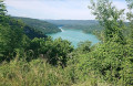
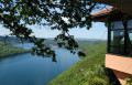
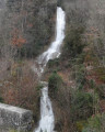
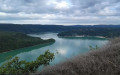
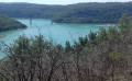
The Prénovel Forest, lush with greenery and dotted with flower-filled glades, gives way to the open Nanchez valley, dominated by agricultural activity, where wetlands and peat bogs stretch along the re-meandering River Nanchez.

Details

n°63087894
Creation:
Last update:
Last review:
  • Mountain biking
    Activity: Mountain biking
  • ↔
    Distance: 5.29 mi
  • ◔
    Duration according to the author: 1.5 hrs 
  • ▲
    Difficulty: Easy

  • ⚐
    Back to start: Yes
  • ↗
    Ascent: + 266 ft
  • ↘
    Descent: - 266 ft

  • ▲
    Highest point: 3,186 ft
  • ▼
    Lowest point: 2,890 ft
  • ⚐ Country: France
  • ⚐
  • ⚐ City: Prénovel (39150)
  • ⚑
    Start/End: N 46.511636° / E 5.839652°
  • ❏
    IGN map(s): Ref. 3327OT

  • ◶
    Type of surface:
  •  
     
     
    ■ 33% Road ■ 34% Byway ■ 33% Path
  • ⇧
    Bike carrying: Not specified
  • ▲
    Difficulty: Easy
  • Hour-by-hour weather

Description of the route

Parking is available in front of the Le Duchet mountain bike centre in Prénovel, Nanchez.
To do so, in the centre of the hamlet of Prénovel in Nanchez, follow signs for “Le Duchet”.

(S/E) Carefully cross the county road to reach the area above the town hall annexe, where you’ll find the PRENOVEL sign at the starting point of the trails.

(1) Follow a grassy path to the “Les Rochats” junction, then take the forest track on the right to quickly reach La Vie des Geais.

(2) Leave the tarmac road and turn right onto the path that runs through the grassy valley, passing through Auges Vuillomets, and arrives at La Vie des Tours, beside a forest track.

(3) Cross the forest track to head into the valley opposite, and cycle on to La Corne au Boeuf.

(4) Take the small path branching off to the right, which leads to Les Cuinets.

(5) Turn right onto a forest track leading to the Chalet du Bief Plotet.

(6) Turn left onto a farm track, heading towards Prénovel de Bise.

(7) Cross the D28 with care. A small road leads down to the hamlet of Les Belbenoits, then a dirt track branches off to the left, turning into a grassy path through the fields, leading to La Passerelle (ignore a junction on the right).

(8) Cross the wooden footbridge leading to La Croisée des Biefs. You can take the Nanchez peat bog trail. If so, please dismount and walk along the boardwalk (an easy round trip of about 30 minutes). Otherwise, take the white track towards the peat bog and continue on to Le Cotat Bossu.

(9) Take the white path on the right, which leads down to the Pont des Janiers. Turn left and, at the end, enter the village of Prénovel via La Vigne. Continue straight ahead until you reach the car park at the start (S/E).

Waypoints

  1. S/E : mi 0 - alt. 2,992 ft - Le Duchet Mountain Bike Centre, Prénovel, Nanchez
  2. 1 : mi 0.07 - alt. 3,009 ft - Start of the walks
  3. 2 : mi 0.31 - alt. 3,058 ft - The Life of the Jays
  4. 3 : mi 1.4 - alt. 3,081 ft - La Vie des Tours
  5. 4 : mi 2.24 - alt. 3,163 ft - La Corne au Boeuf
  6. 5 : mi 2.52 - alt. 3,087 ft - Les Cuinets
  7. 6 : mi 2.68 - alt. 3,081 ft - Chalet du Leat Plotet
  8. 7 : mi 3.33 - alt. 2,940 ft - Prénovel de Bise
  9. 8 : mi 3.92 - alt. 2,897 ft - La Passerelle - Bief de Nanchez (rivière)
  10. 9 : mi 4.51 - alt. 2,927 ft - Le Cotat Bossu
  11. S/E : mi 5.29 - alt. 2,992 ft - Le Duchet Mountain Bike Centre, Prénovel, Nanchez

Notes

The route is part of the circular routes at the Le Duchet mountain bike centre. Follow the green mountain bike signpost no. 83.
Facilities are available at the holiday village: bike hire, guided tours, bike wash, etc.

Worth a visit

The trail through the Bief de Nanchez Peat Bog Regional Nature Reserve can be explored on foot – 30 minutes.

Reviews and comments

5 / 5
Based on 1 review

Reliability of the description
5 / 5
Ease of following the route
5 / 5
Route interest
5 / 5
Le Dex
Le Dex

Overall rating : 5 / 5

Date of your route : Apr 28, 2025
Reliability of the description : ★★★★★ Very good
Ease of following the route : ★★★★★ Very good
Route interest : ★★★★★ Very good
Very busy route : No

A lovely walk for a half-day family outing.

Machine-translated

Other walks in the area

For more walks, use our search engine .

The GPS track and description are the property of this route's author. Please do not copy them without permission.