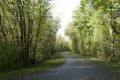
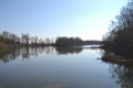
La Combe Noire – Nizelet – Le Vernay

A short, easy circular walk through the commune’s countryside, starting from Iselet.

Details

39030006
Creation:
Last update:
Last review:
  • Walking
    Activity: Walking
  • ↔
    Distance: 3.91 mi
  • ◔
    Average duration: 1h 55 
  • ▲
    Difficulty: Easy

  • ⚐
    Back to start: Yes
  • ↗
    Ascent: + 115 ft
  • ↘
    Descent: - 115 ft

  • ▲
    Highest point: 820 ft
  • ▼
    Lowest point: 702 ft

Description of the walk

The route starts at Iselet, just before the Save bridge. You can park along the hillside. The start of the walk is immediately before the Save bridge.

(S/E) Cross the bridge and take the path on the right towards Roche-Plage until you reach a small path on the left, about 400 m further on.

(1) Turn sharply left, just in front of a meadow fence. Follow this path to the end.

(2) Pass the chicane (be careful, it’s not very visible) and join the communal path, continuing to the left until you reach a pedestrian gate.

(3) After the gate, carry on to the right and join the Route de Creys (D16).

(4) Follow this for about 100 m to the left before turning right onto the path towards the Mares de Jucle.

(5) After passing these, turn left onto the path at a right angle towards Nizeret (Chemin de Jucle). At the end of the path, continue along the access road to Nizeret until you reach a crossroad (D16c).

(6) Turn left onto this road, pass the Mermet sawmill, follow the road towards Concharbin and arrive at the junction with the Route de Creys.

(7) Carry on straight ahead for 150 m and take the left-hand track, which leads back to La Combe Noire at a junction you passed earlier on the way there.

(3) Turn right into the cul-de-sac. Ignore the ‘road closed’ sign; this is the pedestrian gate you passed through on the way there.

(2) Return along the hairpin bends and follow the same route back as on the way there to the car park at Iselet (S/E).

Waypoints

  1. S/E : mi 0 - alt. 705 ft - Iselet, just before the La Save bridge.
  2. 1 : mi 0.24 - alt. 738 ft - Junction common to both outbound and return routes
  3. 2 : mi 0.38 - alt. 758 ft - Chicane
  4. 3 : mi 0.43 - alt. 764 ft - Pedestrian gate. Junction of the circular loop
  5. 4 : mi 0.85 - alt. 817 ft - Route de Creys
  6. 5 : mi 1.23 - alt. 801 ft - Chemin de Jucle
  7. 6 : mi 1.8 - alt. 784 ft - D16c
  8. 7 : mi 2.28 - alt. 814 ft - Junction on the Route de Creys
  9. S/E : mi 3.91 - alt. 705 ft - Iselet, after the La Save bridge

Reviews and comments

4.7 / 5
Based on 2 reviews

Reliability of the description
5 / 5
Ease of following the route
5 / 5
Route interest
4 / 5
Norbert38
Norbert38

Overall rating : 4.7 / 5

Date of your route : Apr 27, 2026
Reliability of the description : ★★★★★ Very good
Ease of following the route : ★★★★★ Very good
Route interest : ★★★★☆ Good
Very busy route : No

No particular difficulties; there aren’t many signposts, so make sure you follow the app

Machine-translated

Ta
Ta
• Edited:

Overall rating : 4.7 / 5

Date of your route : May 01, 2024
Reliability of the description : ★★★★★ Very good
Ease of following the route : ★★★★★ Very good
Route interest : ★★★★☆ Good
Very busy route : No

A pleasant, easy walk
It’s a shame about the 1km stretch of road (which isn’t very busy on public holidays)
Otherwise, very good

Machine-translated

Other walks in the area

For more walks, use our search engine .

The GPS track and description are the property of this route's author. Please do not copy them without permission.