Country:

 City:
City:


The start is at the junction of the Chemin des Sables and the Chemin de Maletang, on the left at the entrance to Charray when coming from Morestel. Park behind the bins in the grassy triangle.
(S/E) Follow Chemin de Maletang, which leads back to Route de Bourgoin (D19): take care when crossing, as the road is busy and visibility is poor. The pedestrian crossing is on the right; you must use it. Take Rue de la Fontaine opposite and turn right at the end.
(1) Continue straight on along Rue du Four Banal, which takes a sharp bend to the left. Carry on for a few dozen metres until you reach the bend to the right.
(2) Take the path leading uphill on your left. As you walk, take in the view of the ivy-covered Tour de Charray on your left. When you reach the top, you’ll come out onto Chemin de la Tour.
(3) Turn left and walk on to the ruins, then turn back.
(3) Return to the main path, which heads off to the left. A little further on, at the Fork in the road, keep to the right towards Le Marteray. Continue until you reach the tarmac road. Then take the road to the right, and turn right again at the next junction.
(4) About a hundred metres further on, take the path on the left between two houses. This leads to a house but continues across the fields to join another path, which is more suitable for vehicles. Follow it, turning right. Carry on until you reach the Route de Morestel (D244).
(5) Turn left onto the road, then cross at the wayside cross to take the uphill path on the right towards Collonge. It’s a steep climb but not very long. Pass through the hamlet and carry on to the left-hand bend.
(6) Follow the path to the right after the transformer. This path passes beneath the house and descends gently. Turn right at the houses and continue down to Route de Morestel, which you follow straight on for a few tens of metres.
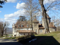
(7) Cross with extreme caution as visibility is poor due to the bend. Then rejoin the Route du Marteray, pass the entrance to the château and turn left about a hundred metres further on. Go past the houses, turn left again and then right at the edge of the woods. Head downhill along a long straight stretch to the Marcolin farm.
(8) First turn left then right and follow the path that runs beneath the farm. Continue to the tarmac road, where you turn right to return to Charray. Carry on straight ahead, join the path that led up to the tower and keep left.
(2) Navigate the left-hand bend, then the right-hand bend, rejoining Rue du Four Banal.
(1) Turn left onto Chemin du Poirier Royal, which leads to Route de Bourgouin (D19). To cross it, use the pedestrian crossing on your right, continue straight ahead onto Chemin des Sables and you’ll come to the bins and the car park (S/E).

 Visorando Member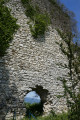

 Moderate