Chatey Hill

A walk to explore Chatey Hill, one of the three hills surrounding the village of Tresilley.

Details

n°3182191
Creation:
Last update:
Last review:
  • Walking
    Activity: Walking
  • ↔
    Distance: 5.95 mi
  • ◔
    Average duration: 3h 20 
  • ▲
    Difficulty: Moderate

  • ⚐
    Back to start: Yes
  • ↗
    Ascent: + 666 ft
  • ↘
    Descent: - 666 ft

  • ▲
    Highest point: 1,302 ft
  • ▼
    Lowest point: 912 ft
  • ⚐ Country: France
  • ⚐ City: Trésilley (70190)
  • ⚑
    Start/End: N 47.450477° / E 6.031391°
  • ❏
    IGN map(s): Ref. 3322E
  • Hour-by-hour weather

Photos

Description of the walk

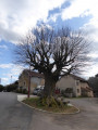
Park in the Place de la Mairie, near the war memorial.

Green signposting

(S/E) Join the departmental road and turn right towards Fondremand.

(1) On leaving the village, take a small path on the left. After 1.3 km, you’ll reach the D5 district road; follow it to the left for 300 m.

(2) Leave the D5 and take a small path on the left; walk for 450 m alongside the forest.

(3) Enter the forest via a path leading uphill on your right; if you look closely, you’ll see the remains of an old wayside cross.
After 300 m, you’ll come out onto a lovely forest track.
Turn left and follow the track, which becomes a tree-lined path after 700 m.
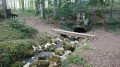
Carry on straight ahead for 450 m. You’ll pass a fountain and arrive at a place called “Les Roselières”.

(4) At the junction (another wayside cross), turn left and follow a small village road for 500 metres.

(5) Turn left onto a small path between two pastures and, after 200 m, you’ll reach a junction.

(6) Head left and follow the Ruisseau de l’Allée Verte: very pleasant in summer, the area stays cool even in the heat. Walk for about 1.3 km.

(7) Turn right, cross the small stream and climb up to the hilltop. You’ll reach a farm track.

(8) Turn left and follow the ridge for 700 m. Before the path drops sharply, leave the track and head for the top of the hill.

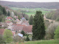
(9) Once you’ve reached the site (which was marked as ‘Roman camp’ on old IGN maps), let your imagination run wild. Retrace your steps and head back down the hill. As you emerge from the woods, you’ll have a lovely view of the countryside and the village of Tresilley. Continue straight on for 500 m.

(10) Turn left onto the departmental road. After walking for 250 m, turn right to pass in front of the school complex. Go round it on the right and follow the small path leading back to the village. When you reach the main street, turn left to return to the starting point (S/E).

Waypoints

  1. S/E : mi 0 - alt. 997 ft - Town Hall Square
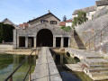
  2. 1 : mi 0.25 - alt. 988 ft - Leaving the village - Église (Trésilley)
  3. 2 : mi 1.3 - alt. 1,004 ft - Path on the left
  4. 3 : mi 1.56 - alt. 1,073 ft - Verbuzon Wood
  5. 4 : mi 2.7 - alt. 991 ft - Les Roselières
  6. 5 : mi 3.02 - alt. 912 ft - Path to the Abyss
  7. 6 : mi 3.15 - alt. 912 ft - Allée Verte stream or - Tounolle (cours d'eau)
  8. 7 : mi 4.01 - alt. 1,007 ft - Turn right at the fork
  9. 8 : mi 4.32 - alt. 1,217 ft - Chatey Wood
  10. 9 : mi 4.83 - alt. 1,302 ft - Summit – Roman Camp
  11. 10 : mi 5.39 - alt. 1,033 ft - Les Orgeries
  12. S/E : mi 5.95 - alt. 997 ft - Town Hall Square

Notes

IBP = 35HKG

Reviews and comments

2.7 / 5
Based on 5 reviews

Reliability of the description
2.8 / 5
Ease of following the route
2.6 / 5
Route interest
2.8 / 5
Paps
Paps

Overall rating : 3.7 / 5

Date of your route : Dec 16, 2024
Reliability of the description : ★★★★☆ Good
Ease of following the route : ★★★★☆ Good
Route interest : ★★★☆☆ Average
Very busy route : No

This is a route that is accessible to everyone without any difficulty and offers some lovely views.

Machine-translated

Wall-E
Wall-E
• Edited:

Overall rating : 2 / 5

Date of your route : May 12, 2024
Reliability of the description : ★★☆☆☆ Disappointing
Ease of following the route : ★☆☆☆☆ Very disappointing
Route interest : ★★★☆☆ Average
Very busy route : No

A route to avoid: the sections through the woods are no longer accessible as they were. Thank goodness we had Visorando and the IGN maps, otherwise we’d have got lost!
Also, if you do want to give it a go, you’ll need good footwear: there are very muddy sections and even a small stream to cross.

Machine-translated

elvyre
elvyre
• Edited:

Overall rating : 1.7 / 5

Date of your route : May 12, 2024
Reliability of the description : ★★☆☆☆ Disappointing
Ease of following the route : ★★☆☆☆ Disappointing
Route interest : ★☆☆☆☆ Very disappointing
Very busy route : No

A third of the route is relatively pleasant, but the pitfalls – both in the gaps in the route description and the rough paths – quickly make us forget this. It’s impossible to follow using just the route description; thank goodness I was following the route map, with my nose glued to my phone. No views, no points of interest
Points 2 and 3: what’s the point of making us go along the road? The path leading into the forest afterwards is very uneven; at times you have to work out where it goes.
Between points 3 and 4, at the junction, the GPS route indicates to go straight on. Don’t bother looking for the path – it’s hidden under the branches – but you’ll find it again once you’ve passed this section (50 metres max). If, at this point, you feel like turning back, do so!!
Between 6 and 7: You’re looking down over the little stream, but the ground is so badly churned up by logging and heavy rain that you’re more concerned with where to put your feet than admiring the woodland.
Point 8: Be careful not to turn left onto the stony path you’ve just come onto!! You must carry on straight ahead to reach the ridge path.
Point 9: Well, apart from wading through the brambles (there’s no path at all) to end up nowhere, except between three moss-covered tree stumps, there’s absolutely NOTHING to see. Do give this pitfall a miss.
As I mentioned earlier: there are no viewpoints or panoramic views.
It should be noted, however, that the route’s author is certainly not responsible for the rough terrain.
But the gaps in the route description are very annoying.
I do not recommend this route.

Machine-translated

Damarj
Damarj

Overall rating : 2.7 / 5

Date of your route : May 22, 2023
Reliability of the description : ★★★☆☆ Average
Ease of following the route : ★★☆☆☆ Disappointing
Route interest : ★★★☆☆ Average
Very busy route : No

Hello
A walk with no signposts and, in some places, completely unmaintained. In some spots, the path no longer exists, so you have to cut across the woods.
We’d done it in winter, and it was brilliant, but this time…
Very disappointed

Machine-translated

AngelineB
AngelineB

Overall rating : 3.7 / 5

Date of your route : Oct 18, 2021
Reliability of the description : ★★★☆☆ Average
Ease of following the route : ★★★★☆ Good
Route interest : ★★★★☆ Good
Very busy route : No

A lovely walk just a stone’s throw from our home; here are our comments on the points in the description:
3 – we didn’t see any remains of the wayside cross; is it still there? A lot of the tree felling looks recent; is it hidden by branches?
5 – We took the first path on our left; it wasn’t the right one. Perhaps it should be clarified: ‘Pass the first path on your left and you’ll then come to a junction’
6 – Of course, as we weren’t on the right path, we didn’t see the little stream at the start; we had to make our way down through the forest to the banks of the stream, which winds its way pleasantly, and there we finally followed the right path.
7 – There are several logging tracks; as we didn’t have a pedometer to measure the distances covered, we took the one where the trees at the entrance were marked 7 and 8. Perhaps we could have gone further, still following the stream.
9 – The ridge path ends at the foot of the ‘Camp Romain’ hill; clearly, a logging machine had cleared a timber storage area there, and at this point there is no fork in the path leading down to Tresilley. So, from the summit, we descended the fairly steep slope through the woods until we came across a logging track.
In conclusion, we really enjoyed this walk because of the pretty village of Tresilley, the variety of landscapes, the stream which added a touch of poetry, and finally the view of the village and the hill opposite at the end of the route.

Machine-translated

Other walks in the area

For more walks, use our search engine .

The GPS track and description are the property of this route's author. Please do not copy them without permission.