Country:

 City:


Park in the car park at the village entrance.
(S/E) From the car park, where you’ll find the first marker (113) – which isn’t shown on the map – head towards the village along the tarmac road.
(1) Enter the village and, after passing through the archway, turn left at marker 113. Take the mule track, which is a descending path with tight hairpin bends.
Yellow markings
(2) At the crossroads of paths, still descending, at marker 439, turn left towards Breil-sur-Roya.
(3) The path runs alongside an old bridge. Ford the Ruisseau de Bramafan and continue straight ahead. From the stream onwards, the vegetation changes.
End of the yellow markings
(4) Just before an old house, turn left at this junction.
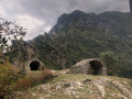
(5) At the junction, turn left, then right shortly afterwards, and continue uphill towards the radio masts and the Cime du Bosc. The path emerges in front of the ruins of a military barracks from the last war.
(6) Turn left and walk parallel to the La Cougoule track. The forest is dotted with fir trees. The path then turns south-west and climbs up to the nearby ridge.
(7) At this bend in the track, continue straight ahead on the signposted path.
Yellow markings in place
(8) Follow the track alongside and round the Cime du Bosc transmission masts. Take the path that starts between the two pylons, one made of wood, the other of iron. Follow the ridge.
(9) At this bend in the track, continue along the path slightly to the left of the bend
(10) Once again, at this hairpin bend in the track, continue along the path opposite.
White and red markings
(11) At marker 123, take the track to the left at this junction of tracks and footpaths, heading towards Piène Haute. The water tanks in the bend shown on the map are not visible from the path.
(12) At this bend in the track, turn right. The descending path follows the pre-1947 French border. There are two concrete boundary markers.
No signposting
(13) At this track junction, turn left and then immediately right; there is a fine cairn at the start of the path, the beginning of which is barely visible.
Red and white markings
(14) Crossroads of paths. Please note: the IGN map states that the route is passable by vehicle, but it is actually a path that becomes stony and worn near the ruins.
(15) Turn left at the start of this track, which is passable by vehicle. Piène Haute comes into view on the left as you continue along the route.
(16) At marker 116, turn left at this junction towards Piène Haute.
(17) At marker 115 (of no particular interest), turn left. Walk carefully alongside the road, as there is traffic, to return to the car park (S/E).




 Visorando Member


 Moderate
 Easy
 Very difficult