La Chavannoise in Chavannes-sur-Reyssouze

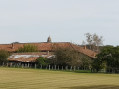
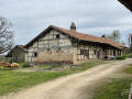
This route takes you through the heart of the Bresse countryside and its farms, many of which are half-timbered. The Domaine de Mareste is situated after the6thkilometre of the route, on the right at the junction with the D46.

By following this route, you can admire the Bresse-style architecture, notably the Domaine de Mareste, a complex whose oldest part is thought to date back to the 11th or 12th century. It was formerly a hunting lodge and outbuildings of the Château de Mareste, built by the Knights of the Hospitaller Order of St John of Jerusalem. Private estate!

Details

n°45303127
Creation:
Last update:
Last review:
  • Walking
    Activity: Walking
  • ↔
    Distance: 6.40 mi
  • ◔
    Average duration: 3h 00 
  • ▲
    Difficulty: Easy

  • ⚐
    Back to start: Yes
  • ↗
    Ascent: + 108 ft
  • ↘
    Descent: - 108 ft

  • ▲
    Highest point: 709 ft
  • ▼
    Lowest point: 581 ft

Description of the walk

Start from the town hall car park.

(S/E) With the town hall behind you, continue straight ahead along the Route de Mantenay and turn off onto the first path on the left, which crosses farmland. Carry on until you reach the first track on the left.

(1) Leave the road and continue along this track, which crosses a stream before becoming a tarmac road. Follow it to the Ruisseau de la Lune.

(2) Cross the stream and turn right, continuing to the next bridge, just before the Moulin de la Besace, situated quite close to the Reyssouze. Turn sharply left onto a path that runs alongside the riverbank for a short while. Ignore another path that rejoins the road and carry on straight ahead until the end of the track.

(3) Turn right and walk past the sewage treatment works on the left to reach the junction at the Domaine de Mareste.

(4) Carry on straight ahead. At Corcelles, turn right and keep going straight ahead. Then turn left twice, and at the three-way junction, turn right to cross the hamlet of l’Orme. At the end of the road, keep to the right, then turn left after the stream and follow the road to the Bois de la Coulaine, crossing this short wooded stretch.

(5) Turn left onto a track at the edge of the woods. At the Fork in the road, carry on straight ahead to reach Le Buchet and its crossroads. Go straight ahead, then turn completely left at the next junction before going straight ahead again at the following crossroads. Pass through Le Pissout and its houses and arrive at a three-way junction.

(6) Follow the path furthest to the left, then, at the next junction, first turn left then right to rejoin a track. At the end of the track, follow the road to the left as far as Les Nugons.

(7) First turn right then left to cross the hamlet before turning right at Les Bourbes. Continue straight on until you reach the town hall (S/E).

Waypoints

  1. S/E : mi 0 - alt. 600 ft - Town hall
  2. 1 : mi 0.7 - alt. 581 ft - Track
  3. 2 : mi 1.3 - alt. 584 ft - Lune - Reyssouze (rivière)
  4. 3 : mi 2.14 - alt. 587 ft - End of the track/sewage treatment plant
  5. 4 : mi 2.47 - alt. 607 ft - Domaine de Mareste
  6. 5 : mi 3.88 - alt. 696 ft - La Coulaine
  7. 6 : mi 4.68 - alt. 709 ft - Le Pissout
  8. 7 : mi 5.48 - alt. 666 ft - Les Nugons
  9. S/E : mi 6.4 - alt. 600 ft - Town hall

Worth a visit

- Bressan-style buildings.

Reviews and comments

4.7 / 5
Based on 1 review

Reliability of the description
5 / 5
Ease of following the route
5 / 5
Route interest
4 / 5
Pascale01440
Pascale01440

Overall rating : 4.7 / 5

Date of your route : Oct 12, 2026
Reliability of the description : ★★★★★ Very good
Ease of following the route : ★★★★★ Very good
Route interest : ★★★★☆ Good
Very busy route : No

A short, half-day walk to get some fresh air. No difficult sections, just a few lovely houses and countryside scenery. Lots of tarmac (a shame), but ideal for very wet seasons.

Machine-translated

Other walks in the area

For more walks, use our search engine .

The GPS track and description are the property of this route's author. Please do not copy them without permission.