


 Country:

 City:
City:


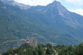

Car park by the tennis courts before the Iscle de Prelles campsite.
(S/E) Take a path on the left, a few dozen metres before the campsite entrance, heading towards the Durance. Follow the Durance, then, after passing under the small railway bridge, follow a small stream and join the A9 national road near the Prelles exit sign.
(1) Pass the Rue du Réal on your left (this is the way back), turn left towards the village, and follow the N94 road to a bus stop, then a pedestrian crossing just before the shops. Cross over and turn right onto the Rue de l’Église. Walk up the street to the church forecourt and the crossroads at the hamlet known as Le Mail.
(2) After passing the church forecourt, turn left then right towards La Ribière, just after the fountain. Walk up Rue du Paroir, which ends as it runs alongside a long stone wall and then continues to the right along a narrow path. Keep left at the first junction; at the next junction, turn left again and continue keeping left towards the Gros Riou stream.
(3) Cross the footbridge and turn left. Carry on straight ahead, leaving a very steep path on your right. You’ll come out onto a wide forest track.
(4) Ignore the very steep path climbing to the right and continue along the track climbing straight ahead. You’ll reach a wide clearing with a bend to the right.
(5) Before the bend, take a small path opposite the track, which rejoins it further up.
(6) Cross the track to continue along the small path opposite (which does not appear on the IGN map). Join the forest track again and follow it to the left. When you reach a large cleared clearing, take the second track on the right that climbs, marked by a red line on a white background on two trees. After a fairly steep climb, you’ll emerge onto another clearing. Take in the view over the Briançon valley, with Mont Charberton in the background and the Saint-Hippolyte Chapel below. Continue along the track, passing through a meadow alongside a stream, until you reach a tree on the right-hand side of the track. Look out for a wooden sign indicating a hiking trail, marked by a donkey.
(7) Take the path that descends to the left towards the Saint-Hippolyte Chapel. You’ll reach a junction in a meadow, with the path leading to the chapel directly opposite.
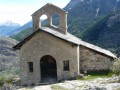
(8) Follow this path to the Chapelle Saint-Hippolyte.
(9) Return to the previous crossroads.
(8) Head down to the right onto the GR®653D. Shortly after a sharp right-hand bend at a wide clearing, continue along the GR® on a narrow path to the left. After a series of right-hand bends followed by a left-hand bend, you’ll reach the vicinity of the road, then a large rock marked with the GR® symbol. About fifty metres further on, look out for a small fir tree on the left.
(10) Head down to the right towards the road: this section is quite steep and the path is poorly marked. Watch out for cars when you reach the road! Walk up the road for a few metres, then take the path that descends to the left until you reach the footbridge over the railway line after a sharp bend to the left.
(11) Cross the railway line and continue towards the old footbridge (Pont de la Chirouze), which once allowed people to cross the Durance. At the old footbridge, turn left onto the nature trail that runs alongside the river. Further on, the trail veers away to the left, passes the Pra-Dory farm, crosses the railway line and shortly afterwards joins the start of a path on the right. This is the walking trail marked with a donkey symbol, which leads to the D4 road. Follow it to the right, cross the bridge over the Gros Riou and look out for the walking trail on the left: ignore the old ‘private property’ sign attached to a tree on the left.
(13) Follow this footpath to the fountain, then turn right towards the church to return to the crossroads you passed on the way out.
(2) Take Rue des Casses, which runs alongside the church on the left. Pass a fountain on the left, then turn right onto Chemin des Noyers to reach the junction opposite the cemetery.
(14) Turn right and walk down Rue du Real to the N94 road.
(1) Cross the road, then follow the route back the way you came to return to the car park near the tennis courts (S/E).
 Visorando Member
 Easy
Easy 
 Difficult
 Very difficult
