The Rosary Chapel, starting from Saint-Pierre-de-Chartreuse

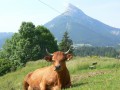
Panoramic view of the village of Saint-Pierre-de-Chartreuse and the surrounding peaks.

Details

n°23873760
Creation:
Last update:
Last review:
  • Walking
    Activity: Walking
  • ↔
    Distance: 1.53 mi
  • ◔
    Average duration: 1h 05 
  • ▲
    Difficulty: Easy

  • ⚐
    Back to start: Yes
  • ↗
    Ascent: + 413 ft
  • ↘
    Descent: - 413 ft

  • ▲
    Highest point: 3,304 ft
  • ▼
    Lowest point: 2,884 ft

Description of the walk

Park in the car park behind the church.

(S/E) From the car park, follow the one-way road, the D512, towards the Town Hall and head for the junction just after the Tourist Office.

(1) Turn right towards Perquelin. Follow the road until you come to the start of a footpath leading uphill to the left a few metres before the sign marking the end of the built-up area of Saint-Pierre-de-Chartreuse.
Follow this path to the next fork.

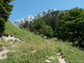
(2) Turn left at the foot of the steep slope towards the Chapelle du Rosaire. Continue along the mountainside, passing through pastoral countryside.

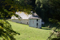
(3) At the end, head up to the right and reach a viewpoint a few metres above the Chapelle du Rosaire. Enjoy a magnificent view of the village and the surrounding peaks. Return to the previous fork.

(3) Carry on to the right. When you reach the tarmac road, turn left, then quickly take a small track that starts to the right of the road and head for the Town Hall Square.

(1) Turn right and, following the route in the opposite direction to the way out, head back to the church (S/E).

Waypoints

  1. S/E : mi 0 - alt. 2,890 ft - Église Saint-Pierre (Saint-Pierre-de-Chartreuse)
  2. 1 : mi 0.14 - alt. 2,910 ft - Route de Perquelin, near the - Guiers (rivière)
  3. 2 : mi 0.69 - alt. 3,238 ft - Towards the Chapelle du Rosaire
  4. 3 : mi 0.89 - alt. 3,248 ft - Access to the - Chapelle du Rosaire (Saint-Pierre-de-Chartreuse)
  5. S/E : mi 1.53 - alt. 2,890 ft - Église Saint-Pierre (Saint-Pierre-de-Chartreuse)

Reviews and comments

4.7 / 5
Based on 1 review

Reliability of the description
5 / 5
Ease of following the route
5 / 5
Route interest
4 / 5
Sakaudos
Sakaudos

Overall rating : 4.7 / 5

Date of your route : Aug 06, 2024
Reliability of the description : ★★★★★ Very good
Ease of following the route : ★★★★★ Very good
Route interest : ★★★★☆ Good
Very busy route : No

A short, or rather very short, walk, which was just what we were looking for at the time.
As soon as we left the county road, the path climbed straight away, but we were sheltered from the sun in a wooded area. The start is shared with other, longer walks. The view of the chapel is somewhat obscured by the lush vegetation.
After the chapel, still in the woodland, the path descends again and takes you back to the village.

Machine-translated

Other walks in the area

For more walks, use our search engine .

The GPS track and description are the property of this route's author. Please do not copy them without permission.